Satellite Image Classification Techniques
Table of Contents
- Introduction to Satellite Image Classification Techniques
- The Foundations of Remote Sensing and Image Classification
- Primary Approaches to Satellite Image Classification
- 1. Unsupervised Classification: Letting the Data Speak
- 2. Supervised Classification: Learning from Examples
- 3. Object-Based Image Analysis (OBIA): Moving Beyond the Pixel
- The Deep Learning Revolution in Remote Sensing
- Convolutional Neural Networks (CNNs)
- Semantic Segmentation
- Comparing Classification Methodologies
- Challenges and Complexities in Image Classification
- Critical Applications of Satellite Image Classification
- Future Trends: The Road Ahead
- Conclusion
- Frequently Asked Questions
rsandgis.me
Introduction to Satellite Image Classification Techniques
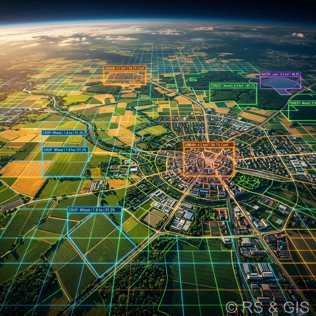
The dawn of the space age brought with it an unparalleled vantage point: the ability to observe the Earth from above. Today, Earth observation satellites generate petabytes of data daily, capturing everything from urban expansion to the subtle shifts of global climate change. But raw satellite imagery is essentially just a grid of digital numbers. Transforming these numbers into actionable, meaningful geographic information is the domain of satellite image classification. In this guide, we will delve deep into the many satellite image classification techniques, exploring how algorithms convert pixels into profound insights, the shift from traditional machine learning to advanced deep learning methodologies, and the far-reaching applications of these technologies.
Satellite imagery classification is fundamentally the process of categorizing pixels or regions in a remote sensing image into specific land-cover or land-use classes. The ultimate goal is to produce a thematic map that accurately represents the surface features of the Earth, such as forests, water bodies, agricultural lands, urban infrastructure, and bare soil. The accuracy and efficiency of this process dictate the reliability of the resulting data, which in turn influences critical decisions in environmental monitoring, disaster management, agriculture, and urban planning.
The Foundations of Remote Sensing and Image Classification
Before diving into specific classification algorithms, it is crucial to understand the foundational principles of remote sensing that make classification possible. Satellite sensors measure electromagnetic radiation reflected or emitted from the Earth's surface. Different materials interact with electromagnetic energy in distinct ways; they absorb, transmit, and reflect different wavelengths to varying degrees. This unique pattern of spectral reflectance is known as a spectral signature.
Modern satellite sensors are often multispectral or hyperspectral, meaning they capture data across multiple bands of the electromagnetic spectrum, including visible light (Red, Green, Blue) and invisible wavelengths such as Near-Infrared (NIR), Shortwave Infrared (SWIR), and Thermal Infrared (TIR). Image classification techniques leverage these spectral signatures, alongside spatial and temporal data, to distinguish one land cover type from another.
For example, healthy vegetation strongly absorbs red light for photosynthesis but highly reflects near-infrared light, a characteristic spectral signature that classification algorithms use to identify forests and crops.
Primary Approaches to Satellite Image Classification
The methodologies used to classify satellite imagery have evolved significantly over the decades. Broadly, these techniques can be categorized into three main paradigms: unsupervised classification, supervised classification, and object-based image analysis (OBIA).
1. Unsupervised Classification: Letting the Data Speak
Unsupervised classification is a highly automated approach where the algorithm groups pixels into clusters based purely on their spectral similarity, without any prior knowledge, user-defined rules, or labeled training data. This technique relies on statistical algorithms to find naturally occurring patterns within the image data.
The typical workflow involves specifying the desired number of clusters (or classes) and letting the software partition the spectral data space. Once the algorithm has grouped the pixels into spectral classes, the human analyst must step in. The analyst's job is to evaluate these mathematical clusters and assign meaningful land-cover labels to them (e.g., matching Cluster 1 to "Water" and Cluster 2 to "Coniferous Forest") by comparing the clusters to reference data or utilizing their own knowledge of the area.
Key Algorithms in Unsupervised Classification:
- K-Means Clustering: A fundamental iterative algorithm that partitions the image into 'K' distinct clusters. It randomly assigns 'K' cluster centers, assigns each pixel to the nearest center, recalculates the centers based on the mean of the assigned pixels, and repeats the process until the clusters stabilize.
- ISODATA (Iterative Self-Organizing Data Analysis Technique): Similar to K-Means but more flexible. ISODATA allows for the merging of clusters if they are statistically too similar and the splitting of clusters if they are too diverse, dynamically adjusting the number of final clusters based on defined thresholds.
While relatively fast and free from human bias during the initial clustering phase, unsupervised classification can struggle with classes that are conceptually distinct but spectrally similar, such as distinguishing between different types of agricultural crops or differentiating a dark asphalt road from deep water.
2. Supervised Classification: Learning from Examples
Supervised classification is a more hands-on, predictive approach. It relies on the concept of "training data", representative samples of known land-cover types selected by an analyst. By feeding the algorithm these labeled examples (e.g., delineating polygons over known areas of forest, urban development, and water), the model "learns" the spectral characteristics associated with each specific class.
Once the model is trained, it generates a mathematical classification rule or decision boundary. The algorithm then applies this rule to every other pixel in the entire satellite image, assigning each pixel to the class it most closely resembles based on the learned spectral signatures. The success of supervised classification heavily depends on the quality, representativeness, and quantity of the training samples provided.
Prominent Algorithms in Supervised Classification:
- Maximum Likelihood Classifier (MLC): A traditional, widely-used statistical method. MLC assumes that the spectral data for each class is normally distributed. It calculates the probability that a given pixel belongs to a specific class and assigns the pixel to the class with the highest probability.
- Support Vector Machines (SVM): A powerful machine learning algorithm that is particularly effective in high-dimensional spaces (like hyperspectral data). SVM works by finding the optimal hyperplane, a boundary in the multi-dimensional spectral space, that best separates different classes while maximizing the margin between them. It is highly robust and performs well even with limited training data.
- Random Forest (RF): An ensemble learning method that constructs a multitude of decision trees during training. Each tree independently predicts the class of a pixel based on a random subset of features. The final classification is determined by a majority vote across all the individual decision trees. Random Forest is highly resistant to overfitting and handles complex, noisy satellite data exceptionally well.
- Artificial Neural Networks (ANN): Inspired by the human brain, ANNs consist of interconnected layers of artificial neurons. Through a process called backpropagation, the network adjusts the weights of these connections to minimize classification errors. ANNs can model highly complex, non-linear relationships between spectral data and land-cover classes.
3. Object-Based Image Analysis (OBIA): Moving Beyond the Pixel
For decades, traditional classification techniques were strictly "pixel-based," meaning they analyzed the spectral properties of one pixel at a time in isolation. But with the advent of very high-resolution (VHR) satellite imagery (such as that from WorldView or Pléiades, where pixels represent areas smaller than a square meter), pixel-based methods began to fail. In VHR images, a single tree might be made up of dozens of pixels with varying spectral values (sunlit leaves, shadowed branches), leading to a noisy, "salt-and-pepper" classification result.
Object-Based Image Analysis (OBIA), or Geographic Object-Based Image Analysis (GEOBIA), was developed to overcome this limitation. Instead of classifying individual pixels, OBIA first segments the image into "objects" or "superpixels", homogeneous groups of contiguous pixels that share similar characteristics.
Once the image is segmented into objects (which might represent actual real-world features like building rooftops, individual tree canopies, or agricultural fields), the classification algorithm analyzes these objects. Crucially, OBIA utilizes not just spectral information, but also spatial and contextual features:
- Shape and Geometry: Assessing whether an object is perfectly rectangular (likely a building) or highly irregular (likely a natural feature).
- Texture: Measuring the smoothness or roughness of the object's surface.
- Context and Topography: Evaluating an object's relationship to its neighbors (e.g., an object is more likely to be a "bridge" if it crosses an object classified as "water").
By incorporating these human-like cognitive parameters, OBIA dramatically improves classification accuracy for high-resolution datasets, bridging the gap between raw pixel data and meaningful geographic features.
The Deep Learning Revolution in Remote Sensing
In recent years, the field of satellite image classification has been completely revolutionized by Deep Learning, a sophisticated subset of machine learning. The explosion of big data in Earth observation, combined with immense increases in computational power (specifically GPUs), has allowed deep neural networks to achieve unparalleled levels of accuracy, automating complex feature extraction processes that previously required intensive human engineering.
Convolutional Neural Networks (CNNs)
At the heart of this revolution is the Convolutional Neural Network (CNN). Unlike traditional algorithms that require an analyst to manually define features (like spectral indices or texture metrics), CNNs automatically learn hierarchical spatial features directly from the raw image pixels through a series of convolutional filters.
In satellite imagery, CNNs excel at identifying complex spatial patterns, shapes, and contextual relationships. They are widely used for scene classification (categorizing an entire image patch, e.g., "Industrial Zone" vs. "Residential Area") and object detection (locating specific entities like airplanes, ships, or storage tanks within a larger scene).
Semantic Segmentation
When it comes to creating detailed, pixel-perfect land-cover maps, deep learning employs a technique known as Semantic Segmentation. This process involves assigning a class label to every single pixel in the image, similar to traditional pixel-based classification, but utilizing the massive spatial awareness of deep neural networks.
Architectures like U-Net and DeepLab have become industry standards for semantic segmentation in remote sensing. These models utilize an encoder-decoder structure: the encoder compresses the image to extract high-level semantic features (understanding "what" is in the image), while the decoder uses spatial information to precisely localize those features back to the original image resolution (understanding "where" it is). This dual capability allows deep learning models to smoothly distinguish complex urban environments, precisely delineate road networks, and map intricate wetland ecosystems with a level of detail previously thought impossible.
Comparing Classification Methodologies
To summarize the strengths and ideal use-cases of the various techniques, consider the following comparative analysis:
| Classification Technique | Core Concept | Primary Advantages | Key Limitations | Best Suited For |
|---|---|---|---|---|
| Unsupervised | Statistical clustering based purely on spectral similarity. | Fast, requires no prior knowledge or training data, unbiased initial grouping. | Cannot distinguish spectrally similar but conceptually different classes; requires manual labeling of clusters. | Initial exploratory analysis, areas with absolutely no ground truth data, broad landscape mapping. |
| Supervised (Traditional ML) | Algorithm learns from human-provided training samples (e.g., Random Forest, SVM). | High accuracy, allows for targeting specific classes of interest, algorithms like Random Forest handle noise well. | Highly dependent on the quality and quantity of training data; can struggle with very high-resolution spatial contexts. | Medium-resolution mapping (e.g., Landsat, Sentinel-2 data), regional land-cover mapping, agricultural crop identification. |
| Object-Based (OBIA) | Segments image into objects before classifying based on spectral, shape, and contextual features. | Eliminates "salt-and-pepper" noise, mimics human visual interpretation, leverages shape and texture. | Computationally intensive, segmenting parameters require careful tuning and trial-and-error. | Very high-resolution imagery (e.g., WorldView), urban mapping, building footprint extraction, individual tree crown delineation. |
| Deep Learning (Semantic Segmentation) | Automated feature extraction using hierarchical neural networks. | Unmatched accuracy in complex scenes, automatically learns both spatial and spectral contexts. | Requires massive amounts of labeled training data and immense computational resources (GPUs); acts as a "black box." | Large-scale automated mapping, complex urban environment analysis, road network extraction, automated damage assessment. |
Challenges and Complexities in Image Classification
Despite significant technological advancements, achieving flawless satellite image classification remains a formidable challenge. Several inherent complexities must be navigated by remote sensing scientists and data analysts:
- Spectral Confusion and the Mixed Pixel Problem: The Earth's surface is heterogeneous. In medium-to-low resolution imagery, a single pixel might cover a large area (e.g., 30x30 meters) containing a mixture of water, soil, and vegetation. This "mixed pixel" produces a blended spectral signature, confusing algorithms that attempt to assign it to a single hard class. Also, different materials can have nearly identical spectral signatures (e.g., a green roof vs. actual vegetation), leading to spectral confusion.
- Atmospheric Interference: Satellites view the Earth through a thick, dynamic atmosphere. Clouds, aerosols, haze, and shadows cast by clouds or topography severely alter the spectral information reaching the sensor. Rigorous atmospheric correction pre-processing is mandatory before running classification algorithms to ensure the data represents the true surface reflectance.
- Temporal Variability: Landscapes change over time. The spectral signature of a deciduous forest in spring is drastically different from its signature in autumn. While temporal data (analyzing a time-series of images) can actually improve classification by capturing phenological cycles, it also adds immense complexity to the modeling process.
- The Training Data Bottleneck: The advanced supervised machine learning and deep learning algorithms that dominate the modern landscape are incredibly data-hungry. Creating massive, highly accurate, geographically diverse, and beautifully labeled training datasets is a painstakingly slow, manual, and expensive process. The scarcity of high-quality training data is often the primary limiting factor in developing robust, globally applicable classification models.
Critical Applications of Satellite Image Classification
The ability to accurately classify the Earth's surface from space has transformative implications across a multitude of sectors, driving sustainability, economic development, and humanitarian efforts.
- Environmental Monitoring and Conservation: Classification is vital for tracking deforestation in the Amazon basin, monitoring the expansion of deserts, assessing the health of coral reefs, and mapping the loss of vital wetlands. It provides the empirical data necessary for environmental policy and conservation enforcement.
- Agriculture and Food Security: "Precision agriculture" heavily relies on satellite data. Classification techniques can identify specific crop types across vast regions, monitor crop health, predict agricultural yields, and identify areas suffering from drought or pest infestations, thereby safeguarding global food supply chains.
- Urban Planning and Smart Cities: As global urbanization accelerates, city planners use high-resolution classification and OBIA to map urban sprawl, identify informal settlements, manage infrastructure development, and assess the distribution of urban green spaces to mitigate the urban heat island effect.
- Disaster Response and Damage Assessment: In the immediate aftermath of natural disasters, such as earthquakes, hurricanes, or floods, rapid image classification algorithms are deployed to map flooded areas, identify destroyed buildings, and assess damage to critical infrastructure. This rapid situational awareness is crucial for directing emergency response resources effectively and saving lives.
Future Trends: The Road Ahead
The field of satellite image classification is evolving at a breakneck pace. The future promises even deeper integration of multi-modal data. We are moving away from relying solely on optical imagery, increasingly fusing multispectral data with Synthetic Aperture Radar (SAR) data, which can penetrate clouds and capture surface texture, and LiDAR data, which provides highly accurate 3D elevation models. Fusing these data types provides a much richer, multi-dimensional dataset for classification algorithms.
Also, the push towards Cloud Computing and Platform-as-a-Service (PaaS) solutions, like Google Earth Engine and Microsoft Planetary Computer, is democratizing access to these powerful tools. Analysts no longer need massive local servers to process petabytes of data; they can run advanced classification algorithms directly in the cloud. Finally, research into transfer learning and few-shot learning aims to address the training data bottleneck, creating deep learning models that can generalize to new geographical regions with only a tiny fraction of the training data previously required.
Conclusion
Satellite image classification has transformed from a niche scientific endeavor into a cornerstone of modern geospatial intelligence. From the foundational statistical clustering of unsupervised methods to the sophisticated, brain-like architecture of modern convolutional neural networks, the techniques we use to interpret our planet from space are becoming remarkably precise. As the resolution of our satellites sharpens and the intelligence of our algorithms deepens, our ability to monitor, manage, and protect the Earth's delicate systems will continue to reach unparalleled heights. Understanding these techniques is not just an exercise in computer science; it is a critical prerequisite for understanding the rapidly changing face of our world.
Frequently Asked Questions
What is the difference between supervised and unsupervised classification?
In supervised classification, an analyst provides training samples (e.g., known pixels of water or forest) to teach the algorithm how to classify the rest of the image. Unsupervised classification algorithms (like K-means) automatically group pixels based on statistical similarities without any prior human input.
What is Object-Based Image Analysis (OBIA)?
Instead of classifying individual pixels, OBIA groups adjacent pixels into homogeneous 'objects' or segments based on color, shape, and texture. This is highly effective for high-resolution imagery where single pixels are smaller than the objects being mapped (e.g., houses or trees).
How do you assess the accuracy of a classified image?
Accuracy assessment involves comparing a random sample of classified pixels against a known 'ground truth' dataset. The results are summarized in a confusion matrix, which calculates metrics like Overall Accuracy, User's Accuracy, and the Kappa Coefficient to validate the map's reliability.
