LiDAR Technology and Its Applications
Table of Contents
- The Ultimate Guide to LiDAR Technology and Applications
- How LiDAR Works: The Science of Light and Distance
- The Core Components of a LiDAR System
- Primary Types of LiDAR Systems
- 1. Airborne LiDAR
- 2. Terrestrial LiDAR
- Transformative Applications of LiDAR Technology
- Autonomous Vehicles and Advanced Driver Assistance Systems (ADAS)
- Topographical Mapping and Surveying
- Environmental Monitoring, Forestry, and Conservation
- Urban Planning and the Rise of Smart Cities
- Industrial Automation, Mining, and Agriculture
- LiDAR vs. Radar vs. Cameras: A Comparative Analysis
- The Future of LiDAR Technology
- Conclusion
- Frequently Asked Questions
rsandgis.me
The Ultimate Guide to LiDAR Technology and Applications
In the modern field of remote sensing and 3D mapping, few innovations have been as disruptive and influential as LiDAR technology. An acronym for Light Detection and Ranging, LiDAR has transitioned from an obscure scientific instrument to the cornerstone of modern automation, autonomous driving, environmental conservation, and urban planning. This guide delves deep into the mechanics of LiDAR, explores its core components, compares it with competing sensory technologies, and examines the real-world applications that are reshaping our future.
How LiDAR Works: The Science of Light and Distance
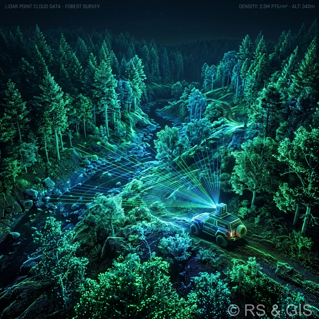
Fundamentally, LiDAR is an active remote sensing method that uses pulsed laser beams to measure distances to the Earth's surface or any other object in its path. Unlike passive sensors, such as standard cameras that rely on ambient light (like sunlight) to capture images, LiDAR generates its own light energy. This characteristic allows LiDAR systems to operate effectively in virtually any lighting condition, including pitch-black darkness.
The fundamental principle of LiDAR is based on the Time of Flight (ToF) calculation. The system rapidly fires a laser pulse at a target surface. The light bounces off the object and returns to the LiDAR sensor. By measuring the exact time it takes for the light pulse to complete this round trip, and knowing that light travels at a constant speed (approximately 299,792 kilometers per second), the system calculates the precise distance between the sensor and the target object.
When millions of these precise measurements are combined, they create a dense, highly accurate, and intricate 3D representation of the scanned environment known as a point cloud. These point clouds are the foundation upon which digital twins and topographical models are built.
The Core Components of a LiDAR System
A functional LiDAR system is an orchestration of several highly sophisticated hardware and software components. The primary elements include:
- Laser Scanner: The emitter that generates and projects the rapid pulses of laser light. Most systems use near-infrared, visible, or ultraviolet light depending on the application and the medium (e.g., air vs. water).
- Scanner and Optics: These components control the speed and direction at which the laser is fired. The scanning mechanism (like an oscillating mirror or a rotating prism) dictates the field of view and resolution of the resulting point cloud.
- Photodetector (Receiver): A highly sensitive sensor that detects the returning light pulses after they have reflected off the target surface.
- Positioning and Navigation Systems: For mobile LiDAR applications, precise location data is critical. This is achieved using a combination of a Global Positioning System (GPS) or GNSS to determine the exact geographic location, and an Inertial Measurement Unit (IMU) to track the orientation, tilt, and acceleration of the scanner.
- Data Processing Software: Raw LiDAR data must be filtered, classified, and processed to generate usable 3D models and extract meaningful insights.
Primary Types of LiDAR Systems
LiDAR technology is highly versatile and can be deployed via various platforms to suit different environmental and operational requirements. The two primary categories of LiDAR are Airborne and Terrestrial.
1. Airborne LiDAR
Mounted on helicopters, airplanes, or drones (UAVs), airborne LiDAR is ideal for scanning massive landscapes quickly. It is further divided into:
- Topographic LiDAR: Uses a near-infrared laser to map land surfaces. It is extensively used in forestry, urban planning, and large-scale cartography.
- Bathymetric LiDAR: Utilizes a water-penetrating green laser to measure the depth of water bodies, map riverbeds, and survey coastal zones.
2. Terrestrial LiDAR
Operated on the ground, terrestrial LiDAR provides unparalleled detail and accuracy for localized environments. It includes:
- Mobile LiDAR: Attached to moving vehicles, trains, or even backpacks, mobile LiDAR scans the surrounding environment in real-time. It is essential for mapping highway infrastructure and creating high-definition maps for autonomous vehicles.
- Static LiDAR: Mounted on a stationary tripod, this system offers the highest level of precision and is often used for building surveys, heritage site preservation, and forensic crime scene investigation.
Transformative Applications of LiDAR Technology
The high-resolution spatial data provided by LiDAR is driving innovation across a multitude of industries. Below, we explore the most impactful applications of this technology.
Autonomous Vehicles and Advanced Driver Assistance Systems (ADAS)
Perhaps the most publicized application of LiDAR is in the automotive industry. For a vehicle to navigate safely without human intervention, it requires a flawless understanding of its surroundings. LiDAR acts as the "eyes" of autonomous vehicles, providing a real-time, 360-degree 3D map of the environment.
Unlike cameras that can be blinded by glare or radar that struggles with fine detail, LiDAR accurately detects pedestrians, cyclists, lane markings, and obstacles at long distances, regardless of lighting conditions. It enables vehicles to perform complex tasks such as localized positioning, object classification, and collision avoidance with unparalleled reliability.
Topographical Mapping and Surveying
Before LiDAR, large-scale topographical surveying was a slow, labor-intensive process. Today, drone-mounted and airborne LiDAR can survey thousands of acres in a single day with centimeter-level accuracy. The technology is capable of penetrating dense forest canopies to reveal the "bare earth" topography beneath, a feat impossible with traditional photogrammetry. This makes LiDAR invaluable for creating Digital Elevation Models (DEMs), land contouring, and infrastructure planning.
Environmental Monitoring, Forestry, and Conservation
Environmental scientists leverage LiDAR to monitor ecosystems and combat climate change. In forestry, LiDAR calculates the biomass, tree height, and canopy density of vast forests, providing critical data for carbon offset calculations and deforestation tracking.
Also, bathymetric LiDAR is used to monitor coastal erosion, map coral reefs, and predict flood plains. By creating accurate models of water flow and terrain, governments can develop robust disaster management and mitigation strategies.
Urban Planning and the Rise of Smart Cities
As urban populations explode, city planners require precise data to optimize infrastructure. LiDAR is used to create "digital twins", exact virtual replicas of physical cities. These models are used to simulate traffic flow, plan 5G network rollouts, optimize solar panel placement by analyzing building shadows, and manage utility assets like power lines and sewage systems. The result is more efficient, sustainable, and connected urban environments.
Industrial Automation, Mining, and Agriculture
In industrial sectors, LiDAR improves both safety and efficiency. In mining, it is used for volumetric analysis of extracted materials, monitoring structural integrity of mine shafts, and guiding autonomous mining trucks. In agriculture, drone-based LiDAR surveys fields to analyze topography, optimize irrigation systems, and assess crop health by measuring plant height and density, driving the adoption of precision agriculture.
LiDAR vs. Radar vs. Cameras: A Comparative Analysis
To fully appreciate LiDAR's value proposition, it is crucial to understand how it compares to other common sensing technologies used in autonomous systems and remote sensing.
| Feature | LiDAR (Light Detection and Ranging) | Radar (Radio Detection and Ranging) | Cameras (Photogrammetry) |
|---|---|---|---|
| Measurement Medium | Light (Laser Pulses) | Radio Waves | Ambient Light (Visible Spectrum) |
| Resolution & Detail | Exceptional (High-density 3D Point Clouds) | Low (Cannot identify fine shapes or edges) | High (Excellent color and texture data) |
| Performance in Darkness | Excellent (Active sensor) | Excellent (Active sensor) | Poor (Requires illumination) |
| Weather Resilience | Moderate (Can be affected by heavy rain/fog) | Excellent (Passes through fog/rain/snow) | Poor (Affected by rain, fog, and glare) |
| Range and Accuracy | High precision over long distances (up to 300m+) | Excellent range, but lower spatial accuracy | Range depends on stereo-vision; struggles with depth perception |
The Future of LiDAR Technology
The future of LiDAR is defined by miniaturization, cost reduction, and integration with Artificial Intelligence (AI). Solid-state LiDAR, which eliminates moving mechanical parts, is making sensors smaller, more durable, and significantly cheaper to produce. This democratization of LiDAR will lead to its integration into everyday consumer electronics; we already see LiDAR scanners in modern smartphones and tablets utilized for augmented reality (AR) applications and advanced photography.
Also, the integration of AI and machine learning algorithms will drastically reduce the time required to process raw point clouds. AI will enable LiDAR systems to not just "see" the environment, but to instantly understand and classify complex dynamic scenes in real-time.
Conclusion
LiDAR technology has proven itself to be much more than a niche scientific tool; it is a fundamental pillar of the fourth industrial revolution. By providing the precise spatial data required to map our world, protect our environment, and guide autonomous machines, LiDAR is paving the way for a safer, smarter, and more efficient future. As the technology continues to evolve, becoming more accessible, compact, and intelligent, its applications will only expand, cementing its status as an indispensable technology for decades to come.
Frequently Asked Questions
How does LiDAR technology work?
LiDAR (Light Detection and Ranging) works by emitting rapid pulses of laser light toward a target and measuring the exact time it takes for the light to bounce back to the sensor. This time-of-flight measurement is used to calculate precise distances and generate highly accurate 3D point clouds.
Can LiDAR penetrate through trees?
Yes. Unlike photogrammetry, airborne LiDAR can penetrate gaps in dense forest canopies. While a single laser pulse might hit the top of a tree (first return), parts of the beam will continue down to hit branches and eventually the bare ground (last return), allowing for the creation of accurate bare-earth models (DTMs) even under dense foliage.
What is the difference between airborne and terrestrial LiDAR?
Airborne LiDAR is mounted on planes or drones to map large areas of terrain from above. Terrestrial LiDAR (or static 3D scanning) is operated from a stationary tripod on the ground and is used for highly detailed, millimeter-accurate architectural surveys, heritage preservation, and industrial mapping.
