Urban GIS and Smart City Planning: Transforming Urban Environments
Table of Contents
- Introduction to Urban GIS and Smart Cities
- Core Technologies Underpinning Urban GIS
- Spatial Data Infrastructure (SDI)
- Remote Sensing and LiDAR
- Internet of Things (IoT) Integration
- Key Applications in Smart City Planning
- Land Use and Zoning Optimization
- Intelligent Transportation Systems (ITS)
- Utility and Infrastructure Management
- Advanced Methodologies: 3D City Modeling and Digital Twins
- Comparison of Spatial Data Models
- Environmental Sustainability and Resilience
- Managing Urban Heat Islands (UHI)
- Flood Risk Assessment and Management
- Social Equity and Participatory GIS (PGIS)
- GIS Software Ecosystem for Smart Cities
- Challenges in Implementing Urban GIS
- Data Privacy and Security
- Interoperability and Data Silos
- The Big Data Conundrum
- Smart City Maturity Model
- Future Horizons: Artificial Intelligence and Edge Computing
- Conclusion
- Frequently Asked Questions

rsandgis.me
Introduction to Urban GIS and Smart Cities
The dawn of the 21st century has brought about an unprecedented wave of urbanization. As populations continue to migrate toward urban centers in search of economic opportunities, cities are faced with the daunting challenge of managing growth while maintaining, if not improving, the quality of life for their residents. This paradigm shift has catalyzed the evolution of the "Smart City" concept—a holistic approach to urban management that leverages advanced digital technologies to optimize city functions, drive economic growth, and enhance the well-being of citizens. At the very heart of this technological revolution lies Urban Geographic Information Systems (GIS).
Urban GIS is not merely a digital map; it is a sophisticated, multi-layered spatial data infrastructure that facilitates the collection, storage, analysis, and visualization of geospatial data. By providing a spatial context to urban phenomena, GIS empowers urban planners, policymakers, and administrators to make informed, data-driven decisions. In the context of smart city planning, GIS serves as the foundational framework upon which various smart technologies—such as the Internet of Things (IoT), artificial intelligence (AI), and big data analytics—are integrated and operationalized.
The transformation of urban environments through GIS involves a transition from traditional, siloed methods of urban planning to dynamic, interconnected, and highly responsive systems. This article delves deeply into the multifaceted role of Urban GIS in smart city planning, exploring the core technologies, applications, challenges, and future prospects that define this critical domain.
Core Technologies Underpinning Urban GIS
Spatial Data Infrastructure (SDI)
A robust Spatial Data Infrastructure (SDI) is the backbone of any Urban GIS implementation. SDI encompasses the policies, standards, institutional arrangements, and technological frameworks necessary to acquire, process, distribute, and utilize spatial data effectively. In a smart city ecosystem, SDI ensures that disparate datasets—ranging from cadastral maps and demographic data to real-time traffic feeds and environmental sensor readings—can be seamlessly integrated and accessed by authorized stakeholders.
The development of a comprehensive SDI involves several critical components:
- Data Governance: Establishing clear protocols for data ownership, access rights, and quality assurance to ensure the integrity and reliability of spatial data.
- Interoperability Standards: Adopting open standards, such as those promulgated by the Open Geospatial Consortium (OGC) (e.g., WMS, WFS, CityGML), to facilitate data exchange across different platforms and systems.
- Data Repositories: Implementing scalable, high-performance spatial databases (e.g., PostgreSQL with PostGIS, Oracle Spatial) capable of handling massive volumes of complex spatial data.
- Metadata Management: Creating and maintaining detailed metadata catalogs to enable users to discover, evaluate, and utilize spatial datasets effectively.
Remote Sensing and LiDAR
The acquisition of high-resolution spatial data is paramount for accurate urban modeling and analysis. Remote sensing technologies, including satellite imagery and aerial photogrammetry, provide comprehensive, up-to-date views of the urban landscape. These technologies are instrumental in monitoring land use changes, assessing urban sprawl, and evaluating environmental conditions.
Light Detection and Ranging (LiDAR) has revolutionized Urban GIS by enabling the generation of highly accurate, three-dimensional (3D) representations of urban environments. Airborne and terrestrial LiDAR systems capture millions of data points (point clouds) that capture the precise geometry of buildings, infrastructure, and topography. This 3D data is crucial for applications such as line-of-sight analysis, flood modeling, and the creation of digital twins.
Internet of Things (IoT) Integration
The proliferation of IoT devices—ranging from smart meters and environmental sensors to connected vehicles and mobile devices—has transformed cities into massive data generators. The integration of IoT data streams into Urban GIS introduces a temporal dimension to spatial analysis, enabling real-time monitoring and response capabilities.
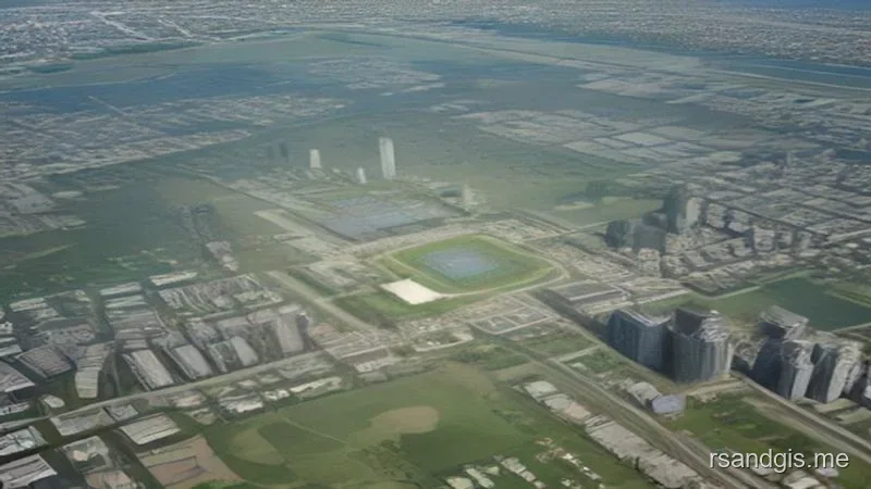
For example, sensors deployed throughout a city can continuously monitor air quality, traffic congestion, or structural health. When this real-time data is ingested into a GIS platform, it can be visualized geographically, allowing administrators to identify spatial patterns, detect anomalies, and deploy resources efficiently. This dynamic, real-time approach represents a significant departure from static, periodic urban planning methods.
Key Applications in Smart City Planning
Land Use and Zoning Optimization
One of the primary functions of Urban GIS is the optimization of land use and zoning regulations. Planners utilize GIS to analyze existing land use patterns, identify underutilized parcels, and project future land requirements based on demographic and economic trends. By layering various datasets—such as transportation networks, environmental constraints, and socioeconomic indicators—GIS enables planners to identify optimal locations for new residential, commercial, or industrial developments.
Furthermore, GIS facilitates the creation of complex suitability models that evaluate the viability of specific land parcels for designated uses. These models can incorporate multiple criteria, such as proximity to public transit, soil stability, and flood risk, ensuring that urban development is both sustainable and resilient.
Intelligent Transportation Systems (ITS)
Transportation is the lifeblood of any city, and Urban GIS plays a pivotal role in the design and management of Intelligent Transportation Systems (ITS). GIS is used to map transportation networks, analyze traffic flow patterns, and identify bottlenecks. By integrating real-time traffic data from IoT sensors and connected vehicles, GIS enables dynamic traffic management strategies, such as adaptive traffic signal control and intelligent routing.
In addition to optimizing vehicular traffic, GIS is essential for planning sustainable transportation options, such as public transit networks, bicycle lanes, and pedestrian walkways. Network analysis tools within GIS can calculate service areas, determine optimal transit routes, and assess the accessibility of transportation hubs, promoting multi-modal transportation solutions and reducing reliance on personal automobiles.
Utility and Infrastructure Management
The efficient management of urban utilities—including water, electricity, gas, and telecommunications—relies heavily on GIS. Utility companies utilize GIS to maintain accurate inventories of their physical assets (e.g., pipes, cables, transformers) and their spatial relationships. This spatial awareness is critical for routine maintenance, outage management, and emergency response.
In a smart city context, GIS is integrated with Supervisory Control and Data Acquisition (SCADA) systems and smart meters to monitor utility network performance in real-time. For instance, GIS can identify the precise location of a water main break, determine which customers will be affected by a service interruption, and map the optimal route for repair crews. Furthermore, GIS aids in long-term infrastructure planning, identifying areas where capacity upgrades are required to accommodate future growth.
Advanced Methodologies: 3D City Modeling and Digital Twins
The transition from 2D mapping to 3D city modeling represents a significant leap forward in Urban GIS capabilities. 3D city models provide a realistic, immersive representation of the urban environment, incorporating building geometries, terrain variations, and subterranean infrastructure. These models are invaluable for urban design, architectural visualization, and spatial analysis tasks that require an understanding of vertical relationships, such as solar potential assessment and shadow analysis.
The concept of the "Digital Twin" builds upon 3D city modeling by linking the digital representation of the city with real-time data from its physical counterpart. A smart city digital twin is a dynamic, constantly updating virtual replica that accurately reflects the current state of the urban environment. This powerful paradigm enables urban planners and city managers to:
- Simulate and Predict: Conduct complex simulations to predict the impact of proposed developments, policy changes, or extreme weather events (e.g., simulating flood scenarios to evaluate mitigation strategies).
- Monitor and Control: Monitor key performance indicators (KPIs) in real-time and, in some cases, remotely control physical assets (e.g., adjusting street lighting levels based on pedestrian activity).
- Enhance Citizen Engagement: Provide citizens with interactive, easy-to-understand visualizations of proposed projects, facilitating more informed public discourse and participatory planning.
Comparison of Spatial Data Models
| Data Model | Characteristics | Primary Use Cases in Urban GIS | Limitations |
|---|---|---|---|
| Vector (2D/3D) | Represents features using points, lines, and polygons (or polyhedrons in 3D) defined by coordinate pairs. | Cadastral mapping, transportation networks, utility asset management, precise boundary definition. | Complex data structures; continuous phenomena are difficult to represent accurately. |
| Raster | Divides space into a grid of cells (pixels), with each cell containing a value representing a specific attribute. | Elevation modeling (DEMs), land cover classification, continuous environmental phenomena (e.g., temperature). | High storage requirements for high resolution; topological relationships are not explicitly defined. |
| Point Cloud | A massive collection of individual 3D points representing the external surfaces of objects, typically acquired via LiDAR. | High-precision 3D city modeling, line-of-sight analysis, asset extraction (e.g., identifying streetlights). | Enormous data volumes require specialized processing power and storage; lack inherent semantic information. |
| CityGML / BIM | Semantic 3D models that include both geometric representations and rich thematic attributes of urban features. | Digital twins, complex urban simulations (energy demand, wind flow), lifecycle management of infrastructure. | High cost of data acquisition and modeling; integration challenges between GIS and BIM domains. |
Environmental Sustainability and Resilience
Managing Urban Heat Islands (UHI)
The Urban Heat Island (UHI) effect, wherein urban areas experience significantly higher temperatures than surrounding rural areas due to human activities and modification of land surfaces, poses a severe threat to public health and energy consumption. Urban GIS provides the analytical capabilities necessary to identify, monitor, and mitigate UHI effects.
By integrating thermal remote sensing data with land cover maps, GIS can pinpoint UHI hotspots within a city. Planners can then use spatial analysis tools to evaluate the effectiveness of mitigation strategies, such as increasing urban canopy cover, implementing cool roofs, or modifying urban geometry to enhance ventilation. GIS enables the targeted deployment of these interventions, maximizing their impact while optimizing resource allocation.
Flood Risk Assessment and Management
Climate change and increased urbanization have exacerbated urban flood risks. Urban GIS is instrumental in developing comprehensive flood risk management strategies. Utilizing high-resolution Digital Elevation Models (DEMs) and hydrological modeling extensions, GIS can simulate various rainfall and runoff scenarios to delineate potential flood zones.
These flood hazard maps are superimposed over data concerning critical infrastructure, vulnerable populations, and property values to assess the overall risk and potential economic impact. In real-time scenarios, GIS can integrate data from stream gauges and weather forecasts to provide early warnings, plan evacuation routes, and coordinate emergency response efforts, thereby enhancing the city's overall resilience to natural disasters.
Social Equity and Participatory GIS (PGIS)
A truly "smart" city must not only be technologically advanced but also socially equitable and inclusive. Urban GIS has traditionally been criticized as a top-down tool controlled by experts and administrators. However, the emergence of Participatory GIS (PGIS) and Public Participation GIS (PPGIS) is democratizing spatial data, empowering citizens to actively engage in the urban planning process.
PGIS platforms utilize user-friendly web interfaces and mobile applications to allow residents to contribute local knowledge, report issues (e.g., potholes, broken streetlights), and provide feedback on proposed development plans. This crowdsourced spatial data—often referred to as Volunteered Geographic Information (VGI)—provides urban planners with invaluable insights into the lived experiences and priorities of the community.
Furthermore, GIS is utilized to conduct spatial equity analyses, ensuring that public services, amenities, and infrastructure investments are distributed fairly across different demographic and socioeconomic groups. By mapping indicators of disadvantage and overlaying them with access to resources (e.g., proximity to healthcare facilities, fresh food sources, public transit), GIS highlights areas of spatial injustice, guiding policymakers toward more equitable resource allocation.
GIS Software Ecosystem for Smart Cities
| Category | Key Capabilities | Prominent Examples (Proprietary & Open Source) |
|---|---|---|
| Desktop GIS | Advanced spatial analysis, complex data editing, cartographic production, geoprocessing model creation. | Esri ArcGIS Pro, QGIS, Hexagon GeoMedia |
| Spatial Databases | Secure storage, indexing, and rapid retrieval of large-scale spatial datasets; support for complex spatial queries. | PostgreSQL + PostGIS, Oracle Spatial, Microsoft SQL Server Spatial |
| Web GIS / Geospatial Servers | Publishing spatial data as web services (WMS, WFS), facilitating enterprise-wide data access and web application development. | ArcGIS Enterprise, GeoServer, MapServer |
| 3D & Digital Twin Platforms | Creation, management, and visualization of complex 3D city models, BIM integration, real-time IoT visualization. | ArcGIS Urban, Bentley Systems, Cesium, SkylineTerraExplorer |
Challenges in Implementing Urban GIS
While the benefits of Urban GIS in smart city planning are immense, the implementation and maintenance of these systems present significant challenges that municipalities must navigate carefully.
Data Privacy and Security
The collection of highly detailed spatial data, particularly when linked with IoT sensors and mobile devices, raises profound concerns regarding data privacy. Smart city GIS platforms often aggregate data that can be used to track the movements and behaviors of individuals. Ensuring robust data anonymization, strict access controls, and compliance with data protection regulations (such as the GDPR) is paramount to maintaining public trust.
Furthermore, as Urban GIS becomes increasingly integrated with critical infrastructure operations, these systems become attractive targets for cyberattacks. Securing the SDI against unauthorized access, data breaches, and ransomware attacks requires substantial investment in cybersecurity measures and continuous vigilance.
Interoperability and Data Silos
A recurring challenge in municipal governance is the presence of organizational data silos, where different departments (e.g., transportation, water, planning) utilize incompatible data formats and proprietary software systems. Achieving the holistic vision of a smart city requires overcoming these technical and institutional barriers.
Interoperability must be mandated through the adoption of open geospatial standards and the implementation of robust ETL (Extract, Transform, Load) pipelines. Furthermore, fostering a culture of data sharing and collaboration across municipal departments is often as challenging as resolving the underlying technical incompatibilities.
The Big Data Conundrum
The transition toward real-time GIS and IoT integration results in an exponential increase in the volume, velocity, and variety of spatial data—commonly referred to as "Spatial Big Data." Traditional relational database management systems (RDBMS) often struggle to process and analyze this data efficiently.
Addressing the Big Data conundrum requires the adoption of distributed computing frameworks (e.g., Apache Hadoop, Apache Spark) and NoSQL databases designed to handle massive, unstructured datasets. Additionally, edge computing—processing data closer to the source (e.g., at the IoT sensor level) rather than transmitting all raw data to a centralized server—is becoming increasingly essential to reduce latency and bandwidth consumption.
Smart City Maturity Model
| Maturity Level | GIS Integration Status | Characteristics |
|---|---|---|
| Level 1: Fragmented | Ad-hoc, departmental usage. | Siloed data, manual map production, lack of enterprise standards, redundant data collection. |
| Level 2: Standardized | Enterprise GIS architecture established. | Centralized spatial database, standardized data formats, intra-departmental data sharing. |
| Level 3: Integrated | GIS integrated with core IT systems. | Integration with ERP, CRM, and asset management systems; automated workflows; basic public web portals. |
| Level 4: Dynamic/Real-Time | IoT and sensor networks integrated. | Real-time dashboards, predictive analytics, mobile workforce enablement, dynamic resource allocation. |
| Level 5: Optimized/Digital Twin | Comprehensive 3D Digital Twin operational. | Advanced AI/ML analysis, autonomous system control, pervasive citizen engagement platforms, highly resilient infrastructure. |
Future Horizons: Artificial Intelligence and Edge Computing
The future of Urban GIS is inextricably linked to advancements in Artificial Intelligence (AI) and Machine Learning (ML). GeoAI—the intersection of AI and geospatial technology—is automating complex analytical tasks that previously required extensive human intervention.
Machine learning algorithms are increasingly utilized for feature extraction from high-resolution imagery, such as automatically identifying building footprints, road networks, or instances of informal settlements. Deep learning models can analyze vast historical datasets to predict future urban growth patterns, traffic congestion, or crime hotspots with unprecedented accuracy.
Concurrently, Edge Computing is redefining the architecture of smart cities. By distributing computational power to the "edge" of the network (e.g., processing video feeds directly at the traffic camera rather than sending them to a central server), edge computing drastically reduces latency. This enables near-instantaneous decision-making, which is critical for applications like autonomous vehicle navigation and dynamic emergency response coordination.
As these technologies mature, Urban GIS will evolve from an analytical tool into an autonomous, self-optimizing "central nervous system" for the smart city, capable of anticipating challenges and adapting urban infrastructure in real-time to meet the needs of its citizens.
Conclusion
Urban Geographic Information Systems constitute the indispensable foundation upon which the edifice of the smart city is constructed. By providing the spatial context required to integrate diverse data streams, GIS transforms raw urban data into actionable intelligence. From optimizing transportation networks and managing utility infrastructure to enhancing environmental resilience and promoting social equity, the applications of Urban GIS are as diverse as the city itself.
However, realizing the full potential of GIS in smart city planning requires more than just technological adoption. It demands a holistic approach that addresses the profound challenges of data privacy, system interoperability, and equitable access. Municipalities must invest not only in cutting-edge software and hardware but also in robust data governance frameworks and human capital.
As cities continue to grapple with the complexities of 21st-century urbanization, Urban GIS will remain an essential instrument for planners and policymakers. By bridging the gap between the physical and digital realms, GIS empowers cities to become more efficient, sustainable, and responsive to the needs of the communities they serve. The ongoing evolution of GeoAI, 3D digital twins, and edge computing promises to further elevate the capabilities of Urban GIS, ensuring that it remains at the vanguard of urban innovation for decades to come.