Automated Feature Extraction from Satellite Imagery Using AI
Table of Contents
- Introduction to AI in Remote Sensing
- The Evolution of Remote Sensing Data Analysis
- Core Architectural Paradigms in AI-Driven Extraction
- Convolutional Neural Networks (CNNs)
- Vision Transformers (ViTs)
- Advanced Methodologies for Feature Delineation
- Semantic Segmentation
- Instance Segmentation
- Object Detection
- Panoptic Segmentation
- Key Targets for Automated Feature Extraction
- Building Footprints and Urban Infrastructure
- Road Networks and Transportation Topologies
- Vegetation and Agricultural Parcels
- Hydrological Features and Coastlines
- The Preprocessing Pipeline: Preparing Data for AI
- Radiometric and Geometric Corrections
- Pan-Sharpening
- Tiling and Data Augmentation
- Overcoming Challenges in Remote Sensing AI
- Resolution and Scale Variance
- Cloud Cover, Shadows, and Atmospheric Occlusion
- Domain Shift and Generalization
- Evaluation Metrics for Feature Extraction Models
- Software Ecosystems and Deep Learning Frameworks
- Advanced Techniques: Multi-Modal Fusion and SSL
- Multi-Modal Data Fusion (Optical + SAR)
- Self-Supervised Learning (SSL)
- Foundation Models in Earth Observation
- Real-World Applications and Global Impact
- Disaster Response and Global Humanitarian Aid
- Urban Planning, Smart Cities, and Cadastral Mapping
- Environmental Monitoring and Climate Change Tracking
- The Future Horizon of Geospatial AI
- Conclusion
- Frequently Asked Questions
rsandgis.me
Introduction to AI in Remote Sensing
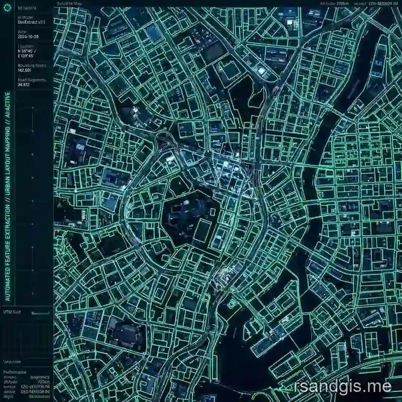
The field of Earth observation has experienced a major shift over the past decade. With the proliferation of high-resolution commercial satellites and open-access constellations like Sentinel and Landsat, the volume of geospatial data generated daily is staggering. Analyzing this petabyte-scale data manually is no longer feasible. This is where automated feature extraction steps in, leveraging the power of Artificial Intelligence (AI) to transform raw satellite imagery into actionable, structured geographic information.
Automated feature extraction refers to the computational process of identifying, delineating, and classifying specific objects or land cover types within geospatial datasets without human intervention. By deploying advanced computer vision algorithms, primarily driven by deep learning architectures, we can rapidly extract entities such as building footprints, road networks, water bodies, and agricultural plots from complex remote sensing imagery.
This article delves deeply into the technical nuances of automated feature extraction. We will explore the evolutionary leap from traditional image processing to deep neural networks, analyze state-of-the-art architectural paradigms, and examine the unique challenges inherent to satellite imagery. Whether you are a geospatial data scientist, a remote sensing engineer, or an AI practitioner, understanding the intricacies of automated feature extraction is paramount to harnessing the full potential of modern Earth observation data. The transition from massive raster datasets to highly precise vector polygons represents the core value proposition of modern geospatial analytics.
The Evolution of Remote Sensing Data Analysis
The discipline of Earth observation has historically relied heavily on manual interpretation. Highly trained photogrammetrists and Geographic Information Systems (GIS) analysts would spend countless hours digitizing maps, delineating boundaries, and classifying land cover based on visual cues such as tone, texture, pattern, and shadow. While extremely accurate, this manual approach is profoundly unscalable. But the modern aerospace industry has deployed vast constellations of satellites, ranging from sub-meter high-resolution commercial systems like WorldView, Pléiades, and PlanetScope to government-backed, medium-resolution open-access systems like the Copernicus Sentinel missions and the Landsat series. This explosion in orbital sensors has created a continuous, petabyte-scale influx of multi-spectral, hyperspectral, and Synthetic Aperture Radar (SAR) data streams.
To keep pace with this unrelenting data deluge, the geospatial industry initially turned to rule-based algorithms and classical machine learning paradigms. Techniques such as Object-Based Image Analysis (OBIA), Random Forests, and Support Vector Machines (SVMs) were utilized for automated feature extraction. While effective for localized tasks and specific sensors, these methods relied heavily on hand-crafted features, meaning engineers had to manually define the mathematical representation of what a "building" or a "road" looked like mathematically. This approach often failed to generalize across diverse geographic environments, varied lighting conditions, and different sensor specifications.
The true breakthrough occurred with the advent of deep learning. Modern automated feature extraction is the process of utilizing deep computational algorithms that automatically learn optimal hierarchical representations of data to systematically identify, isolate, and vectorize specific objects or land classes from raster imagery. By transitioning from traditional heuristic algorithms to advanced deep neural networks, automated feature extraction now enables unparalleled scalability, accuracy, and temporal frequency in geospatial analysis, transforming raw pixels into structured vector databases at global scales with minimal human oversight.

Core Architectural Paradigms in AI-Driven Extraction
The computational engine driving modern automated feature extraction is deep learning, specifically specialized branches of computer vision tailored for dense prediction tasks. These architectures must be robust enough to handle massive, multi-band raster arrays and extract meaningful semantic information across varying spatial resolutions.
Convolutional Neural Networks (CNNs)
For the better part of the last decade, Convolutional Neural Networks (CNNs) have been the undisputed backbone of automated feature extraction. CNNs utilize spatial convolution operations, mathematical linear operations where a kernel or filter slides across the image to extract local features. In early layers, these filters learn low-level primitives such as edges, corners, and color gradients. As the network deepens, pooling layers downsample the spatial resolution, and subsequent convolutions aggregate these primitives into high-level semantic representations (e.g., the structural layout of a suburban neighborhood or the repeating texture of a forest canopy).
In remote sensing workflows, Fully Convolutional Networks (FCNs) are commonly deployed. Unlike standard CNNs designed for image classification that end in fixed-size fully connected layers, FCNs replace these with 1x1 convolutions and upsampling layers. This structural modification allows the neural network to process arbitrarily sized raster arrays, typical of massive satellite image tiles, and output a spatial map of predictions rather than a single categorical label. This spatial awareness is foundational for pixel-level automated feature extraction tasks.
Vision Transformers (ViTs)
While CNNs have dominated historical workflows, a profound major shift is currently underway toward Vision Transformers (ViTs). Originally designed for natural language processing, Transformer architectures rely entirely on self-attention mechanisms rather than localized convolutions. When adapted for computer vision applications, a ViT divides a satellite image into a grid of non-overlapping patches. Each patch is linearly embedded into a token, much like a word in a text sentence.
The defining advantage of ViTs in automated feature extraction is their innate ability to model global context. CNNs are intrinsically limited by their localized receptive fields; they only "see" a small neighborhood of pixels at any given depth within the network. In contrast, the self-attention mechanism in ViTs computes mathematical relationships between every patch and every other patch in the image simultaneously. In satellite imagery, the macro-context of a feature is critical, a bridge is defined not just by its concrete surface, but by the fact that it spans water and connects to road networks on either adjacent landmass. The global receptive field of ViTs captures these macro-spatial relationships far more effectively than CNNs, offering a profound advantage for complex, large-scale automated feature extraction tasks where spatial context dictates classification.
Advanced Methodologies for Feature Delineation
Automated feature extraction encompasses a variety of distinct algorithmic methodologies. The choice of architecture depends entirely on the specific topological requirements of the target object and the desired output GIS data format.
Semantic Segmentation
Semantic segmentation involves classifying every individual pixel within a satellite image into a predefined class. The objective is to partition the image into semantically meaningful regions without differentiating between individual instances of the same class. The U-Net architecture, initially developed for biomedical image segmentation, has become extraordinarily popular and highly effective for automated feature extraction in remote sensing.
U-Net employs a symmetric encoder-decoder structure. The encoder pathway gradually reduces spatial dimensions while increasing channel depth, effectively capturing deep semantic context and feature representations. The decoder pathway then progressively upsamples this representation back to the original image resolution. Crucially, U-Net utilizes "skip connections" that directly concatenate high-resolution feature maps from the encoder with the corresponding upsampled feature maps in the decoder. This architectural choice allows the network to preserve fine-grained spatial details, essential for delineating sharp boundaries of buildings or narrow winding roads, while maintaining the broad semantic understanding required for accurate land cover classification.
More advanced iterations, such as DeepLabV3+, employ Atrous (dilated) Spatial Pyramid Pooling (ASPP). Atrous convolutions insert artificial zeroes between filter weights, effectively expanding the network's field of view without increasing the number of trainable parameters or losing critical spatial resolution. This multi-scale processing makes DeepLab highly effective for automated feature extraction across diverse and complex landscape scales.
Instance Segmentation
While semantic segmentation effectively labels pixels, it fails critically when tasked with differentiating between touching or overlapping objects of the exact same class. Instance segmentation solves this limitation by uniquely identifying and delineating each distinct object instance. Architectures like Mask R-CNN form the bedrock of this approach. Mask R-CNN extends traditional object detection architectures by adding a parallel computational branch that predicts a precise, pixel-level binary mask for each detected bounding box.
In the context of automated feature extraction, instance segmentation is absolutely critical for inventory and tracking tasks.
For example, when extracting building footprints in a dense, unstructured urban slum, standard semantic segmentation might merge hundreds of adjacent roofs into a single massive, unusable blob. Mask R-CNN, however, isolates each distinct structure, assigning it a unique instance identifier. This capability is equally vital for agricultural applications, such as delineating individual, overlapping crop fields, or forestry surveys where counting individual, intersecting tree crowns is the primary objective.
Object Detection
When precise geometric boundaries are less critical than the geographic location and classification of discrete entities, object detection algorithms are deployed. Models like YOLO (You Only Look Once), SSD (Single Shot MultiBox Detector), and Faster R-CNN draw oriented or axis-aligned bounding boxes around identified features rather than extracting full pixel masks.
In automated feature extraction pipelines, object detection is heavily utilized in defense intelligence, maritime domain awareness, and global logistics tracking. It enables the rapid counting and tracking of discrete, dynamic entities like cargo ships loitering in ports, civilian and military aircraft parked on runways, or vehicle convoys moving across vast geographic areas. Modern variants adapt these networks to predict Rotated Bounding Boxes (RBB), which are fundamentally essential for satellite imagery where objects like ships or planes can be oriented at arbitrary angles relative to the orbital sensor's nadir view.
Panoptic Segmentation
Panoptic segmentation represents the ultimate, cutting-edge unification of computer vision tasks, providing a comprehensive, holistic understanding of the entire observed scene. It smoothly merges the methodologies of semantic segmentation and instance segmentation into a single, unified output map. The panoptic algorithm assigns a categorical class label to every amorphous background pixel (referred to as "stuff", like water bodies, vast forests, or bare earth) and simultaneously assigns a unique instance ID to distinct, countable objects (referred to as "things", like individual buildings, cars, or ships).
This emerging technique offers the most robust framework for automated feature extraction currently available. By algorithmically understanding the complex interaction between "stuff" and "things," panoptic models can dramatically reduce false positives and generate highly structured, ready-to-use vector maps that deeply replicate human cognitive understanding of geography and spatial relationships.
Key Targets for Automated Feature Extraction
The applications of AI in remote sensing are exceptionally broad, but the industry generally focuses heavily on extracting several critical categories of features from both the built, anthropogenic environment and natural ecosystems.
Building Footprints and Urban Infrastructure
Extracting highly accurate, vectorized building footprints is a cornerstone capability of automated feature extraction. This data is absolutely essential for municipal urban planning, property taxation assessments, highly granular population density estimation, and accurate disaster risk modeling. AI models trained on Very High-Resolution (VHR) imagery (typically ranging from 0.3m to 0.5m GSD) must contend with immense intraclass variance: diverse architectural styles, varying roof materials (tiles, concrete, highly reflective metal), and complex, dynamic shadow patterns cast by adjacent high-rise structures.
A significant technical challenge in extracting building footprints is the infamous "jaggies" problem. Neural networks inherently output pixelated, rasterized probability masks. For this data to be actually useful in a vector-based Geographic Information System (GIS) environment, sophisticated post-processing vectorization techniques, such as the Douglas-Peucker algorithm or specialized, end-to-end polygon regularization neural networks, must be applied. These techniques ensure the AI-generated shapes are converted into clean, geometrically orthogonal vector polygons with sharp 90-degree corners, accurately reflecting human architecture.
Road Networks and Transportation Topologies
Extracting comprehensive road networks via automated feature extraction presents a fundamentally unique topological challenge. Unlike buildings, which are closed, isolated polygons, roads form continuous, highly interconnected graphs. In satellite imagery, roads are frequently occluded by overhanging seasonal tree canopies, completely obscured by tall building shadows in urban canyons, or display varying spectral signatures due to different paving materials (fresh asphalt vs. concrete vs. dirt) or degradation over time.
Neural network models tasked with this extraction must prioritize continuous connectivity and topological correctness over strict pixel-wise accuracy. Standard semantic segmentation loss functions like Binary Cross-Entropy (BCE) often fail here, producing highly fragmented, disconnected road segments that are useless for routing. Advanced automated feature extraction pipelines utilize specialized loss metrics, such as Dice loss, Focal loss, or explicitly designed Topological loss functions (like clDice). These advanced metrics guide the neural network to infer and hallucinate the continuous centerline of a road even through occlusions, ensuring the resulting vector network is fully connected and directly routable for logistics, emergency response, and navigation applications.
Vegetation and Agricultural Parcels
Automated feature extraction is heavily relied upon in the modern agricultural sector to drive global precision farming initiatives. Delineating precise crop field boundaries across massive geographical extents enables national governments and commodities traders to accurately assess total arable land and predict harvest outputs. Beyond simple geometric boundary extraction, AI models frequently integrate multi-spectral satellite data, taking profound advantage of derived spectral indices like the Normalized Difference Vegetation Index (NDVI), Enhanced Vegetation Index (EVI), or the Soil Adjusted Vegetation Index (SAVI).
By processing deep spatio-temporal datasets, analyzing the distinct phenological growth curves across a dense time-series of satellite images over an entire growing season, AI can perform incredibly deep automated feature extraction. It can not only map the exact boundary of a field but also accurately classify the specific crop species being cultivated (e.g., distinguishing between visually similar fields of corn and soybeans) and predict overall crop yield volumes based on accumulated canopy health metrics and stress indicators.
Hydrological Features and Coastlines
Monitoring dynamic, shifting water bodies, complex river networks, man-made reservoirs, and eroding coastlines is vital for climate change tracking, scientific hydrology, and municipal flood management. Water poses uniquely difficult challenges for automated feature extraction. Its visual appearance from space is highly variable due to localized depth, extreme turbidity, suspended sediment loads, and specular reflection (sun glint), which can make tranquil water appear blindingly white and saturated in standard optical imagery.
Robust automated feature extraction models targeting hydrological features must leverage the full multi-spectral payload of modern observation satellites. They heavily utilize Near-Infrared (NIR) and Short-Wave Infrared (SWIR) bands, as water strongly and predictably absorbs these specific wavelengths, making it appear distinctively dark and easily separable against surrounding highly reflective landmasses. Advanced recurrent segmentation networks can track the temporal evolution of ephemeral, seasonal rivers or dynamically map the expanding extent of catastrophic floodwaters in near real-time during extreme weather events and monsoons.
The Preprocessing Pipeline: Preparing Data for AI
Raw satellite imagery downlinked from space is inherently noisy, geometrically distorted, and generally entirely unsuitable for direct ingestion into deep learning models. A highly optimized, production-grade automated feature extraction pipeline requires meticulous, computationally intensive data preprocessing to ensure model stability and accuracy.
Radiometric and Geometric Corrections
Orbital sensors naturally degrade over time due to cosmic radiation, and the Earth's thick, dynamic atmosphere constantly interferes with incoming and outgoing electromagnetic radiation. Images must undergo rigorous radiometric calibration to convert raw Digital Numbers (DN) captured by the sensor into absolute Top of Atmosphere (TOA) reflectance or, more preferably for AI applications, Bottom of Atmosphere (BOA) Surface Reflectance. Complex atmospheric correction algorithms utilizing advanced radiative transfer models strip away the obscuring scattering and absorption effects caused by varying aerosols, ozone concentrations, and water vapor profiles.
Geometrically, orbital images suffer from significant parallax errors due to the sensor's off-nadir viewing angle and the Earth's highly varied topography. Before automated feature extraction can occur, raw images must be meticulously orthorectified. Using a high-resolution Digital Elevation Model (DEM), the orthorectification process mathematically warps the image, removing topographic relief displacement and ensuring that every single pixel aligns perfectly with a definitive geographic coordinate system (e.g., WGS84). Without this critical orthorectification step, extracted building footprints would appear to lean or shift dynamically depending on the viewing angle, resulting in massive, compounding spatial inaccuracies in the final dataset.
Pan-Sharpening
Due to the rigid physical limitations of sensor optics and bandwidth constraints, many high-resolution satellites (like Landsat 8, Sentinel-2, or WorldView-3) capture a single ultra-high-resolution panchromatic (black and white) band alongside multiple lower-resolution multi-spectral (color) bands. Pan-sharpening algorithms are critical mathematical techniques that fuse these disparate datasets. They intelligently inject the high-frequency spatial details from the panchromatic band into the lower-resolution multi-spectral bands. This computationally heavy process produces a synthesized, artificial image that possesses both extreme spatial fidelity and rich, varied spectral information, significantly boosting the accuracy and discrimination capabilities of downstream automated feature extraction models.
Tiling and Data Augmentation
A single standard satellite scene can easily encompass thousands of square kilometers and contain billions of distinct pixels, vastly exceeding the VRAM memory limits of even the most powerful modern GPUs. As a result, the preprocessing pipeline systematically slices the massive geospatial raster into smaller, computationally manageable, overlapping tiles (e.g., 512x512 or 1024x1024 pixels). The physical overlap is crucial to provide context at the borders and prevent severe edge artifacts during the final mosaic reconstruction phase.
Also, deep neural networks are notoriously data-hungry and highly prone to overfitting on limited training data. To improve model generalization across unseen geographies, extensive data augmentation strategies are applied dynamically during the training phase. Geometric augmentations include random rotations, horizontal/vertical flips, and random scaling. Radiometric augmentations are equally critical for remote sensing automated feature extraction; simulating varying seasonal lighting conditions through heavy color jittering, contrast adjustments, and intentionally injecting synthetic Gaussian noise ensures the model remains robust against the varied, messy realities of global, year-round satellite captures.
Overcoming Challenges in Remote Sensing AI
Despite significant and rapid advancements, deploying highly reliable automated feature extraction systems effectively on a global, multi-continental scale presents substantial technical and environmental hurdles that engineers must actively combat.
Resolution and Scale Variance
An object's physical representation in a raster array is entirely dependent on the sensor's Ground Sample Distance (GSD). A residential house appears as a highly detailed structure with visible roof tiles and chimneys at 0.3m resolution, but merely as a single mixed, indistinct pixel at 30m resolution. Also, geographic features vary wildly in physical size globally. An automated feature extraction model trained exclusively to detect densely packed, extremely small residential structures in urban Asian centers will almost certainly fail catastrophically to accurately identify sprawling, massive suburban homes in North America or vast industrial complexes.
To combat this severe scale variance, AI engineers deploy scale-invariant architectures. Feature Pyramid Networks (FPN) are heavily utilized as architectural backbones. An FPN extracts multi-scale feature maps from the backbone CNN and fuses them intelligently, allowing the model to make predictions simultaneously at high-resolution (essential for finding small objects) and low-resolution (essential for framing massive objects), enabling robust automated feature extraction across highly diverse, multi-scale environments.
Cloud Cover, Shadows, and Atmospheric Occlusion
The fundamental, unavoidable limitation of passive optical satellite imagery is weather. Statistically, roughly 67% of the Earth's surface is totally obscured by clouds at any given moment. Cloud cover and the resulting deep cloud shadows completely blind optical sensors, rendering standard optical automated feature extraction entirely impossible in those specific regions.
Operational, global pipelines must incorporate highly accurate, automated cloud detection algorithms (such as Fmask, s2cloudless, or dedicated deep semantic segmentation models explicitly trained for clouds) to accurately identify and meticulously mask out invalid data. Temporally, remote sensing analysts often create "cloud-free composites", advanced algorithms that stack dozens of images of the exact same area over a specific time window and apply statistical median filters to strip away transient clouds and shadows, synthesizing a perfectly clear, artificial base map specifically for subsequent automated feature extraction.
Domain Shift and Generalization
Perhaps the most persistent, difficult machine learning challenge in automated feature extraction is the "domain shift" phenomenon. A deep neural network trained extensively and exclusively on labeled imagery from one specific geographic region (e.g., highly structured European cities) or one specific sensor, often exhibits catastrophic degradation in performance when deployed over a novel region (e.g., chaotic, unstructured Sub-Saharan Africa) or a different sensor type with different spectral response curves. The immense variance in solar illumination angles, local building materials, cultural architectural designs, and underlying biome characteristics creates a stark, mathematical difference in data distributions.
Solving this domain shift requires extensive, complex domain adaptation techniques. Strategies like adversarial training, where a secondary discriminator network actively attempts to distinguish between features extracted from the source domain and the unseen target domain, force the primary model to learn universally domain-agnostic representations. Actively expanding training datasets to encompass maximum, curated global diversity is fundamentally required for creating truly universally applicable, commercial-grade automated feature extraction tools.
Evaluation Metrics for Feature Extraction Models
To rigorously and mathematically quantify the performance of an automated feature extraction system, specific statistical metrics must be employed. Simple pixel accuracy is often highly misleading, especially in highly imbalanced geospatial datasets where the vast background class vastly outnumbers the specific feature of interest (e.g., roads or small buildings might make up only 2% of a total image's pixels).
- Intersection over Union (IoU): Also widely known as the Jaccard Index, IoU is the universally accepted gold standard metric for evaluating segmentation tasks. It calculates the exact area of overlap between the AI model's predicted semantic mask and the human-annotated ground truth mask, divided by the total area encompassing both masks combined. An IoU score consistently above 0.8 generally indicates highly accurate, production-ready automated feature extraction.
- Precision: Precision measures the strict proportion of positive identifications that were actually correct. It focuses entirely on minimizing false positives. High precision means when the model says there is a building, there almost certainly is one, but it might miss others.
- Recall: Recall measures the strict proportion of actual positive features that were correctly identified by the model. It focuses on minimizing false negatives. In automated feature extraction, there is a constant, unavoidable mathematical trade-off between precision and recall based on the prediction confidence threshold.
- F1-Score: The F1-score is the harmonic mean of Precision and Recall. It provides a balanced, single-value metric that is highly indicative of an automated feature extraction model's overall reliability, robustness, and balance, particularly when dealing with severely imbalanced geospatial classes.
Software Ecosystems and Deep Learning Frameworks
The rapid, explosive advancement of automated feature extraction is heavily supported by a highly robust ecosystem of open-source software, specialized geospatial libraries, and massive corporate backing.
- PyTorch and TensorFlow: The vast majority of cutting-edge deep learning models for automated feature extraction are built utilizing PyTorch (backed by Meta) or TensorFlow (backed by Google). Their highly dynamic computation graphs, extensive GPU acceleration, and massive community support make them absolutely ideal for developing, training, and deploying custom CNNs and ViTs at scale.
- TorchGeo: A critical extension of the PyTorch ecosystem specifically designed from the ground up for massive geospatial data. TorchGeo provides pre-trained satellite weights, highly optimized specialized dataloaders for massive multi-spectral GeoTIFFs, and specific geometric loss functions absolutely essential for remote sensing automated feature extraction.
- Rasterio and GDAL: At the very base of the data preprocessing pipeline, the Geospatial Data Abstraction Library (GDAL) and its highly popular Pythonic wrapper, Rasterio, are strictly mandatory. They efficiently handle the complex I/O operations, complex coordinate reference system (CRS) transformations, and radiometric scaling required before gigabytes of data ever touch a neural network's input layer.
- QGIS and ArcGIS Pro: Post-extraction, the finalized vector results (typically GeoJSONs or ESRI Shapefiles) generated by the automated feature extraction algorithms are routinely ingested into enterprise GIS desktop software like open-source QGIS or ESRI's ArcGIS Pro for advanced spatial querying, topological cleanup, and final cartographic rendering for end-users.
Advanced Techniques: Multi-Modal Fusion and SSL
To shatter existing accuracy ceilings and push the boundaries of what is possible, researchers are aggressively integrating cutting-edge machine learning paradigms into automated feature extraction pipelines.
Multi-Modal Data Fusion (Optical + SAR)
Synthetic Aperture Radar (SAR) systems, such as the Copernicus Sentinel-1 constellation, possess the profound, unique capability to emit active microwave pulses. These powerful pulses effortlessly penetrate dense cloud cover, heavy rain, and operate completely independently of solar illumination, providing guaranteed, reliable data acquisition day or night, regardless of extreme weather. But SAR imagery is notoriously difficult for humans and standard optical CNNs to interpret due to inherent, heavy speckle noise, extreme layover distortion, and highly complex microwave scattering properties.
The absolute frontier of modern automated feature extraction lies in multi-modal data fusion. By architecting complex neural networks with dual, multi-stream inputs, systems can mathematically fuse high-resolution optical data with perfectly co-registered SAR data. The neural network learns to smoothly leverage the rich spectral and contextual information of optical sensors alongside the all-weather reliability and physical structural data (surface roughness, dielectric properties) inherently provided by SAR. This multi-modal fusion is profoundly critical in disaster response, enabling the flawless automated feature extraction of flooded urban areas or massive earthquake damage even when heavy, impenetrable storm clouds completely obscure the optical view from space.
Self-Supervised Learning (SSL)
The single most significant bottleneck in developing powerful deep learning models for Earth observation is the exorbitant financial cost and massive time required to generate pixel-perfect, manually annotated training data by human experts. Self-Supervised Learning (SSL) offers a truly revolutionary, paradigm-shifting solution. SSL algorithms allow massive neural networks to pre-train on vast repositories of entirely unlabeled satellite imagery, which is incredibly abundant and cheap.
The model autonomously learns fundamental, highly generalized representations of the Earth's complex surface physics by solving computationally difficult pretext tasks without human labels. Techniques like Masked Image Modeling (where large portions of a satellite image are artificially hidden and the network must mathematically reconstruct them) or Contrastive Learning (where the model learns to identify augmented, distorted views of the exact same geographic location as mathematically similar) are heavily employed. Once this foundational, highly generalized understanding is established, the model can be rapidly and cheaply fine-tuned for highly specific automated feature extraction downstream tasks using only a tiny fraction of the expensive labeled data previously necessitated.
Foundation Models in Earth Observation
The entire geospatial intelligence industry is rapidly transitioning toward the transformative era of Geospatial Foundation Models. Drawing direct, powerful inspiration from the astronomical success of Large Language Models (LLMs) in Natural Language Processing, massive organizations are currently training gargantuan Vision Transformer architectures on diverse, petabyte-scale datasets spanning the entire globe and multiple distinct sensor modalities.
Pioneering, open-source models such as the NASA and IBM collaborated 'Prithvi' model, or Stanford University's 'SatMAE', are explicitly designed to serve as universal "jack-of-all-trades" base models for the entire industry. Rather than undertaking the computationally brutal, incredibly expensive process of training a new neural network completely from scratch for every specific commercial use case, practitioners can simply download these robust, pre-trained geospatial foundation models. Through highly efficient, lightweight transfer learning protocols, these massive models can be quickly fine-tuned for highly targeted automated feature extraction tasks, whether that entails extracting residential building footprints in Tokyo, classifying specific vineyard types in France, or mapping illegal deforestation fronts deep in the Amazon basin. This paradigm dramatically lowers the barrier to entry for smaller companies, achieving state-of-the-art results with absolute minimal computational overhead and remarkably sparse datasets.
Real-World Applications and Global Impact
The reliable, operational deployment of highly accurate automated feature extraction systems is actively and aggressively transforming critical workflows across numerous global industries and government agencies.
Disaster Response and Global Humanitarian Aid
In the chaotic, desperate immediate aftermath of catastrophic natural disasters, such as severe 8.0+ earthquakes, category 5 hurricanes, or massive tsunamis, rapid situational awareness is literally the difference between life and death. First responders and military units cannot wait days for manual map digitization. Automated feature extraction models can instantly ingest post-disaster satellite passes as they are downlinked, automatically coregister them against pre-disaster historical baselines, and autonomously execute complex change detection protocols. Within minutes, they generate maps of destroyed infrastructure, delineate completely flooded roadways, and identify blocked critical supply routes, enabling emergency management agencies (like FEMA) to optimize logistical triage and target rescue operations with surgical, data-driven precision.
Urban Planning, Smart Cities, and Cadastral Mapping
Explosive, rapid urbanization is severely straining global municipal infrastructure, particularly in the developing world. City planners rely heavily on automated feature extraction to continuously monitor unchecked urban sprawl, map the rapid growth of informal settlements (slums), and maintain dynamic, legally accurate, up-to-date cadastral (property boundary) databases for taxation. By continuously running these algorithms over deep historical satellite archives, urban planners can mathematically model population growth vectors, quantify the dangerous expansion of impervious surfaces (crucial for urban heat island mitigation and flood runoff), and design massive future transit infrastructure utilizing absolute data-driven spatial intelligence.
Environmental Monitoring and Climate Change Tracking
Tracking the macroscopic, devastating impacts of anthropogenic climate change necessitates continuous, highly accurate, global-scale observation that only satellites can provide. Automated feature extraction serves as the primary, indispensable analytical tool for modern environmental scientists. It is utilized to precisely and automatically measure the volumetric rate of glacial retreat in the Himalayas, map rapidly expanding illegal deforestation fronts in the Amazon basin, and track the relentless, creeping expansion of desertification in Sub-Saharan Africa. By automating the massive extraction of these critical environmental indicators continuously over decades of Landsat archives, climatologists can construct highly accurate, predictive mathematical models of shifting global biomes.
The Future Horizon of Geospatial AI
Looking toward the near future, the capabilities and deployment strategies of automated feature extraction are poised to expand dramatically, constrained only by the limits of computational physics and launch capabilities.
The most profound, game-changing shift currently underway is the advent of Edge AI in Space. Historically, satellites functioned entirely as "dumb" sensors, blindly capturing massive arrays of raw pixels and downlinking them to ground stations for all processing, a process severely choked by extreme radio bandwidth limitations and high latency. Next-generation orbital constellations are deploying powerful, radiation-hardened AI processing units (GPUs/NPUs) directly onboard orbiting satellites. The satellite itself executes the complex automated feature extraction algorithms directly in low-earth orbit in real-time. Instead of transmitting heavy, gigabyte-sized raw raster images, the satellite downlinks only the lightweight, highly actionable vector intelligence (e.g., transmitting a tiny kilobyte string: "Active wildfire perimeter detected at coordinates X,Y"). This major shift reduces analytical latency from several days to mere seconds, enabling true real-time Earth observation.
Simultaneously, the deep integration of Generative AI, notably advanced Generative Adversarial Networks (GANs) and geospatial Diffusion models, is permanently solving the industry's critical data scarcity problem. Engineers can now reliably synthesize hyper-realistic, mathematically accurate training data. By generating totally synthetic satellite imagery of statistically rare events (like specific military deployments, rare natural disasters) or hard-to-capture features under varied seasonal conditions, developers can continuously and cheaply fortify the robustness and edge-case resilience of their automated feature extraction systems without ever waiting for the actual physical data to be acquired by orbiting sensors.
Conclusion
The seamless, powerful integration of advanced deep learning architectures with high-resolution remote sensing has fundamentally and irreversibly altered how humanity monitors and interacts with geospatial data. Automated feature extraction has completely transcended its origins as a niche academic research topic; it is now a critical, operational capability that powers modern cartography, real-time environmental monitoring, autonomous navigation, and global strategic security. As satellite constellations grow increasingly dense and artificial intelligence architectures, particularly Vision Transformers and multi-modal Foundation Models, become ever far more sophisticated, our capacity to autonomously extract, quantify, and comprehend the complex features of our planet from orbit will continue to accelerate exponentially. The historical, crippling technical barriers of data volume and analytical complexity are being systematically dismantled by AI, ushering in an unparalleled, transformative new era of instant, high-fidelity Earth intelligence that will shape the 21st century.
Frequently Asked Questions
What is automated feature extraction in remote sensing?
Automated feature extraction uses computer vision and machine learning algorithms to automatically identify and digitize specific geographic features, such as buildings, roads, or water bodies, directly from raw satellite imagery.
How do Convolutional Neural Networks (CNNs) help in feature extraction?
CNNs are highly effective deep learning models that excel at recognizing complex spatial patterns, edges, and textures in images, allowing them to rapidly distinguish man-made structures like buildings from natural landscapes.
Why is automated feature extraction important for disaster response?
After a disaster like an earthquake or flood, automated extraction can instantly compare pre- and post-disaster satellite imagery to identify damaged buildings and blocked roads, drastically accelerating emergency response efforts.
