Automated Road Network Extraction LiDAR
Table of Contents
- Introduction to Modern Geoinformatics
- The Basics of Point Cloud Data
- Laser Reflection Properties
- Intensity Calibration
- Practical Calibration Techniques
- Key Algorithms and Methodologies
- Filtering Techniques
- Ground vs. Non-Ground Separation
- Morphological Filters
- Implementation Details for Morphology
- Feature Extraction
- Tensor Voting and Curvature
- Advanced Classification Strategies
- Machine Learning Fundamentals
- Deep Learning Approaches
- Convolutional Neural Networks on Grids
- PointNet and Variations
- Challenges in Urban Environments
- Occlusions and Canopy Cover
- Complex Intersections and Overpasses
- Practical Applications and Industry Impact
- Autonomous Driving and HD Maps
- Smart City Infrastructure Management
- Future Directions and Technology Fusion
- Integration with Photogrammetry
- Real-Time Processing and Edge Computing
- Frequently Asked Questions
Introduction to Modern Geoinformatics
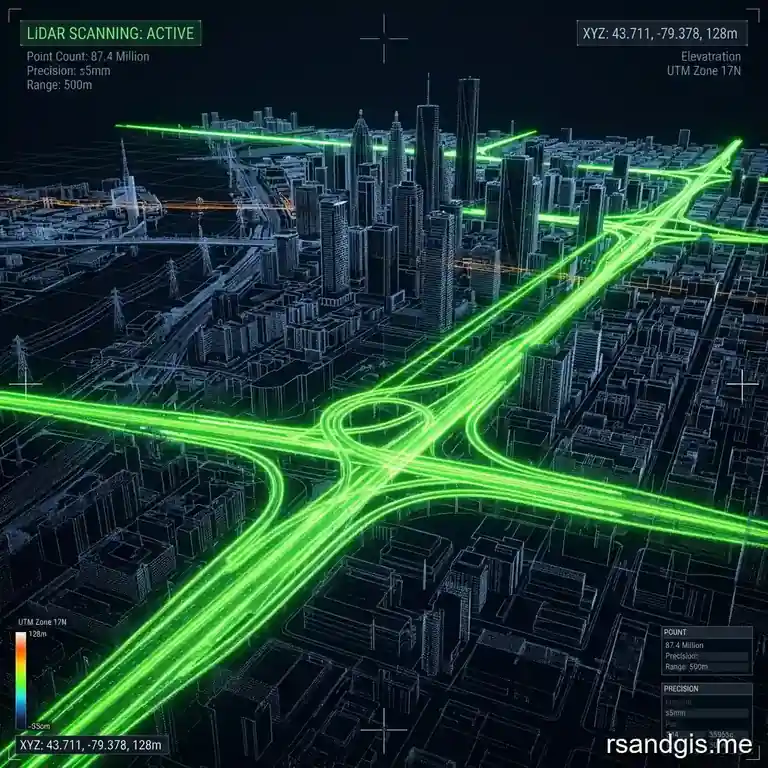
The process of automated road network extraction lidar has become an essential component in modern geoinformatics, urban planning, and autonomous vehicle navigation. Over the past decade, light detection and ranging technology has transitioned from an esoteric remote sensing technique to a mainstream methodology used to map the physical world in three dimensions with unparalleled accuracy. Road networks form the backbone of urban and rural infrastructure, and their precise delineation is critical for a wide array of applications ranging from traffic management to emergency response routing. As cities grow and transportation networks become increasingly complex, the manual extraction of these features from aerial imagery or low-resolution topographical maps is no longer viable. The necessity for high-speed, high-accuracy, and high-reliability spatial data has driven researchers and engineers to develop sophisticated algorithms designed specifically for handling dense point clouds generated by aerial, terrestrial, and mobile laser scanning systems.
In the context of geographical information systems (GIS), the extraction of roads using active sensors provides significant advantages over passive optical sensors. Passive sensors rely on external light sources, predominantly the sun, making them susceptible to shadows, cloud cover, and variations in illumination. In contrast, laser scanning systems emit their own light pulses, enabling them to operate under diverse weather conditions and even at night. Also, the ability of laser pulses to penetrate certain types of vegetation canopy allows for the mapping of road surfaces that would otherwise be obscured in traditional aerial photographs. This capability is particularly vital in forested regions or suburban areas with dense tree-lined streets. As a result, researchers have focused heavily on refining the algorithms that process this raw three-dimensional coordinate data to automatically and accurately vectorise road networks.
The Basics of Point Cloud Data
At the heart of this technology is the point cloud, a massive collection of points in three-dimensional space, where each point represents a surface reflection recorded by the scanner. Every single point possesses X, Y, and Z coordinates relative to a specific spatial reference system. In addition to these spatial coordinates, modern scanners also capture the intensity of the returning laser pulse, which provides invaluable information regarding the reflective properties of the surface material.
For instance, the asphalt or concrete used in road construction typically exhibits a different reflectance signature compared to surrounding vegetation, soil, or building rooftops. By exploiting these intensity values alongside the spatial geometry, extraction algorithms can more easily distinguish road surfaces from non-road surfaces.
Point clouds can be staggeringly large, often comprising billions of individual points for a single survey area. Processing such vast datasets requires robust computational resources and highly optimized data structures, such as octrees or k-d trees, which allow for efficient spatial querying. The initial step in any extraction pipeline generally involves organizing this unstructured data into a format that facilitates rapid access to a point and its local neighborhood. Understanding the local context of each point, such as surface normal, local curvature, and point density, is crucial for identifying the planar characteristics typical of road networks.
Laser Reflection Properties
The interaction between the laser pulse and the target surface is a complex physical process that heavily influences the quality of the resulting data. The amplitude of the returned signal, recorded as the intensity value, is dependent on several factors including the angle of incidence, the distance to the target, the wavelength of the laser, and the physical and chemical composition of the surface. Asphalt roads, being relatively dark and rough at a microscopic level, tend to scatter the laser pulse, resulting in lower intensity returns compared to smooth, highly reflective surfaces like glass or metallic signs. But the consistency of this intensity across the surface of a road can be a powerful feature for automated classification algorithms.
Plus, the phenomenon of multiple returns plays a significant role in differentiating ground features from above-ground features. A single laser pulse can strike multiple targets as it travels toward the ground, particularly in vegetated areas. The first return might correspond to the top of a tree canopy, intermediate returns to branches, and the final return to the ground surface beneath the tree. By isolating the last returns, data scientists can generate a digital terrain model (DTM) that strips away the vegetation, revealing the bare earth and the road network embedded within it.
Intensity Calibration
To fully leverage intensity data for classification, it must first be properly calibrated. Raw intensity values are often relative and can vary between different flight lines or even between different scanners of the same model. Calibration processes attempt to normalize these values, compensating for variables such as range and atmospheric attenuation, to produce a standardized measure of surface reflectance. This standardization is critical when applying machine learning models trained on one dataset to a completely new geographic area, ensuring that the model does not misinterpret the intensity features due to uncalibrated sensor variations.
Practical Calibration Techniques
In practice, calibration involves flying the scanner over known reference targets with precisely measured reflectance properties before and after the primary survey. These targets provide a baseline against which the entire dataset can be adjusted. Software tools then apply mathematical correction models to the raw intensity values, resulting in a more uniform and reliable dataset that significantly enhances the performance of subsequent extraction algorithms.
Key Algorithms and Methodologies
The extraction of road infrastructure from point clouds is typically approached as a multi-step pipeline, beginning with raw data ingestion and ending with the output of structured vector graphics representing the road centerlines and boundaries. While specific implementations vary wildly across academic literature and commercial software, the fundamental methodologies generally fall into a series of well-defined stages: filtering, feature extraction, classification, and vectorization.
Each of these stages presents its own unique set of challenges. The algorithms must be robust enough to handle noise, varying point densities, and the presence of complex urban features that mimic the geometrical properties of roads, such as large flat rooftops or open concrete plazas. Over the years, the geospatial community has developed an arsenal of techniques to tackle these problems, ranging from traditional mathematical modeling to cutting-edge deep learning frameworks.
Filtering Techniques
Filtering is the critical first step in the pipeline. Before one can identify a road, one must separate the points that belong to the ground from those that belong to buildings, vegetation, vehicles, and power lines. This process, often referred to as ground filtering or bare-earth extraction, aims to produce a highly accurate Digital Elevation Model (DEM) or Digital Terrain Model (DTM).
Numerous ground filtering algorithms exist, and they are generally categorized into morphological filters, surface-based filters, and segmentation-based filters. Each approach has its strengths and weaknesses depending on the terrain type, whether it is steeply mountainous, gently undulating, or heavily urbanized.
Ground vs. Non-Ground Separation
The separation of ground points from non-ground points relies heavily on the assumption that the ground forms a continuous, relatively smooth surface, whereas objects like buildings and trees represent abrupt, discontinuous elevation changes. Algorithms iterate through the point cloud, examining local neighborhoods to identify the lowest points, which are assumed to be ground. From these seed points, the algorithm gradually builds a surface model, iteratively evaluating and adding neighboring points that fall within a specified elevation threshold relative to the modeled surface.
A major challenge in this phase is the presence of outliers, such as points resulting from multipath reflections or atmospheric interference. If an outlier with an artificially low elevation is mistakenly identified as a ground seed point, the resulting surface model can be heavily distorted, leading to errors that propagate through the entire extraction pipeline.
Morphological Filters
Mathematical morphology, originally developed for image processing, has been highly successful when adapted for point cloud filtering. The fundamental operations of morphology are dilation and erosion, which can be combined to form opening and closing operations. In the context of elevation data, a morphological opening filter essentially slides a geometric shape, typically a flat disk or a sphere, underneath the terrain surface. Any features that are narrower than the disk, such as trees or buildings, are effectively removed, leaving only the broader, continuous ground surface.
The size of the structural element (the disk or sphere) is a critical parameter. If it is too small, large buildings may not be filtered out; if it is too large, natural terrain features like hills and ridges may be incorrectly flattened. Progressive morphological filters attempt to mitigate this by starting with a small structural element and gradually increasing its size while applying an elevation threshold to identify non-ground points at each step.
Implementation Details for Morphology
Implementing morphological filters directly on unstructured 3D point clouds is computationally expensive. Therefore, a common optimization involves rasterizing the point cloud into a 2D grid of elevation values before applying the filters. While this significantly speeds up processing, it introduces a loss of precision, as multiple points falling within the same grid cell must be aggregated, typically by taking the minimum elevation value. The resolution of this grid must be carefully chosen to balance processing speed with the spatial detail required for accurate road extraction.
Feature Extraction
Once the ground points have been isolated, the next phase is to extract features that differentiate roads from other ground cover types, such as bare soil, grass, or sidewalks. These features can be broadly divided into geometric features and radiometric features. Geometric features describe the physical shape and layout of the surface, including local planarity, roughness, slope, and curvature. Roads are engineered structures designed to be relatively flat and smooth, meaning their local geometric features typically exhibit low variance in elevation and a high degree of planarity.
Radiometric features, on the other hand, relate to the intensity of the returned laser pulse, as discussed earlier. By combining these geometric and radiometric features into a multi-dimensional feature vector for each point, the algorithm can create a comprehensive profile that serves as the input for subsequent classification models.
Tensor Voting and Curvature
Tensor voting is an advanced geometric technique used to infer continuous structures, such as lines and surfaces, from noisy point data. By encoding the local geometry of each point as a tensor, the algorithm can propagate this information to neighboring points. Points that lie on a continuous surface, like a road, will receive strong 'votes' from their neighbors, reinforcing their classification as part of a planar structure. Conversely, points at the edges of roads or in noisy areas will receive conflicting votes, allowing the algorithm to clearly define the boundaries of the road network.
Similarly, evaluating the principal curvatures of the local surface can help identify road corridors. Roads typically exhibit low curvature along the direction of travel and slightly higher curvature perpendicular to the travel direction to facilitate water drainage (the road crown). Identifying these specific curvature patterns is a powerful method for isolating road segments from flat parking lots or fields.

Advanced Classification Strategies
With features extracted, the points must be classified into 'road' and 'non-road' categories. Historically, this was achieved using rule-based expert systems or simple thresholding techniques.
For instance, a rule might state that any ground point with an intensity value between X and Y, and a local slope of less than Z degrees, is a road. While easy to implement, these heuristic methods often fail to generalize across different datasets and urban environments, requiring constant manual tweaking of parameters.
The limitations of rule-based systems paved the way for the adoption of machine learning techniques. Algorithms such as Support Vector Machines (SVMs), Random Forests, and Gaussian Mixture Models have been extensively used to classify point clouds. These supervised learning methods require a labeled training dataset, from which they learn the complex, non-linear relationships between the extracted features and the target classes.
Machine Learning Fundamentals
Random Forests, in particular, have proven highly effective for point cloud classification. By constructing an ensemble of decision trees during training, Random Forests can handle high-dimensional feature spaces and are inherently resistant to overfitting. Also, they provide a measure of feature importance, allowing researchers to understand which geometric or radiometric properties are most influential in identifying road surfaces, thereby guiding future feature engineering efforts.
But traditional machine learning models still rely on hand-crafted features. The accuracy of the classification is fundamentally bounded by the quality and expressiveness of the features defined by the human engineer. If the engineered features fail to capture a crucial nuance of the road structure, the model will inevitably misclassify points.
Deep Learning Approaches
The advent of deep learning has revolutionized computer vision and, more recently, 3D point cloud processing. Unlike traditional machine learning, deep neural networks are capable of automatically learning hierarchical feature representations directly from the raw data. This eliminates the need for tedious manual feature engineering and allows the model to discover complex spatial patterns that might be overlooked by human designers.
Adapting deep learning to point clouds, however, is not straightforward. Standard Convolutional Neural Networks (CNNs) are designed for dense, regular grids, such as pixels in an image. Point clouds, by contrast, are sparse, unordered, and lack a regular grid structure. To overcome this, researchers have developed specialized neural network architectures tailored for 3D data.
Convolutional Neural Networks on Grids
One approach to utilizing CNNs for point clouds is to transform the 3D data into a structured format. This can be done through voxelization, where the 3D space is divided into a regular grid of cubes (voxels), and each voxel is assigned a value based on the points it contains. While this allows for the application of 3D CNNs, voxelization is highly memory-intensive and computationally expensive. Most of the 3D space in a point cloud is empty, meaning a large portion of the computational power is wasted processing empty voxels. This limits the resolution of the voxel grid, which can result in the loss of fine details critical for accurate road boundary delineation.
Alternatively, the point cloud can be projected into 2D images, such as elevation maps or intensity images, from multiple viewpoints. Standard 2D CNNs, like U-Net or ResNet, can then be applied to segment these images, and the resulting classifications are projected back onto the 3D points. While computationally efficient, this multi-view approach can suffer from occlusion issues and loss of true 3D spatial relationships.
PointNet and Variations
A major breakthrough occurred with the introduction of PointNet, a pioneering architecture designed to consume raw, unordered point clouds directly. PointNet achieves this by utilizing a symmetric function, specifically, max pooling, to aggregate information from all points in a given set, making the network invariant to the permutation of the input points. It also employs multi-layer perceptrons (MLPs) to process each point independently, learning powerful spatial encodings.
While PointNet is highly effective, its original design struggles to capture local structural context, as it evaluates each point in isolation before the final global aggregation. Subsequent architectures, such as PointNet++ and various graph convolutional networks (GCNs), address this limitation by applying PointNet recursively to nested partitions of the input space. These localized structures allow the network to understand intricate geometric details, significantly improving the extraction of complex road geometries like intersections, overpasses, and roundabouts.
Challenges in Urban Environments
Despite the sophisticated algorithms available today, automated extraction remains a deeply challenging problem, particularly in dense urban environments. Cities are chaotic, cluttered spaces that present numerous obstacles to remote sensing technologies. The ideal scenario of a flat, unobstructed road surface is rarely encountered in real-world urban datasets.
The presence of vehicles, pedestrians, street furniture, and vegetation introduces massive amounts of noise into the data. Algorithms must be able to differentiate between a car parked on the side of the road and the road surface itself. Failure to do so results in 'holes' in the extracted road network or the incorrect inclusion of vehicle geometries into the road boundary.
Occlusions and Canopy Cover
One of the most persistent issues is occlusion. In urban canyons formed by towering skyscrapers, or under the dense canopy of old-growth street trees, the laser pulses may be completely blocked from reaching the ground. This results in significant data gaps in the point cloud. When a road segment is entirely occluded, the extraction algorithm has no raw data to process, leading to broken road network topology.
Addressing occlusions requires sophisticated gap-filling techniques. Morphological operations can bridge small gaps, but larger occlusions require advanced topological reasoning. Algorithms may analyze the trajectory of known road segments on either side of a gap and use spline interpolation or graph theory to predict the path of the obscured road. But predicting complex intersections or sharp curves that occur within an occluded area remains highly problematic and often requires manual intervention or fusion with supplementary data sources.
Complex Intersections and Overpasses
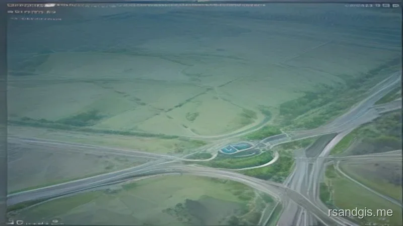
The topology of modern road networks is inherently complex. Multi-level overpasses, cloverleaf interchanges, and intricate roundabouts confound many extraction algorithms that rely on simple 2D planarity assumptions. When roads stack vertically, a traditional 2.5D elevation grid model will fail entirely, as it can only represent a single elevation value for any given X,Y coordinate.
Extracting multi-level structures requires true 3D processing. Algorithms must be capable of identifying multiple planar surfaces stacked upon one another and establishing the correct connectivity and traffic flow logic between them. This often involves modeling the road network as a 3D mathematical graph, where nodes represent intersections and edges represent road segments, complete with elevation attributes to handle grade separations.
Practical Applications and Industry Impact
The successful automation of road extraction has profound implications across multiple industries. As the technology matures, it is rapidly transitioning from academic research labs into commercial production environments, driving efficiencies and enabling new capabilities that were previously unimaginable.
The most immediate beneficiaries are mapping agencies and GIS data providers. Historically, updating national road databases involved thousands of hours of manual digitizing by human operators. Automated extraction pipelines can process massive aerial surveys in a fraction of the time, dramatically reducing costs and ensuring that digital maps accurately reflect the rapid pace of urban development.
Autonomous Driving and HD Maps
Perhaps the most critical application today is the development of High-Definition (HD) maps for autonomous vehicles. Standard navigation maps, like those on a smartphone, are accurate to within a few meters and only indicate the general topology of the road network. Autonomous driving systems require maps with centimeter-level precision that detail the exact lane boundaries, curbs, drivable surfaces, and traffic control devices.
Mobile mapping systems, consisting of high-density laser scanners mounted on vehicles, continuously traverse road networks to capture this data. The sheer volume of data generated by these fleets necessitates entirely automated processing pipelines. The extraction algorithms must not only find the road but also delineate the individual lanes, detect painted road markings using intensity data, and identify physical barriers. The safety and reliability of autonomous vehicles are directly predicated on the accuracy of these automated extraction processes.
Smart City Infrastructure Management
Beyond navigation, extracted road networks are foundational to smart city initiatives. Urban planners utilize these precise 3D models to simulate traffic flow, analyze stormwater runoff, and optimize the placement of utilities and streetlights. By possessing an exact digital twin of the physical road surface, municipalities can monitor pavement degradation over time, prioritizing maintenance and paving operations based on objective geometric data rather than subjective visual inspections.
Also, in disaster response scenarios, such as floods or earthquakes, rapid post-event aerial scanning combined with automated extraction can immediately identify blocked or destroyed road segments. This real-time intelligence is vital for routing emergency services and coordinating logistical relief efforts, saving critical time when it matters most.
Future Directions and Technology Fusion
The field of point cloud processing is evolving at a breakneck pace. As sensor hardware becomes more powerful and less expensive, the density and quality of the raw data will continue to improve. Solid-state sensors, which lack moving parts, are reducing the cost and size of scanners, paving the way for ubiquitous integration into commercial vehicles and consumer devices.
But the future of automated extraction lies not just in better lasers, but in the intelligent fusion of disparate data sources. No single sensor modality is perfect. Lasers provide unparalleled geometric precision but lack rich spectral information. Optical cameras provide high-resolution color and texture but struggle with depth perception and lighting conditions.
Integration with Photogrammetry
The synergistic fusion of point clouds with high-resolution photogrammetry represents a massive leap forward. By colorizing the 3D points with RGB values extracted from overlapping imagery, classification algorithms can leverage both precise geometry and rich visual semantics. A neural network can analyze the color and texture of a surface to confidently distinguish a gray concrete road from a gray concrete rooftop, a task that might confound an algorithm relying solely on elevation and intensity data.
This multi-modal approach requires rigorous calibration and co-registration of the camera and laser sensors to ensure that the optical pixels perfectly align with the 3D points. When properly executed, this data fusion significantly increases the robustness and accuracy of the road extraction pipeline, particularly in complex urban environments where visual context is indispensable.
Real-Time Processing and Edge Computing
Currently, the majority of massive-scale extraction occurs offline, utilizing powerful cloud computing clusters long after the survey vehicle or aircraft has completed its mission. But the rise of edge computing and specialized AI accelerators is pushing processing power closer to the sensor. The future envisions systems capable of performing automated extraction in real-time as the data is being collected.
Real-time extraction would allow autonomous vehicles to generate and update their own local HD maps on the fly, sharing these updates with other vehicles via cellular networks. This dynamic, self-healing map ecosystem would ensure that the digital representation of the road network is always perfectly synchronized with the physical reality, adapting instantly to new construction, accidents, or changing weather conditions. Achieving this vision will require continued breakthroughs in algorithmic efficiency, neural network quantization, and low-power hardware design.
Frequently Asked Questions
How does LiDAR extract road networks automatically?
Automated extraction algorithms analyze the geometric properties of 3D LiDAR point clouds, identifying planar surfaces, elevation changes, and specific intensity values that correspond to paved asphalt or concrete roads.
What is the benefit of LiDAR over optical imagery for road extraction?
LiDAR can penetrate tree canopies and is completely independent of lighting conditions or shadows, making it highly accurate for extracting hidden or obscured forest roads and urban networks.
What software is used for LiDAR road extraction?
Specialized software such as TerraScan, PDAL, and deep learning frameworks integrated with ArcGIS or QGIS are commonly used to automate the classification and vectorization of road surfaces from point clouds.
