The Best Open Source Software for LiDAR Point Clouds
Table of Contents
- Introduction to LiDAR and the Open Source Revolution
- The Anatomy and Physics of a LiDAR Point Cloud
- Data Acquisition Modalities
- Data Attributes and Industry Standard Formats
- Foundational Open Source Tools for LiDAR Point Cloud Processing
- PDAL: Point Data Abstraction Library
- Advanced PDAL Capabilities
- CloudCompare: The 3D Analytical Swiss Army Knife
- Registration and Alignment Mechanics
- Advanced Distance Computations
- WhiteboxTools: The Geospatial Analysis Engine
- Topological and Hydrological Modeling
- Computer Vision and Advanced Programmatic Processing
- Open3D: The Modern 3D Data Processing Architecture
- Spatial Indexing and Geometric Processing
- Global Registration and Feature Descriptors
- Machine Learning Synergy
- Point Cloud Library (PCL): The Heavyweight Champion
- Massive Data Management and Web Visualization
- Entwine and the EPT Format
- Potree: Democratizing Point Cloud Visualization
- Architecting an Automated Open Source LiDAR Pipeline
- The Future Horizon of Open Source LiDAR Processing
- Cloud Optimized Point Clouds (COPC)
- AI-Driven Semantic Segmentation
- Conclusion
- Frequently Asked Questions
rsandgis.me
Introduction to LiDAR and the Open Source Revolution
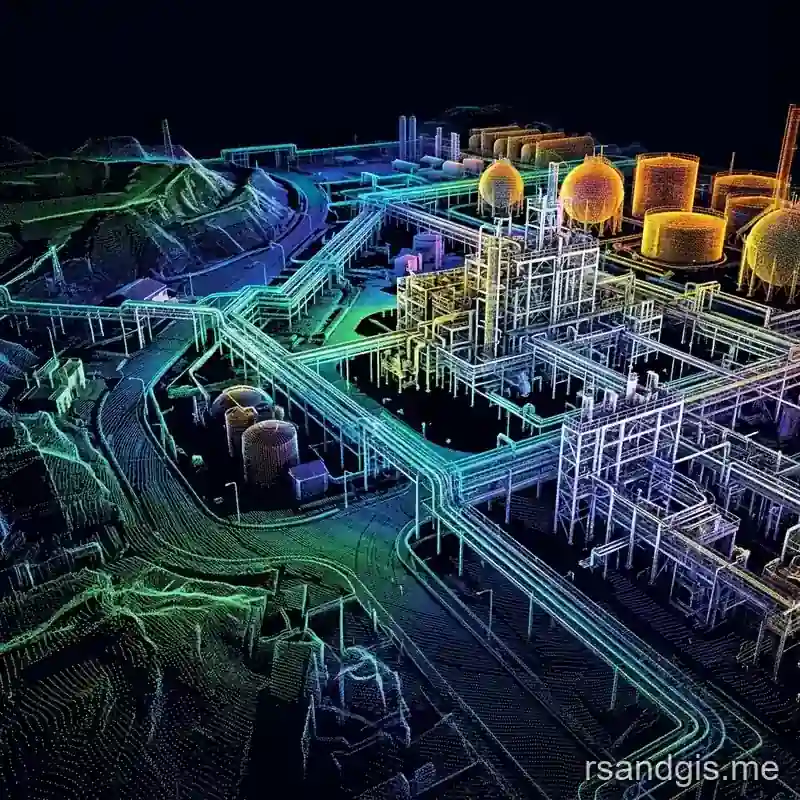
Light Detection and Ranging (LiDAR) technology has radically transformed our ability to map, analyze, and comprehend the three-dimensional structures of our physical world. From generating millimeter-accurate topological maps for civil engineering to powering the complex navigation systems of autonomous vehicles, LiDAR sensors capture reality with unparalleled precision. The output of this active remote sensing technology is a point cloud, a massive dataset comprising millions, or billions, of discrete three-dimensional coordinates in space. But capturing this data is merely the first, and arguably the easiest, step. To extract meaningful, actionable intelligence from these chaotic arrays of points, robust computational software is required. Historically, the geospatial and geomatics industries were entirely reliant on exorbitant, proprietary software suites that locked users into rigid workflows and opaque, "black box" algorithms. Today, the landscape has fundamentally shifted due to the rapid maturity and sheer power of open source tools for LiDAR point cloud processing.
This comprehensive, highly technical guide delves deep into the vibrant ecosystem of open-source solutions. These tools not only equal their commercial counterparts in performance and scalability but frequently surpass them by offering unparalleled transparency, scriptability, and community-driven rapid prototyping. Whether you are a geospatial data scientist, a geomorphologist, an urban planner, or a computer vision engineer, mastering these open source tools for LiDAR point cloud processing is critical for architecting scalable, repeatable, and highly cost-effective 3D data workflows.
The Anatomy and Physics of a LiDAR Point Cloud
To fully appreciate the capabilities of processing software, one must first understand the fundamental nature of the data it operates upon. A LiDAR point cloud is not merely a collection of XYZ vertices; it is a rich, multidimensional dataset where each point encapsulates a wealth of physical interactions between the laser pulse and the target surface.
Data Acquisition Modalities
The method of acquisition heavily influences the characteristics of the resulting point cloud, dictating the necessary processing steps:
- Airborne Laser Scanning (ALS): Captured from fixed-wing aircraft or drones (UAVs). ALS is characterized by a top-down perspective, yielding excellent bare-earth penetration through vegetation canopies but suffering from lower point density (points per square meter) and occlusions under overhanging structures.
- Terrestrial Laser Scanning (TLS): Captured using stationary, tripod-mounted scanners. TLS provides immense point density and millimeter precision, ideal for architectural heritage, industrial metrology, and detailed forest plot analysis. But it generates massive localized datasets that require complex registration workflows.
- Mobile Laser Scanning (MLS): Captured from moving vehicles (cars, trains, backpacks). MLS provides street-level detail combined with high mobility, but requires highly sophisticated trajectory processing (IMU/GNSS integration) to minimize drift and noise.
Data Attributes and Industry Standard Formats
Modern LiDAR sensors record numerous attributes for every emitted pulse. Processing software must efficiently handle these variables:
- Spatial Coordinates (X, Y, Z): Typically projected in a specific Coordinate Reference System (CRS) like UTM.
- Intensity: A measure of the return signal's amplitude. It provides radiometric information about the target.
For instance, asphalt absorbs near-infrared lasers, resulting in low intensity, while white lane markings reflect highly.
- Return Number and Number of Returns: Crucial for ALS. A single laser pulse can split, hitting the top of a tree (Return 1), intermediate branches (Return 2), and finally the ground (Return 3). Analyzing multiple returns is the primary mechanism for generating bare-earth models.
- Classification: ASPRS (American Society for Photogrammetry and Remote Sensing) defines standard integer codes categorizing points (e.g., 2 for Ground, 5 for High Vegetation, 6 for Buildings).
The industry-standard format for storing this data is the LAS format. Because uncompressed point clouds are incredibly bloated, the LAZ (LASzip) format, a mathematically lossless compression algorithm, is universally adopted. Handling the complex bit-level operations of the LAS 1.4 specification requires sophisticated data abstraction.
Foundational Open Source Tools for LiDAR Point Cloud Processing
The open-source geospatial ecosystem is anchored by foundational libraries and applications explicitly engineered to process massive point cloud topologies. These tools form the core mechanics of automated processing scripts and cloud-native workflows.
PDAL: Point Data Abstraction Library
Widely regarded as the "GDAL of point clouds," the Point Data Abstraction Library (PDAL) is arguably the most essential piece of software among open source tools for LiDAR point cloud processing. Written in modern C++, PDAL is not a point-and-click GUI; it is an highly capable programmatic engine designed for data translation, filtering, and manipulation.
PDAL operates on the architectural paradigm of a "pipeline." Data is ingested via a Reader, pushed sequentially through an array of Filters, and exported via a Writer. These pipelines are defined using a declarative JSON syntax, making them completely reproducible and easily version-controlled.
Advanced PDAL Capabilities
- Comprehensive Data Translation: PDAL can read and write nearly every 3D format in existence, including LAS/LAZ, E57, PLY, PCD, text files, and spatial databases like PostgreSQL/PostGIS Pointcloud.
- Complex Spatial Filtering: PDAL excels at topological manipulation. Its decimation filters (like voxel centroid downsampling) can reduce data volumes by 90% while preserving geometric fidelity. Its outlier filters utilize Statistical Outlier Removal (SOR) to eliminate phantom points caused by sensor noise or atmospheric scattering.
- Coordinate System Transformations: Leveraging PROJ underneath, PDAL handles complex geodetic reprojections, moving data between different datums, epochs, and coordinate systems flawlessly.
- Bare-Earth Extraction Algorithms: PDAL incorporates state-of-the-art ground classification algorithms. The Simple Morphological Filter (SMRF) and the Progressive Morphological Filter (PMF) utilize mathematical morphology (erosion and dilation) to strip away vegetation and buildings, leaving pristine ground points. The Cloth Simulation Filter (CSF) algorithm simulates a physical cloth dropping onto an inverted point cloud, providing a robust approach for steep, mountainous terrain.
By utilizing Python bindings (pdal-python), geospatial developers can loop through thousands of LAZ files on a distributed computing cluster, automating the entirety of a statewide LiDAR classification project without any human intervention.
CloudCompare: The 3D Analytical Swiss Army Knife
If PDAL is the hidden engine, CloudCompare is the premier front-end workshop. CloudCompare is an open-source 3D point cloud and mesh processing software. Originally conceptualized in France to compare 3D point clouds with CAD models (hence the name), it has organically grown into the most feature-rich graphical open source tool for LiDAR point cloud processing available today.
Registration and Alignment Mechanics
CloudCompare is renowned for its robust registration algorithms, the process of aligning multiple overlapping TLS scans into a unified coordinate system.
- Coarse Alignment: Users can manually select homologous point pairs between two datasets to execute an initial, rough alignment.
- Iterative Closest Point (ICP): CloudCompare features a highly optimized implementation of the ICP algorithm. It iteratively minimizes the root mean square error (RMSE) between a source and reference cloud. It allows users to exclude high-error points (like moving pedestrians) during calculation, ensuring millimeter-perfect scan integration.
Advanced Distance Computations
CloudCompare's analytical core is its ability to compute and visualize topological differences between datasets:
- Cloud-to-Cloud (C2C): Calculates the absolute nearest neighbor distance using rapid octree spatial indexing.
- Cloud-to-Mesh (C2M): Calculates orthogonal distances between points and a referenced 3D triangulated mesh.
- M3C2 (Multiscale Model to Model Cloud Comparison): This is the crowning jewel for geomorphologists. Unlike C2C, M3C2 computes distances along locally estimated surface normals. It explicitly calculates the statistical confidence of the detected changes based on point density and local surface roughness. It is the definitive algorithm for monitoring rockfalls, coastal erosion, and structural deformation over time.
Crucially, CloudCompare also features an extensive Command Line Interface (CLI). Every complex operation available in the GUI can be executed headlessly via batch scripts, allowing analysts to prototype in the GUI and deploy in the CLI.
WhiteboxTools: The Geospatial Analysis Engine
Developed entirely by Dr. John Lindsay, WhiteboxTools is a standalone geospatial analysis platform. While it operates on vectors and rasters, its specialized module for LiDAR processing solidifies its status as a top-tier open-source tool. Written in Rust, it guarantees exceptional concurrency, memory safety, and raw processing speed.
Topological and Hydrological Modeling
WhiteboxTools is deeply rooted in physical geography and hydrological modeling. It translates raw, chaotic point clouds into structured, analytical raster surfaces.
- High-Fidelity DEM Generation: WhiteboxTools provides multiple interpolation algorithms, from simple Inverse Distance Weighting (IDW) to complex Triangulated Irregular Networks (TIN), to construct Digital Elevation Models (DEMs) and Digital Surface Models (DSM).
- Canopy Height Modeling (CHM): By subtracting the bare-earth DEM from the highest-return DSM, WhiteboxTools generates precise CHMs, essential for forestry inventory, biomass estimation, and carbon mapping.
- Point Density and Statistical Profiling: It allows users to rapidly compute local point density, intensity histograms, and return-ratio metrics across massive flight blocks.
Because WhiteboxTools is a single, compiled executable, it is universally deployable. Through its Python frontend (whitebox-python) or its seamless integration as a QGIS Processing Provider, it acts as the perfect analytical backend for complex spatial data science workflows.
Computer Vision and Advanced Programmatic Processing
Beyond traditional mapping, LiDAR is the primary sensory modality for autonomous systems and robotics. Open-source libraries in this domain are oriented towards real-time processing, computer vision, and machine learning integration.
Open3D: The Modern 3D Data Processing Architecture
Open3D represents the modern era of open source tools for LiDAR point cloud processing. Developed with a focus on rapid prototyping, Open3D provides an optimized C++ backend exposed entirely through elegant, highly intuitive Python APIs. It bridges the historical gap between computer vision researchers and geospatial analysts.
Spatial Indexing and Geometric Processing
Open3D excels at geometric manipulation utilizing advanced spatial indexing frameworks like KD-Trees and Voxel Grids. This allows for lightning-fast radius searches and k-nearest neighbor (KNN) queries. Its normal estimation algorithms utilize Principal Component Analysis (PCA) on local neighborhoods to calculate surface normals, a prerequisite for rendering, advanced registration, and surface reconstruction (like Poisson Surface Reconstruction).
Global Registration and Feature Descriptors
For autonomous systems operating in GPS-denied environments, Open3D provides Global Registration workflows. Instead of relying on a pre-existing rough alignment, Open3D computes Fast Point Feature Histograms (FPFH), multi-dimensional descriptors of local geometry. It then uses RANSAC (Random Sample Consensus) to match these descriptors between two arbitrary point clouds, calculating the precise affine transformation matrix required to merge them.
Machine Learning Synergy
Open3D was architected specifically to support the deep learning revolution. With the introduction of Open3D-ML and the core Tensor architecture, 3D data can smoothly interface with PyTorch and TensorFlow. This allows developers to construct end-to-end pipelines where a LiDAR scan is ingested, pre-processed by Open3D, and directly fed into a neural network for 3D object detection without any costly memory serialization.
Point Cloud Library (PCL): The Heavyweight Champion
The Point Cloud Library (PCL) is the undisputed behemoth of open-source 3D processing. Backed by a massive consortium of researchers and corporations, PCL is a comprehensive C++ framework encompassing hundreds of bleeding-edge algorithms. While its learning curve is famously steep, relying heavily on complex C++ template metaprogramming, its performance is unmatched.
PCL is heavily modularized. Its Segmentation module contains Region Growing, Euclidean Cluster Extraction, and Supervoxel clustering algorithms, which are fundamental for isolating discrete objects (like individual vehicles or pedestrians) from a dense urban scan. Because PCL natively interfaces with the Robot Operating System (ROS), it is the de facto standard for real-time, in-the-loop LiDAR processing for autonomous driving stacks.
Massive Data Management and Web Visualization
Generating insights is useless if the data cannot be shared or visualized. Traditional software chokes when attempting to render terabytes of data. Open source has solved this through intelligent data structures and web technologies.
Entwine and the EPT Format
Entwine is an open-source data organization library designed expressly for massive point clouds. Feeding raw LAZ files directly into a viewer is impossible. Entwine ingests these files and restructures them into a highly optimized, octree-based spatial index known as the Entwine Point Tile (EPT) format. This hierarchical structure means that zooming out shows a sparse representation of the data, while zooming in loads progressively denser data clusters, allowing instantaneous querying of petabyte-scale datasets.
Potree: Democratizing Point Cloud Visualization
Potree is a WebGL-based point cloud renderer that runs natively in any standard web browser. By consuming the EPT data structures generated by Entwine, Potree enables smooth, 60-frames-per-second navigation through billions of points. It includes advanced measurement tools for distances, areas, and volumes, alongside cross-section generation and height profiles. Because it is completely open-source and web-based, government agencies and enterprises use Potree to publicly host massive municipal and state-wide LiDAR surveys, democratizing access to 3D spatial data.
Architecting an Automated Open Source LiDAR Pipeline
The true major shift occurs when these open source tools for LiDAR point cloud processing are chained together using standard scripting languages like Python or Bash. The Unix philosophy applies heavily here: utilize the most specific, powerful tool for each individual task within the pipeline.
Consider the architecture of an enterprise-grade, fully automated forestry classification pipeline:
- Data Ingestion & Normalization: A master Python script triggers PDAL. PDAL reads raw ALS flightlines stored in a PostgreSQL database. It applies a reprojection filter to standardize the CRS and utilizes an outlier filter to strip atmospheric noise.
- Classification & Bare Earth Extraction: The cleaned data remains in the PDAL pipeline, passing through the SMRF (Simple Morphological Filter) to identify ground points.
- Topological Surface Generation: The script invokes WhiteboxTools via its Python API. It ingests the PDAL output, interpolating the classified ground points into a high-resolution bare-earth DEM, and creates a Canopy Height Model (CHM).
- Semantic Deep Learning: The localized point cloud segments are passed to Open3D, converting them into Tensor formats, and pushed into a custom PyTorch PointNet++ model. The model semantically segments the data, classifying individual tree species based on 3D geometric signatures.
- Indexing and Dissemination: Finally, Entwine is triggered to index the processed, classified LAZ files into an EPT directory. A Potree web server points to this directory, instantly allowing stakeholders to view the classified, 3D forest inventory from their tablets in the field.
This entire pipeline relies on zero commercial software. It can be encapsulated within a Docker container and deployed via Kubernetes on AWS, automatically scaling up to process tens of thousands of square miles of LiDAR data in parallel.
The Future Horizon of Open Source LiDAR Processing
The trajectory of open source tools for LiDAR point cloud processing is exceptionally aggressive, driven by the exponential growth of 3D data and artificial intelligence.
Cloud Optimized Point Clouds (COPC)
The most disruptive recent advancement is the Cloud Optimized Point Cloud (COPC) specification. Built natively on the LAZ 1.4 format, COPC embeds a clustered spatial octree directly within the file structure. This allows analytical software (like PDAL or QGIS) to execute HTTP Range Requests, streaming only the exact spatial bounds of data required for processing directly from remote cloud storage (like Amazon S3), without ever downloading the multi-gigabyte file. COPC transforms point clouds into true cloud-native data assets.
AI-Driven Semantic Segmentation
Traditional, algorithmic classification methods (like thresholding or geometric primitives) are reaching their limits in complex, messy environments. The future belongs to deep learning. Architectures specifically designed to consume unordered, unstructured 3D point data, such as PointNet, PointNet++, RandLA-Net, and Sparse Convolutional Networks (MinkowskiEngine), are rapidly moving from academic research into open-source production environments. Soon, running an open-source inference script to automatically map traffic lights, powerlines, and curb edges with 99% accuracy will become a standard industry practice.
Conclusion
The era of being locked into slow, opaque, and wildly expensive proprietary software for geospatial analysis is over. The ecosystem of open source tools for LiDAR point cloud processing provides a comprehensive, enterprise-ready alternative. Tools like PDAL offer programmatic dominance, CloudCompare provides unmatched analytical precision, WhiteboxTools delivers immense geospatial processing power, and Open3D bridges the gap into the machine learning future.
As LiDAR hardware continues to miniaturize, finding its way onto commercial drones, industrial robots, and consumer devices, the sheer volume of resulting 3D data will demand scalable, automated solutions. By investing the time to master these open-source frameworks, geomatics professionals, researchers, and engineers empower themselves to build customized, highly efficient, and transparent workflows, unlocking the profound analytical potential hidden within billions of points of light.
Frequently Asked Questions
What are the best open-source tools for LiDAR processing?
Industry-standard open-source tools include PDAL (Point Data Abstraction Library) for building automated point cloud processing pipelines, CloudCompare for interactive 3D visualization and editing, and WhiteboxTools for advanced geospatial analysis of LiDAR data.
What is a point cloud?
A point cloud is a massive dataset containing millions of individual 3D coordinates (X, Y, Z), often acquired via LiDAR scanners or photogrammetry, representing the external surface of objects, terrain, and vegetation.
How do you extract a Digital Elevation Model (DEM) from LiDAR?
Extracting a DEM requires 'ground filtering', where algorithms classify the point cloud to separate bare-earth points from unclassified points like trees and buildings. The bare-earth points are then interpolated into a continuous raster grid (the DEM).
