Remote Sensing Greenhouse Gas Emission Monitoring
Table of Contents
- Introduction to Remote Sensing Greenhouse Gas Monitoring
- The Fundamental Physics: Atmospheric Spectroscopy
- Molecular Vibrations, Rotations, and Quantum Mechanics
- Key Spectral Absorption Bands for Remote Sensing of GHGs
- Advanced Sensor Technologies for Atmospheric Sounding
- Passive Sensors: Fourier Transform Spectrometers (FTS) and Grating Spectrometers
- Active Sensors: IPDA LIDAR Systems
- Key Satellite Missions in Remote Sensing Greenhouse Gas Monitoring
- GOSAT and GOSAT-2 (Greenhouse gases Observing SATellite)
- OCO-2 and OCO-3 (Orbiting Carbon Observatory)
- Sentinel-5P and the TROPOMI Revolution
- Emerging and Future Architectures: MethaneSAT, MicroCarb, and CO2M
- Advanced Retrieval Algorithms for Gas Concentrations
- Forward Modeling and Radiative Transfer Models (RTMs)
- The Optimal Estimation Method (OEM)
- Differential Optical Absorption Spectroscopy (DOAS)
- Atmospheric Inversion Models and Data Assimilation
- Top-Down Flux Estimation
- AI and Machine Learning in GHG Remote Sensing
- Automated Plume Detection using Convolutional Neural Networks (CNNs)
- Enhancing Retrieval Algorithms with Machine Learning Emulators
- Rigorous Calibration, Validation, and Ground Truth Networks
- The TCCON Validation Network
- AirCore Profiling and Extensive Aircraft Campaigns
- Critical Modern Applications of GHG Remote Sensing
- Detecting Methane Super-Emitters and Point Source Plumes
- Urban Dome Monitoring, Smart Cities, and Fossil Fuel Signatures
- Tracking the Global Carbon Cycle: Massive Biomass Burning and Permafrost Thawing
- Persistent Challenges and Limitations in GHG Remote Sensing
- The Menace of Aerosol and Cloud Interference
- Extreme Albedo Variations, Topography, and Low Reflectivity
- The Inherent Spatial vs. Spectral Resolution Trade-off
- The Future Horizon: Massive Constellations and Geostationary Orbits
- The Critical Shift to Geostationary Platforms
- Integrated, Multi-Tiered Monitoring Architectures
- Conclusion
- Frequently Asked Questions
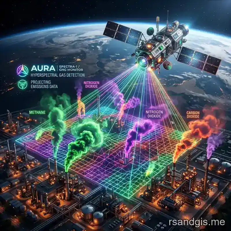
rsandgis.me
Introduction to Remote Sensing Greenhouse Gas Monitoring
The imperative to monitor, quantify, and ultimately mitigate anthropogenic and natural greenhouse gas (GHG) emissions has never been more critical in the history of atmospheric science. As the global community strives to meet the stringent emission reduction targets outlined in the Paris Agreement, traditional bottom-up emission inventories, which rely heavily on statistical economic data, self-reported metrics, and generic emission factors, are proving vastly insufficient. These methodologies are often subject to significant uncertainties, reporting lags, and regional biases that make independent verification nearly impossible. This is precisely where the advanced science of remote sensing greenhouse gas technologies steps in to bridge the critical data gap.
By providing top-down, observation-based measurements from the vantage point of space and the upper atmosphere, satellite and airborne remote sensing offer a transparent, globally consistent, and independent mechanism to verify GHG fluxes at high spatial and temporal resolutions. Remote sensing of greenhouse gases primarily focuses on the big three anthropogenic climate forcers: Carbon Dioxide (CO2), Methane (CH4), and Nitrous Oxide (N2O). Each of these gases possesses unique and highly specific spectral signatures that can be detected and quantified from space or high-altitude airborne platforms.
The historical transition from rudimentary atmospheric sounders, which were initially designed primarily for numerical weather prediction and meteorology, to dedicated, hyper-spectral, high-resolution GHG monitoring constellations represents a profound major shift in atmospheric chemistry and climate science. Today, orbiting observatories can detect minute variations in atmospheric gas columns, allowing scientists to track plumes from specific oil and gas facilities, monitor the carbon respiration of massive forests, and identify the methane emissions of distant wetlands. In this comprehensive and highly technical guide, we will dive deeply into the physical principles, intricate sensor technologies, historical and future orbital missions, mathematically rigorous retrieval algorithms, and the future trajectory of remote sensing greenhouse gas monitoring.
The Fundamental Physics: Atmospheric Spectroscopy
At the absolute core of all remote sensing greenhouse gas monitoring endeavors is the complex physics of atmospheric spectroscopy. The gases that compose the Earth's atmosphere absorb, scatter, and emit electromagnetic radiation at highly specific wavelengths. These wavelengths are unequivocally dictated by the quantized energy levels inherent to the molecular structures of the gases in question. When solar shortwave radiation passes through the atmosphere, reflects off the Earth's surface (the boundary layer), and travels back up through the atmospheric column to a satellite sensor in orbit, the greenhouse gases imprint a distinct, quantifiable absorption spectrum on the returning radiance.
Molecular Vibrations, Rotations, and Quantum Mechanics
Greenhouse gases are inherently polyatomic molecules, meaning they consist of three or more atoms.
For instance, Carbon Dioxide (CO2) is a linear triatomic molecule, Methane (CH4) forms a tetrahedral structure, and Nitrous Oxide (N2O) is a linear asymmetric molecule. Unlike diatomic molecules such as Nitrogen (N2) or Oxygen (O2), which are largely transparent to infrared radiation, the complex bonds of GHGs allow for distinct vibrational modes, specifically stretching and bending, as well as rotational transitions.
These complex vibrational-rotational transitions correspond to distinct energy changes within the molecule that perfectly match the energy of photons primarily found in the shortwave infrared (SWIR) and thermal infrared (TIR) regions of the electromagnetic spectrum. When a photon of the exact resonant frequency strikes a GHG molecule, the photon is absorbed, causing the molecule to transition to a higher energy state. This leaves a "dark line" or absorption trough in the continuous spectrum observed by the remote sensor.
Key Spectral Absorption Bands for Remote Sensing of GHGs
To accurately perform remote sensing greenhouse gas measurements, scientists target very specific spectral windows where the absorption of the target gas is strong, but interference from other atmospheric constituents (like water vapor or ozone) is minimized.
- Carbon Dioxide (CO2): The primary spectral regions utilized for highly accurate CO2 retrieval are the weak CO2 absorption band centered around 1.61 μm and the strong CO2 absorption band centered around 2.06 μm. The 1.61 μm band provides optical depth information that is highly sensitive to the lower troposphere, precisely where most anthropogenic emissions are introduced into the atmosphere. The 2.06 μm band, being significantly stronger, helps constrain interferences caused by atmospheric aerosols and thin cirrus clouds. Also, the Oxygen A-band (O2 A-band) situated at 0.76 μm is simultaneously measured. Because the concentration of atmospheric oxygen is constant and well-known, the O2 A-band is used to determine surface pressure and the precise optical path length of the light, which is absolutely crucial for converting absolute column concentrations into the standard metric of dry-air mole fractions (XCO2).
- Methane (CH4): Methane retrievals from space are predominantly conducted using its exceptionally strong absorption features in the SWIR band at 1.65 μm and the broader 2.3 μm region. The 2.3 μm band is particularly useful and frequently exploited because it allows for distinguishing between the spectral lines of methane and the heavily overlapping, interfering lines of atmospheric water vapor (H2O) and carbon monoxide (CO).
- Nitrous Oxide (N2O): While considerably harder to detect from orbit due to its much lower atmospheric concentrations compared to CO2, N2O can be effectively measured in the mid-infrared (MIR) and thermal infrared (TIR) regions. Instruments specifically target the absorption bands around 3.9 μm and 4.5 μm. But extracting near-surface N2O emissions remains a significant challenge, as TIR sensors are typically more sensitive to the mid-to-upper troposphere rather than the planetary boundary layer where the agricultural emissions actually originate.
Advanced Sensor Technologies for Atmospheric Sounding
The highly specialized instrumentation deployed for remote sensing greenhouse gas monitoring can be broadly categorized into passive sensors and active sensors. Each category employs highly sophisticated spectrometers tailored to dissect the atmospheric radiation with extreme precision and incredibly high spectral resolution.
Passive Sensors: Fourier Transform Spectrometers (FTS) and Grating Spectrometers
The vast majority of current operational and historical GHG monitoring satellites rely on passive remote sensing architectures. Passive sensors do not emit their own light; instead, they utilize the sun as the illumination source (observing reflected sunlight in the SWIR spectrum) or the Earth's own natural thermal emission (observing in the TIR spectrum).
Fourier Transform Spectrometers (FTS): Instruments such as the Thermal And Near-infrared Sensor for carbon Observation (TANSO-FTS) on Japan's GOSAT mission utilize a Michelson interferometer. Instead of physically separating light into distinct bands, an FTS splits the incoming light into two paths, changes the path length of one, and recombines them to create an interference pattern known as an interferogram. A complex mathematical algorithm, the Fourier transform, is then applied to this interferogram to reconstruct the highly resolved optical spectrum. FTS technology provides an exceptionally high spectral resolution, allowing for the precise isolation of individual, closely spaced absorption lines from overlapping interference caused by water vapor or other trace gases.
Grating Spectrometers: Missions such as NASA's OCO-2 and ESA's Sentinel-5P utilize advanced diffraction gratings to spatially separate the incoming broadband light into its component wavelengths. This dispersed light is then focused onto incredibly sensitive, cryogenically cooled two-dimensional focal plane arrays (FPAs). Grating spectrometers often boast significantly higher signal-to-noise ratios (SNR) compared to FTS and can be engineered to cover a wide continuous spatial swath. This "push-broom" scanning technique enables true mapping capabilities, creating continuous, contiguous images of gas concentrations across the globe.
Active Sensors: IPDA LIDAR Systems
While passive SWIR sensors provide incredible data, they possess an inherent limitation: they require sunlight. They struggle immensely in darkness (e.g., high-latitude polar nights), under thick cloud cover, and over regions with very low surface reflectivity (albedo), such as the open ocean. Active remote sensing technologies offer a robust and highly targeted alternative to overcome these geometrical and illumination constraints.
Integrated Path Differential Absorption (IPDA) LIDAR systems represent the cutting edge of active remote sensing greenhouse gas detection. Unlike passive systems, an IPDA LIDAR carries its own light source. It actively emits perfectly calibrated laser pulses downward from the satellite or aircraft at two slightly different, precisely tuned wavelengths. One wavelength is centered exactly on a known absorption line of the target GHG (the "on-line" pulse), and the second wavelength is located adjacent to it in an atmospheric window where absorption is minimal (the "off-line" pulse). By measuring the precise ratio of the backscattered energy of these two distinct pulses after they reflect off the Earth's surface and return to the sensor, the exact column density of the gas can be calculated. Because the LIDAR provides its own light, it works flawlessly at night, over dark oceans, and is largely unaffected by aerosol scattering that plagues passive sensors. The upcoming French-German MERLIN mission is a prime example, dedicated to active methane monitoring.
Key Satellite Missions in Remote Sensing Greenhouse Gas Monitoring
The fleet of Earth observation satellites dedicated specifically to carbon and methane tracking has expanded exponentially over the last two decades. Understanding the evolution of these missions provides vital insight into the trajectory of spatial and spectral resolution in the field of remote sensing.
GOSAT and GOSAT-2 (Greenhouse gases Observing SATellite)
Launched by the Japan Aerospace Exploration Agency (JAXA) in 2009, GOSAT (also known as Ibuki) holds the historical distinction of being the world's first spacecraft designed and dedicated exclusively to greenhouse gas monitoring. Equipped with the powerful TANSO-FTS, it uniquely measures both SWIR and TIR spectrums. This dual-band capability allows scientists to estimate both the total atmospheric column down to the surface and the upper atmospheric concentrations of CO2 and CH4, providing a 3D perspective of gas transport. GOSAT-2, launched successfully in 2018, brought improved optical precision, an intelligent pointing mechanism to actively avoid clouds, and the crucial new ability to measure Carbon Monoxide (CO). Co-measuring CO is critical because it acts as a tracer for combustion, heavily aiding in distinguishing anthropogenic fossil fuel emissions from natural biogenic fluxes.
OCO-2 and OCO-3 (Orbiting Carbon Observatory)
NASA's OCO-2, launched in 2014 after the tragic launch failure of the original OCO, fundamentally revolutionized CO2 monitoring. It abandoned the FTS approach in favor of three high-resolution grating spectrometers tailored precisely to the O2 A-band, weak CO2, and strong CO2 bands. OCO-2 was purposefully designed to track the precise geographic distribution of CO2 sources and sinks at an unparalleled high spatial resolution (roughly 1.29 km by 2.25 km footprints). This allowed it to peer between clouds, vastly increasing the number of successful soundings compared to GOSAT. Its immediate successor, OCO-3, was constructed from OCO-2's spare parts and mounted on the exterior of the International Space Station (ISS) in 2019. OCO-3 utilizes an innovative agile pointing mirror assembly (PMA). This PMA allows for "Snapshot Area Mapping" (SAM) mode, where the instrument rapidly sweeps its field of view back and forth over targeted urban areas, massive power plants, or volcanic regions, effectively mapping continuous emission plumes in a single orbital pass.
Sentinel-5P and the TROPOMI Revolution
The European Space Agency's (ESA) Sentinel-5 Precursor satellite, carrying the revolutionary Tropospheric Monitoring Instrument (TROPOMI), has acted as an absolute major advancement for short-lived climate forcers, primarily methane. While TROPOMI is not explicitly designed for high-precision CO2 quantification, its daily global coverage, incredibly wide swath (2600 km), and high spatial resolution (initially 7x7 km, later upgraded via software to 5.5x7 km) have enabled the routine detection of extreme methane point sources worldwide. TROPOMI data has exposed massive, previously unknown leaks from oil and gas infrastructure in Turkmenistan, unlit flares in the Permian Basin, and immense continuous emissions from massive landfills across the global south.
Emerging and Future Architectures: MethaneSAT, MicroCarb, and CO2M
The immediate future of remote sensing greenhouse gas monitoring relies heavily on the deployment of high-resolution, targeted constellations designed to fuse global coverage with facility-level precision.
- MethaneSAT: Developed non-traditionally by a non-governmental organization, the Environmental Defense Fund (EDF), MethaneSAT aims to perfectly bridge the gap between global mappers (like TROPOMI) and narrow point-source imagers (like the commercial GHGSat). It will provide high-precision CH4 data over a 200 km swath, targeting the world's major oil and gas producing basins to capture total basin-wide emissions that other satellites might miss.
- MicroCarb: A joint mission by the French (CNES) and UK space agencies, MicroCarb aims to map CO2 fluxes across the globe using an extremely compact, highly miniaturized grating spectrometer, proving that massive, heavy instruments are not the only way to achieve high-precision carbon tracking.
- Copernicus Anthropogenic CO2 Monitoring (CO2M): This flagship European mission is arguably the most ambitious GHG project to date. CO2M will deploy a constellation of multiple identical satellites purposefully designed to specifically quantify anthropogenic fossil-fuel CO2 emissions. By flying in a constellation, CO2M will provide the high-resolution, high-frequency, and robust data backbone explicitly required for the rigorous Global Stocktake mechanism of the Paris Agreement, effectively holding nations accountable to their reported inventories.
Advanced Retrieval Algorithms for Gas Concentrations
The intricate process of converting the raw, digitized radiance data (Level 1 data) collected by satellite spectrometers into highly accurate, chemically meaningful atmospheric gas concentrations (Level 2 data) is arguably one of the most mathematically complex and computationally intensive processes in modern Earth observation science. The standard operational metric output for GHG remote sensing is the column-averaged dry-air mole fraction, universally denoted as XCO2 or XCH4.
Forward Modeling and Radiative Transfer Models (RTMs)
The retrieval process always begins with the construction of a Forward Model. This is an extraordinarily advanced physics simulator, a Radiative Transfer Model (RTM), that meticulously calculates precisely what the satellite sensor should see based on an initial, educated guess of the entire atmospheric and surface state. The RTM must take into account an overwhelming number of variables:
- Precise solar zenith angles, satellite viewing geometry, and orbital ephemeris data.
- A priori vertical profiles of temperature, pressure, and humidity ingested from global numerical weather prediction models (like the ECMWF).
- Highly detailed molecular absorption cross-sections pulled from expansive high-resolution spectroscopic databases (such as HITRAN, GEISA, or ABSCO).
- The complex Mie scattering and Rayleigh scattering properties of multiple layers of atmospheric aerosols and thin cirrus clouds.
- Detailed surface albedo characteristics, including the complex bidirectional reflectance distribution function (BRDF) of different biomes, soils, and urban landscapes.
The Optimal Estimation Method (OEM)
The vast majority of state-of-the-art GHG retrievals, such as the widely utilized ACOS (Atmospheric CO2 Observations from Space) algorithm originally developed for OCO-2 and later adapted for GOSAT, utilize the mathematically rigorous Optimal Estimation Method (first formalized for atmospheric sounding by Clive Rodgers in 2000). OEM is a highly advanced inverse modeling technique fundamentally based on Bayesian statistics.
OEM works by iteratively adjusting the "state vector", a massive matrix of variables that we want the algorithm to solve for. This primarily includes the desired XCO2/XCH4 concentrations across different vertical layers, but it must also simultaneously solve for interfering variables like aerosol optical depth, aerosol height, precise surface pressure, and albedo shift. The algorithm calculates a simulated spectrum using the forward RTM based on the current state vector, compares it to the actual measured spectrum from the satellite, and calculates the spectral residuals.
The core of OEM is a cost function minimization process. The algorithm must perfectly balance minimizing the spectral residuals with adhering to the prior knowledge (the a priori) of the atmospheric state, constrained strictly by an error covariance matrix. It uses Levenberg-Marquardt or Gauss-Newton iterative optimization to walk down the gradient of the cost function. If the iterations converge successfully, the algorithm produces the final gas concentration along with a mathematically rigorous estimation of the retrieval error and the averaging kernels (which describe the vertical sensitivity of the measurement).
Differential Optical Absorption Spectroscopy (DOAS)
For certain applications, particularly in the field of methane retrievals from broad-swath sensors like TROPOMI, highly optimized variations of DOAS (such as the Weighting Function Modified DOAS, or WFM-DOAS) are frequently employed. The DOAS principle separates the trace gas absorption cross-section into two components: a slow-varying broadband component (which encompasses Rayleigh scattering and broadband aerosol extinction, usually removed by simple polynomial fitting) and a rapid-varying narrow-band component, which contains the highly specific molecular absorption signatures.
By fitting these narrow-band cross-sections to the measured atmospheric optical depth, DOAS algorithms derive the "slant column density", the total number of molecules along the exact path the light traveled. Complex Air Mass Factors (AMFs), calculated via RTMs, are then applied to convert this slant column into a vertical column. This DOAS method is often significantly more computationally efficient than full-physics OEM retrievals, allowing it to rapidly process the massive volume of data produced by wide-swath mappers, though it requires rigorous a posteriori corrections for complex scattering effects.
Atmospheric Inversion Models and Data Assimilation
Retrieving a highly accurate XCO2 or XCH4 measurement at a specific latitude and longitude is only half the battle. To be useful for tracking global emissions and carbon budgets, these instantaneous "snapshots" of gas concentration must be transformed into continuous spatial maps of gas fluxes (emissions and absorptions). This is achieved through the use of Atmospheric Inversion Models.
Top-Down Flux Estimation
Atmospheric inversion relies on sophisticated chemical transport models (CTMs) like GEOS-Chem or TM5. These models simulate the complex movement of air masses around the globe driven by prevailing winds, thermal convection, and complex weather systems. By taking a prior estimate of greenhouse gas fluxes (both anthropogenic emissions and natural biospheric respiration) and running it forward in time through the CTM, scientists simulate a 3D field of atmospheric concentrations.
The inversion process, much like the spectral OEM retrieval, uses Bayesian optimization. It takes the millions of satellite data points globally and continuously tweaks and adjusts the underlying surface flux estimates until the output of the 3D transport model precisely matches what the satellites are actually seeing in orbit. This "top-down" approach provides a continuous, globally consistent map of where carbon and methane are entering the atmosphere and where they are being absorbed by oceans and forests, completely independent of human-reported economic data.
AI and Machine Learning in GHG Remote Sensing
As the volume of data generated by Earth observation satellites scales from gigabytes to terabytes and eventually petabytes per day, the traditional, manual methods of data processing and plume identification are becoming functionally obsolete. The integration of Artificial Intelligence (AI) and Machine Learning (ML) into the remote sensing greenhouse gas pipeline is driving the next major leap in operational capability.
Automated Plume Detection using Convolutional Neural Networks (CNNs)
Historically, finding a methane plume in a TROPOMI or hyperspectral dataset required a human analyst to meticulously review imagery, applying localized background enhancements to visually spot the anomalous concentration gradient. Today, sophisticated Convolutional Neural Networks (CNNs) are being trained on thousands of confirmed, human-annotated methane plumes and complex synthetic datasets generated by Large Eddy Simulations (LES). These deep learning models can ingest raw, uncalibrated Level 1 radiance data or Level 2 concentration maps and automatically flag potential super-emitters in near real-time, often detecting subtle, highly diffused plumes that human eyes would easily miss. This rapid, automated triage is absolutely essential for tasking the high-resolution "tip-and-cue" satellites to follow up on the anomalies before the emission event ceases.
Enhancing Retrieval Algorithms with Machine Learning Emulators
As previously discussed, the full-physics Optimal Estimation Method (OEM) relying on complex Radiative Transfer Models (RTMs) is incredibly computationally expensive. Processing a single orbit of OCO-2 data can take massive supercomputer clusters days to complete. To alleviate this computational bottleneck, scientists are developing ML "emulators." By training deep neural networks on millions of RTM simulations, the neural network learns to perfectly mimic the complex physics of atmospheric scattering and absorption. Once trained, these ML emulators can replace the computationally heavy forward model in the retrieval algorithm, accelerating the calculation of XCO2 and XCH4 by orders of magnitude with minimal loss in accuracy. This is a critical development for upcoming missions like CO2M, which will generate data at an unparalleled rate.
Rigorous Calibration, Validation, and Ground Truth Networks
The physical and precision requirements for remote sensing greenhouse gas monitoring are notoriously unforgiving. To detect a biologically or anthropogenically significant 1 ppm (part per million) change in CO2 against an immense background atmospheric concentration of approximately 420 ppm requires a strict instrument accuracy of roughly 0.25%. A tiny error in sensor calibration or algorithmic assumption can manifest as a massive artificial carbon source or sink in the inversion models. Therefore, without extensive and highly robust ground-truth validation networks, satellite data remains virtually useless for strict policy enforcement or scientific publication.
The TCCON Validation Network
The Total Carbon Column Observing Network (TCCON) serves as the absolute global gold standard for validating space-based greenhouse gas measurements. TCCON is a globally distributed network of highly sophisticated, ground-based, sun-viewing Fourier Transform Spectrometers. Because these instruments sit on the ground and stare directly up at the solar disc, their optical light path is functionally identical to the satellite's, but in reverse. Crucially, TCCON measurements completely avoid the massive complications of surface albedo reflectance and suffer from drastically lower aerosol scattering uncertainty.
By carefully synchronizing satellite overpasses with TCCON measurements, scientists can compare the satellite's derived XCO2/XCH4 values against the highly precise TCCON reference data. This allows space agencies to meticulously calibrate satellite biases, adjust complex RTM scattering parameters, and ensure long-term stability of the space-based records.
AirCore Profiling and Extensive Aircraft Campaigns
To validate the precision of the TCCON stations themselves, and to fill in the vertical profile gaps, atmospheric scientists utilize an innovative system called AirCore. AirCore consists of a tremendously long, meticulously coiled stainless steel tube lofted to the stratosphere via a large weather balloon. As the balloon ascends, the air empties from the tube. As it descends via parachute, ambient air is passively pushed into the tube, preserving the vertical profile of the atmosphere. Once recovered on the ground, the trapped air is slowly pushed through a highly precise laboratory spectrometer, providing a continuous, extremely high-resolution vertical profile of GHG concentrations from the stratosphere down to the boundary layer.
Also, massive, multi-million dollar aircraft campaigns (such as NASA's CARVE or ACT-America) routinely fly directly beneath satellite ground tracks. These aircraft are loaded with highly precise in-situ cavity ring-down spectrometers (CRDS) that sniff the air in real-time. By flying in complex spiral and grid patterns, these aircraft map out exact 3D emission plumes from cities, agricultural regions, and oil fields, validating both the satellite's concentration data and the transport models used for flux inversion.
Critical Modern Applications of GHG Remote Sensing
The rapid maturation and commercialization of remote sensing greenhouse gas technology has unlocked utterly unparalleled capabilities in tracking the global carbon cycle, enforcing climate policy, and actively mitigating climate change.
Detecting Methane Super-Emitters and Point Source Plumes
Perhaps the most immediate, actionable, and profoundly impactful application of modern GHG remote sensing is the rapid detection and mitigation of methane "super-emitters." High-spatial-resolution commercial satellites, pioneered by companies like GHGSat (which boasts an astounding spatial resolution of roughly 25 meters), and the heavily anticipated Carbon Mapper constellation, possess the capability to pinpoint exact, facility-level emissions. They can look at an oil and gas field and tell operators exactly which specific compressor station, unlit flare stack, leaky storage tank, or fractured pipeline is venting massive quantities of methane into the atmosphere. This provision of actionable, hyper-local intelligence allows energy operators and regulators to mobilize repair crews and plug massive leaks rapidly, providing an extraordinarily fast, highly cost-effective, and massively impactful climate win.
Urban Dome Monitoring, Smart Cities, and Fossil Fuel Signatures
Global metropolitan regions and megacities account for an estimated 70% of total global fossil fuel CO2 emissions. Advanced remote sensing instruments are highly adept at observing the "urban dome", the localized, persistent enhancement of CO2 concentrations sitting directly over large urban areas. By meticulously co-measuring secondary pollutants like Nitrogen Dioxide (NO2) or Carbon Monoxide (CO), which are always co-emitted during the combustion of fossil fuels but possess much shorter atmospheric lifespans, scientists can mathematically isolate the anthropogenic fossil-fuel emissions from the natural, background biogenic respiration (plants breathing) occurring in the parks, lawns, and surrounding forests of urban centers. This provides city planners and mayors with independent, verifiable data on the efficacy of their green transport policies and industrial regulations.
Tracking the Global Carbon Cycle: Massive Biomass Burning and Permafrost Thawing
At the macro, hemispheric level, continuous remote sensing greenhouse gas data is fed directly into global atmospheric inversion models. These models map the massive seasonal fluxes and the very heartbeat of the Earth's biosphere. Satellites can smoothly monitor and quantify the severe, abrupt carbon pulses resulting from extreme biomass burning events, such as the devastating wildfires in the Amazon basin, the vast boreal forests of Siberia, and the mega-fires of Australia. Crucially, SWIR remote sensing is increasingly being leveraged to monitor fragile, highly inaccessible high-latitude regions. The goal is to detect the dreaded release of ancient methane and CO2 from rapidly thawing permafrost, a massive potential climate feedback loop and tipping point that could drastically accelerate global warming beyond human control.
Persistent Challenges and Limitations in GHG Remote Sensing
Despite the incredible, rapid advancements in orbital engineering and inverse mathematics, remote sensing greenhouse gas monitoring remains fraught with tremendously complex physical, geometric, and computational challenges that scientists are continuously striving to overcome.
The Menace of Aerosol and Cloud Interference
The absolute greatest source of systematic error and data loss in SWIR GHG retrievals stems from the complex scattering of light by atmospheric aerosols (such as desert dust, sea salt spray, urban smog, and wildfire smoke) and optically thin, nearly invisible cirrus clouds. If an incoming photon is scattered by a suspended dust particle high in the atmosphere before it can reach the ground, the total optical path length of that photon is drastically shortened. If this is not perfectly accounted for by the RTM, the retrieval algorithm will inherently underestimate the total gas column. Conversely, complex multiple scattering events trapped within a thick aerosol layer can artificially increase the photon path length, leading to a massive overestimation of the gas concentration. Advanced multi-angle light polarization measurements (like those planned for the sophisticated SPEXone instrument on NASA's upcoming PACE mission) are explicitly required to better characterize aerosol microphysics and mathematically strip their interference from the carbon signal.
Extreme Albedo Variations, Topography, and Low Reflectivity
Passive SWIR sensors absolutely require reflected sunlight to function. Therefore, they struggle immensely over geographic areas possessing very low surface albedo (reflectivity). The most notable blind spot is the world's oceans. Water is highly absorptive of SWIR radiation, meaning standard nadir (directly downward-looking) observations over oceans yield almost zero usable signal back to the satellite. To circumvent this, satellites like OCO-2 must perform complex orbital maneuvers to utilize "glint mode," physically tilting the entire spacecraft to track the blinding sunglint spot on the ocean surface to gather enough reflected light for a successful retrieval. Similarly, heavily snow-covered and ice-covered regions in high latitudes offer remarkably poor SWIR reflectivity, severely complicating and often outright preventing measurements over critical Arctic permafrost zones during much of the year.
The Inherent Spatial vs. Spectral Resolution Trade-off
Optical sensor engineering is eternally bound by the uncompromising laws of physics and the inherent necessity of compromise. To achieve an exceptionally high signal-to-noise ratio and the ultra-fine spectral resolution strictly required to accurately quantify subtle gas absorption lines, a sensor needs to gather light for a longer integration time. This inherently results in a larger, smeared spatial footprint on the ground. Conversely, to achieve ultra-high spatial resolution necessary to pinpoint specific facility-level leaks, the spectral resolution or the SNR must inevitably be sacrificed, as the sensor simply cannot stare at a tiny spot for long enough as it races across the globe at 7 kilometers per second. The next generation of satellites aims to violently push the boundaries of this physical trade-off using massively larger optical telescopes, hyper-fast readout electronics, and incredibly sophisticated 2D grating arrays.
The Future Horizon: Massive Constellations and Geostationary Orbits
The developmental roadmap for the next decade of remote sensing greenhouse gas monitoring involves a massive, coordinated transition from solitary, experimental scientific missions to robust, highly redundant, operational, weather-like monitoring systems designed to enforce international law.
The Critical Shift to Geostationary Platforms
Nearly all current and historical GHG satellites reside in Low Earth Orbit (LEO). They are typically deployed in sun-synchronous orbits, meaning they pass over a given location at the exact same local solar time every single day (e.g., precisely 1:30 PM). This fundamentally limits their observations to a single, fleeting snapshot per day, completely missing the vast dynamic changes that occur throughout the morning, evening, and night. The holy grail of the future involves deploying heavy, highly complex spectrometers on massive Geostationary (GEO) satellites. Instruments like the proposed NASA GeoCarb aim to sit completely stationary 35,000 kilometers above the Earth's equator. From this unparalleled vantage point, they will provide continuous, high-frequency, sub-daily monitoring of carbon fluxes across entire continents, finally allowing scientists to capture the complex diurnal cycle of plant respiration and the highly variable hourly traffic patterns of major megacities.
Integrated, Multi-Tiered Monitoring Architectures
The consensus among the global atmospheric science community is that no single satellite, no matter how advanced, can do it all. The future relies absolutely on an integrated, multi-tiered architecture, frequently referred to as a "System of Systems." This highly complex, interconnected web of sensors involves:
- Broad Global Mappers (LEO): Wide-swath satellites like TROPOMI and the immense CO2M constellation to provide daily, continuous global baselines, track massive regional fluxes, and serve as the early warning system for large-scale anomalies.
- Targeted Point-Source Imagers (LEO): Massive commercial and governmental constellations of highly agile, ultra-high-resolution satellites like GHGSat, Carbon Mapper, and MethaneSAT to zoom in with surgical precision on the specific plumes initially detected by the broad mappers.
- Geostationary Sentinels (GEO): To capture the continuous diurnal variations over key industrial continents like North America, Europe, and Asia.
- Dense Airborne and Ground Networks: Fleets of automated drones, high-altitude aircraft, and thousands of TCCON sites to provide continuous calibration, validation, and extremely high-resolution local monitoring in critical areas.
When combined with the massive, parallel advancements in cloud computing infrastructure and the implementation of highly sophisticated Artificial Intelligence (AI) and Machine Learning (ML) algorithms for automated, real-time plume detection, this multi-tiered approach will bring an era of radical, undeniable transparency to global carbon accounting.
Conclusion
The remarkable evolution of remote sensing greenhouse gas technologies represents one of the most monumental and critically important achievements in modern Earth observation science. From the incredibly complex fundamental quantum physics of molecular spectroscopy to the flawless deployment of multi-million dollar orbital spectrometers in the hostile vacuum of space, and the execution of intensely complex Bayesian retrieval algorithms running on supercomputers, every single step of this intricate process is engineered to exact unparalleled precision from a few scattered photons of light. As the global push for net-zero emissions dramatically intensifies and climate impacts become inescapable, these remote sensing tools are rapidly evolving from scientific novelties into essential, legally binding operational utilities. By providing strictly accurate, universally unbiased, and globally continuous data, remote sensing greenhouse gas monitoring forms the indispensable, indisputable bedrock upon which effective climate policy, global emission trading systems, and corporate accountability must be built. The continued, aggressive investment in space-based infrastructure, advanced algorithmic research, and the training of the next generation of atmospheric scientists is not merely an academic pursuit, but an absolute prerequisite for successfully managing the Earth's incredibly delicate climate system in the 21st century and beyond.
Frequently Asked Questions
How do satellites monitor greenhouse gas emissions?
Satellites use spectrometers to measure the absorption of sunlight as it reflects off the Earth and passes back through the atmosphere. Different gases, like methane and CO2, absorb light at specific wavelengths, allowing sensors to calculate their exact concentrations.
What is the TROPOMI sensor?
TROPOMI (Tropospheric Monitoring Instrument) is a satellite sensor on the Sentinel-5P mission. It is widely used for global air quality and climate monitoring because of its unparalleled ability to detect trace gases like nitrogen dioxide (NO2) and methane at high resolutions.
Can remote sensing detect individual methane leaks?
Yes, high-resolution hyperspectral satellites (and specialized aircraft) can identify distinct methane plumes leaking from specific oil and gas facilities, pipelines, or landfills, enabling rapid regulatory intervention.
