Satellite Bathymetry for Coastal Monitoring
Table of Contents
- Theoretical Foundations of Orbital Hydrography
- Radiative Transfer and Optical Attenuation
- Atmospheric and Sunglint Corrections
- Methodological Approaches to Depth Inversion
- Empirical and Semi-Empirical Algorithms
- Machine Learning and Non-Linear Modeling
- Physics-Based Analytical Inversion
- Optimization and Spectral Matching Frameworks
- Orbital Platforms and Sensor Capabilities
- High-Resolution Commercial Constellations
- Nanosatellite Swarms and High-Frequency Observation
- Medium-Resolution Public Missions
- Hyperspectral Precursors and Future Prospects
- Applications in Coastal Morphodynamics
- Tracking Nearshore Sandbar Migration
- Event-Driven Topographic Evolution
- Estuarine and Deltaic Sedimentation
- Dredging Optimization and Verification
- Operational Challenges and Limitations
- Turbidity and Optically Deep Water Limitations
- Benthic Heterogeneity and Signal Ambiguity
- The Synthesis of Space and In Situ Technologies
- Data Fusion and Assimilation Frameworks
- Vertical Datum Harmonization
- Advancing Towards Real-Time Assimilation
- Integrating with Hydrodynamic Models
- The Road Ahead for Optical Remote Sensing
- Frequently Asked Questions
rsandgis.me
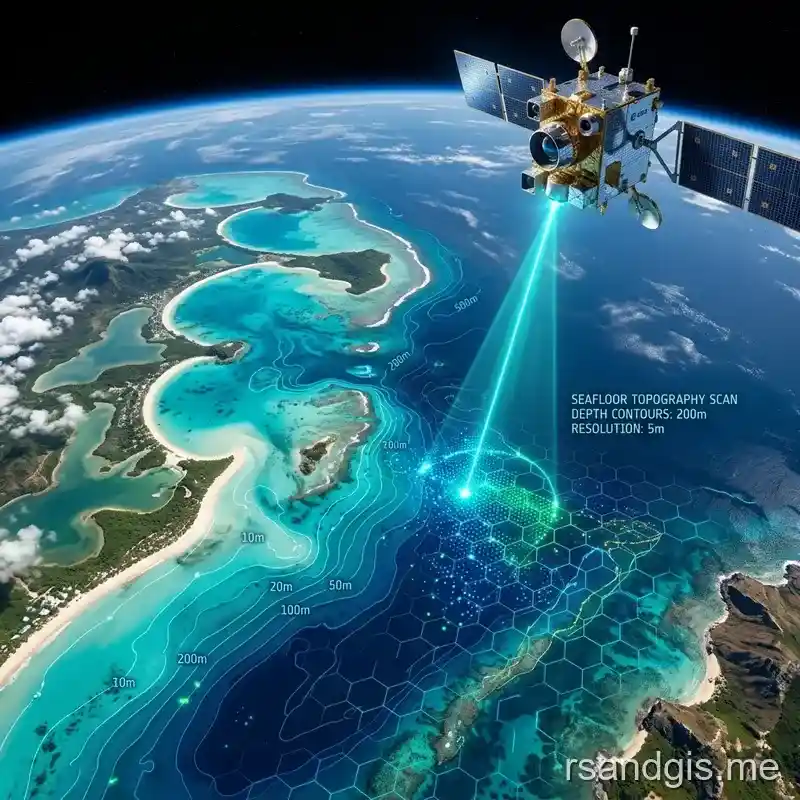
The implementation of satellite bathymetry for coastal monitoring has completely transformed our approach to quantifying nearshore morphodynamics, providing unparalleled spatial continuity and temporal frequency in environments historically constrained by the logistical limitations of acoustic vessel-based surveys. In an era where littoral zones are subjected to accelerating sea-level rise, intensified storm surge events, and anthropogenic modifications, the capacity to rapidly assess sub-aqueous topography from orbit represents a critical leap forward in hydrographic science. This methodology, commonly referred to as Satellite-Derived Bathymetry (SDB), exploits the differential attenuation of electromagnetic radiation across the visible and near-infrared spectra as it penetrates the water column. By inverting the radiative transfer equations governing light propagation in aquatic media, remote sensing scientists can extract highly accurate depth estimations, provided the optical properties of the water and the benthic reflectivity are adequately modeled or empirically constrained. The proliferation of multi-spectral and hyperspectral orbital sensors has further accelerated the adoption of this technology across marine science disciplines.
Theoretical Foundations of Orbital Hydrography
The physical basis for deriving depth from satellite imagery rests on the predictable absorption and scattering of light within the water column. The downwelling irradiance from the sun interacts with atmospheric aerosols, the air-water interface, organic and inorganic constituents within the water, and finally the bottom substrate. The upwelling radiance captured by a satellite sensor is thus a complex composite signal that must be rigorously deconstructed to isolate the depth-dependent component. This deconstruction requires a deep understanding of ocean optics and the specific absorption coefficients of various water constituents.
Radiative Transfer and Optical Attenuation
Radiative transfer theory dictates that the spectral radiance leaving the water surface is exponentially related to the depth of the water column, modulated by the inherent optical properties (IOPs) of the medium. These IOPs include the absorption coefficient and the volume scattering function, which are primarily driven by the concentration of chlorophyll-a, colored dissolved organic matter (CDOM), and total suspended matter (TSM). In clear waters, blue and green wavelengths (400-550 nm) exhibit maximum penetration, reaching depths of up to 30 meters under optimal conditions. Conversely, red and near-infrared wavelengths are rapidly attenuated within the first few meters, providing an excellent mechanism for delineating the land-water boundary and resolving ultra-shallow geomorphology. Understanding these attenuation dynamics is crucial for algorithm development.
Atmospheric and Sunglint Corrections
Before any depth inversion algorithm can be applied, the top-of-atmosphere (TOA) radiance must be corrected to surface reflectance. Atmospheric correction over aquatic targets is notoriously challenging because the water leaving radiance typically constitutes less than 10% of the total signal received by the sensor at orbit. The remaining 90% originates from Rayleigh scattering and aerosol scattering within the atmosphere. Advanced atmospheric correction processors, such as ACOLITE or C2RCC, utilize specific aerosol models and the assumption of zero water-leaving radiance in the shortwave infrared (SWIR) bands to extrapolate aerosol contributions into the visible spectrum. Also, specular reflection from the water surface, known as sunglint, must be mitigated. Sunglint correction algorithms often rely on the near-infrared band, assuming that any signal detected over deep water in this band is purely surface reflection, which can then be proportionally subtracted from the visible bands based on the refractive index of water.
Methodological Approaches to Depth Inversion
The transition from corrected surface reflectance to bathymetric maps involves mathematical models that correlate spectral variations to depth. These models broadly fall into two categories: empirical methods and physics-based analytical methods. Each approach possesses distinct advantages and is selected based on the availability of in situ data, the optical complexity of the water, and the required accuracy of the final hydrographic product. The choice of algorithm dictates the required preprocessing steps and the nature of the final error propagation.
Empirical and Semi-Empirical Algorithms
Empirical models, pioneered by Lyzenga in the 1970s and later refined by Stumpf et al., rely on statistical regressions between satellite band ratios and known depth points acquired via traditional multibeam echosounders or airborne lidar bathymetry (ALB). The band ratio algorithm, perhaps the most widely implemented semi-empirical approach, utilizes the ratio of the log-transformed reflectances of two bands (typically blue and green) to linearize the exponential decay of light with depth. This ratio is inherently robust to variations in bottom albedo, making it particularly useful in environments with heterogeneous benthic covers, such as coral reefs interspersed with sand patches. But these models require a substantial quantity of temporally coincident ground truth data to calibrate the regression coefficients for every specific scene, limiting their utility in truly remote, unsurveyed coastal zones. Also, the accuracy degrades non-linearly as depth increases beyond the optimal penetration zone.
Machine Learning and Non-Linear Modeling
In recent years, the limitations of simple linear regressions have been overcome through the application of advanced machine learning (ML) architectures. Random Forests, Support Vector Machines, and Deep Convolutional Neural Networks (CNNs) are now being deployed to model the highly non-linear relationships between multi-band spectral signatures and water depth. ML algorithms excel at identifying complex patterns in high-dimensional feature spaces, allowing for the incorporation of ancillary datasets, such as spatial texture, wave kinematics derived from sun-glint patterns, and multi-temporal image stacks. While highly capable, these data-driven approaches remain susceptible to overfitting and often suffer from poor generalizability when applied to geographic regions outside their training domain. Rigorous spatial cross-validation is therefore mandatory to ensure the reliability of the output.
Physics-Based Analytical Inversion
Physics-based approaches attempt to simultaneously retrieve water depth, bottom composition, and water column optical properties without the strict requirement for local empirical tuning data. These methods, such as the widely used HydroLight model or the Sentinel-2 specific Sen2Coral toolset, employ look-up tables (LUTs) generated by simulating millions of combinations of depth, bottom reflectance, and water constituents using radiative transfer software. The observed satellite spectrum is then matched to the closest simulated spectrum in the LUT, yielding the corresponding depth value. While analytically elegant and capable of operating in data-poor regions, physics-based methods are computationally intensive and highly sensitive to absolute radiometric calibration errors and imperfections in the atmospheric correction phase.
Optimization and Spectral Matching Frameworks
To navigate the vast parameter space of physical models, optimization algorithms such as Levenberg-Marquardt or genetic algorithms are employed to minimize the cost function between the satellite observation and the forward-modeled spectrum. These frameworks must carefully balance computational efficiency with the risk of converging on local minima. By incorporating spatial constraints, assuming that depth and water quality parameters vary smoothly across neighboring pixels, researchers have significantly improved the robustness of analytical inversions, reducing the classic 'salt and pepper' noise often associated with per-pixel spectral matching. Spatial regularization techniques effectively filter spurious high-frequency noise while preserving true geomorphological breaklines.
Orbital Platforms and Sensor Capabilities
The efficacy of deriving bathymetry from space is inextricably linked to the specifications of the orbiting sensor payload. Spatial resolution, spectral resolution, radiometric quantization, and temporal revisit frequency all dictate the applicability of the data for coastal engineering, navigation, and environmental monitoring. The current landscape is defined by a tiered architecture of commercial high-resolution and public medium-resolution satellites.
High-Resolution Commercial Constellations
Commercial satellites, such as Maxar's WorldView series and Airbus's Pléiades Neo, offer sub-meter spatial resolution, enabling the detection of intricate morphological features, submerged navigational hazards, and fine-scale benthic habitats. WorldView-2 and WorldView-3 are particularly advantageous for bathymetry due to their dedicated 'coastal blue' band (400-450 nm), which penetrates deeper into the water column than standard blue bands, and their high signal-to-noise ratio. But the high cost of tasking and data acquisition limits their widespread use for continuous, large-scale regional monitoring. These assets are typically reserved for localized, high-value engineering or defense applications.
Nanosatellite Swarms and High-Frequency Observation
The proliferation of nanosatellite constellations, most notably the PlanetScope doves, has introduced the concept of daily to sub-daily coastal monitoring. While their radiometric quality and spectral band availability (typically just RGB and NIR) are inferior to traditional large platforms, their unparalleled temporal resolution allows for the application of multi-temporal composite techniques. By aggregating dozens of images over a short period, researchers can statistically eliminate transient noise sources such as breaking waves, boat wakes, and moving clouds, producing a robust, cloud-free surface reflectance composite that significantly improves the accuracy of subsequent bathymetric inversions.
Medium-Resolution Public Missions
Publicly funded missions, such as the European Space Agency's Sentinel-2 and NASA's Landsat 8/9, form the backbone of global coastal monitoring initiatives. Sentinel-2, with its 10-meter spatial resolution in the visible bands and a 5-day global revisit time, provides an optimal balance between detail and coverage. The free and open data policy of these programs has democratized access to bathymetric data, spurring a massive increase in algorithmic development and regional-scale applications. The radiometric stability and rigorous cross-calibration of these sensors ensure consistent time-series analysis, essential for tracking decadal morphological trends.
Hyperspectral Precursors and Future Prospects
The transition from multispectral to hyperspectral orbital sensors represents the next frontier in aquatic remote sensing. Instruments like PRISMA, EnMAP, and the upcoming PACE mission capture data in hundreds of contiguous narrow bands. This spectral richness resolves the inherent ambiguity between bottom depth and bottom type that plagues multispectral inversion. With hyperspectral data, it becomes possible to identify specific coral species, differentiate between various types of submerged aquatic vegetation, and derive highly precise bathymetry simultaneously, paving the way for holistic three-dimensional coastal ecosystem mapping. Also, hyperspectral data allows for dynamic derivation of localized IOPs on a per-pixel basis.
Applications in Coastal Morphodynamics
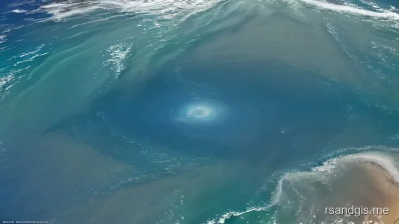
The ability to rapidly and repeatedly measure shallow-water topography from space has revolutionized our understanding of coastal processes. Traditional surveys, constrained by ship time and operational costs, provide only static snapshots of highly dynamic environments. Satellite observations fill the spatio-temporal gaps, revealing the continuous evolution of the littoral zone across massive geographical extents.
Tracking Nearshore Sandbar Migration
Nearshore sandbars act as natural breakwaters, dissipating wave energy and protecting the beach face from erosion. Their position, volume, and cross-shore migration are primary indicators of coastal resilience. Time-series satellite bathymetry allows coastal geomorphologists to track the rhythmic movement of these bars in response to seasonal wave climates. By quantifying the volumetric flux of sediment within the surf zone, engineers can better calibrate numerical sediment transport models, improving the design and longevity of beach nourishment projects and hard engineering structures.
Event-Driven Topographic Evolution
Extreme weather events, such as hurricanes and extratropical cyclones, induce massive and instantaneous changes to coastal topography. Assessing the immediate post-storm bathymetry is critical for updating navigational charts, evaluating the integrity of coastal defenses, and quantifying volumetric land loss. Satellites can image the impacted region within hours or days of the storm passing, long before survey vessels can safely mobilize. This rapid response capability provides emergency managers with critical situational awareness regarding altered navigable channels and breached barrier islands, fundamentally improving disaster recovery logistics.
Estuarine and Deltaic Sedimentation
Estuaries and river deltas are highly active sedimentary environments where fluvial inputs interact with tidal currents and wave action. Monitoring the bathymetry of tidal channels, intertidal mudflats, and prograding delta lobes is essential for maintaining navigable waterways and understanding the fate of terrestrial carbon and nutrients entering the marine system. Satellite data can track the migration of tidal channels, the accretion of mudflats, and the morphological response of deltas to upstream dam construction or changing land-use practices. The sheer scale of major deltaic systems makes satellite remote sensing the only economically viable method for comprehensive monitoring.
Dredging Optimization and Verification
Maintaining the required depth of shipping channels and harbor approaches necessitates continuous, expensive dredging operations. Satellite bathymetry can serve as a reconnaissance tool to identify areas of rapid shoaling, optimizing the deployment of survey vessels and dredging equipment. Also, pre- and post-dredging satellite imagery can provide an independent, albeit lower-resolution, verification of the extracted volumes and the successful clearance of the channel, complementing the high-resolution multibeam data acquired by the dredging contractors. This hybrid approach significantly reduces total operational expenditure.
Operational Challenges and Limitations
Despite its immense potential, deriving bathymetry from space is not without significant challenges. The accuracy and reliability of the data are highly dependent on environmental conditions, requiring careful consideration and rigorous quality control protocols. Without a clear understanding of these boundaries, derived products can easily mislead decision-makers.
Turbidity and Optically Deep Water Limitations
The fundamental constraint of optical bathymetry is the penetration depth of light. In optically complex waters with high concentrations of suspended sediments or phytoplankton, the signal from the bottom is rapidly extinguished, severely limiting the maximum mappable depth. In highly turbid estuaries, this limit may be less than one meter, rendering optical techniques largely ineffective. To address this, researchers are exploring the integration of active microwave sensors, such as synthetic aperture radar (SAR), which can infer shallow bathymetry by analyzing the modulation of surface wave spectra as waves interact with the bottom topography. This synergy between optical and radar data is critical for providing continuous coastal coverage regardless of water clarity.
Benthic Heterogeneity and Signal Ambiguity
A persistent challenge in semi-empirical models is distinguishing between a dark bottom substrate at a shallow depth and a bright substrate at a deeper depth. If the algorithm relies solely on a band ratio, a dense patch of dark seagrass in two meters of water may yield the same spectral signature as white coral sand in ten meters of water. Addressing this ambiguity requires either the application of physics-based models that explicitly solve for bottom reflectance, the incorporation of spatial texture analysis, or the use of multi-temporal approaches where transient changes in bottom vegetation can be factored into the inversion process. Spatial clustering prior to regression is also frequently utilized to partition the image into optically homogeneous regions.
The Synthesis of Space and In Situ Technologies
It is crucial to recognize that satellite bathymetry is not a replacement for traditional acoustic or lidar surveying, but rather a powerful complementary technology. The ultimate objective is a synthesized hydrographic framework where orbital data provides continuous, low-cost regional coverage, while high-resolution in situ sensors are strategically deployed to map critical navigational corridors and complex structural environments. Such an integrated paradigm maximizes both spatial extent and localized precision.
Data Fusion and Assimilation Frameworks
The future of coastal mapping relies on sophisticated data fusion architectures that smoothly integrate multibeam echosounder data, airborne lidar, satellite-derived bathymetry, and hydrodynamic model outputs. Geostatistical techniques, such as kriging with external drift, can utilize sparse but highly accurate ship tracks to calibrate and anchor the continuous spatial surfaces generated by satellites. This multi-tiered approach ensures that hydrographic offices and coastal engineers have access to the most accurate, up-to-date, and comprehensive bathymetric data possible, driving more informed decision-making in the face of dynamic coastal evolution.
Vertical Datum Harmonization
A technical hurdle in integrating satellite bathymetry with legacy survey data is the alignment of vertical reference frames. Satellite models inherently estimate water depth relative to the instantaneous sea surface at the exact time of image acquisition. This dynamic surface is influenced by tides, atmospheric pressure, and regional oceanography. Converting this relative depth to a standard geodetic or chart datum (e.g., Mean Lower Low Water) requires the application of precise hydrodynamic tide models or data from nearby tide gauges. Ensuring meticulous vertical datum harmonization is an absolute prerequisite before satellite-derived products can be utilized for volumetric change analysis or incorporated into official navigational products. Failure to properly align these datums will result in spurious morphological change detections.
Advancing Towards Real-Time Assimilation
The trajectory of space-based coastal mapping is moving unequivocally towards near-real-time operational assimilation. As communication bandwidths increase and on-orbit processing capabilities mature, the latency between image acquisition and depth derivation will compress from days to mere minutes. This will foster an entirely new class of applications, including dynamic maritime routing optimization and real-time storm impact assessment. The foundational role of orbital hydrography in global climate adaptation strategies cannot be overstated, as the coastal zone hosts a disproportionate percentage of global population and economic activity.
Integrating with Hydrodynamic Models
Bathymetry is the primary boundary condition for all coastal hydrodynamic and wave propagation models. Traditionally, these models relied on static bathymetric grids that quickly became obsolete in highly dynamic environments. By continuously assimilating updated satellite-derived bathymetric surfaces into these models, the accuracy of wave forecasting, storm surge prediction, and sediment transport simulations will dramatically improve. This dynamic coupling represents a major shift from static mapping to continuous predictive monitoring.
The Road Ahead for Optical Remote Sensing
The continuous refinement of satellite bathymetry algorithms, coupled with the launch of next-generation hyperspectral and ultra-high-resolution sensors, promises a future where our understanding of the nearshore environment is bounded only by the ingenuity of our models and the capacity of our computational infrastructure. The democratization of this data, enabled by cloud computing and open-source frameworks, ensures that even resource-constrained developing nations can effectively manage their coastal resources, adapting to the unparalleled challenges posed by global environmental change.
Frequently Asked Questions
What is Satellite-Derived Bathymetry (SDB)?
Satellite-Derived Bathymetry (SDB) is a technique used to estimate underwater depth (bathymetry) in shallow coastal areas by analyzing how different wavelengths of light (from satellite imagery) are absorbed and reflected by the water column.
Which satellite bands are used for bathymetry?
The blue and green visible light bands are most commonly used because they penetrate water the deepest. By comparing the attenuation (fading) of these bands, algorithms can accurately calculate the depth of the seafloor.
What are the limitations of Satellite-Derived Bathymetry?
SDB is limited by water clarity; highly turbid (muddy) water absorbs and scatters light too quickly. It is also generally restricted to shallow coastal waters (typically 0 to 30 meters deep) depending on the water's optical properties.
