Real Time Flood Inundation Mapping
Table of Contents
- Introduction to Hydroinformatics
- The Role of Continuous Simulation
- Governing Equations in Hydraulics
- The Shallow Water Equations
- Numerical Discretization Methods
- Sensor Networks and Telemetry Systems
- Terrestrial Stream Gauges
- Acoustic Doppler Current Profilers
- Remote Sensing Technologies
- Synthetic Aperture Radar (SAR)
- Sentinel-1 and Constellation Orbits
- Penetration Capabilities Through Cloud Cover
- Cloud Infrastructure and Data Assimilation
- Real-Time Data Pipelines
- Apache Kafka and Streaming Architectures
- Microservices in Hydrological Modeling
- Containerization with Kubernetes
- Machine Learning in Inundation Mapping
- Surrogate Modeling Techniques
- Long Short-Term Memory (LSTM) Networks
- Graph Convolutional Networks (GCN) for River Routing
- Physics-Informed Neural Networks (PINNs)
- Conclusion and Future Trajectories
- Next-Generation Digital Twins
- Integrating Socio-Hydrological Variables
- Edge Computing for Immediate Warnings
- Final Thoughts on Resilience
- Frequently Asked Questions
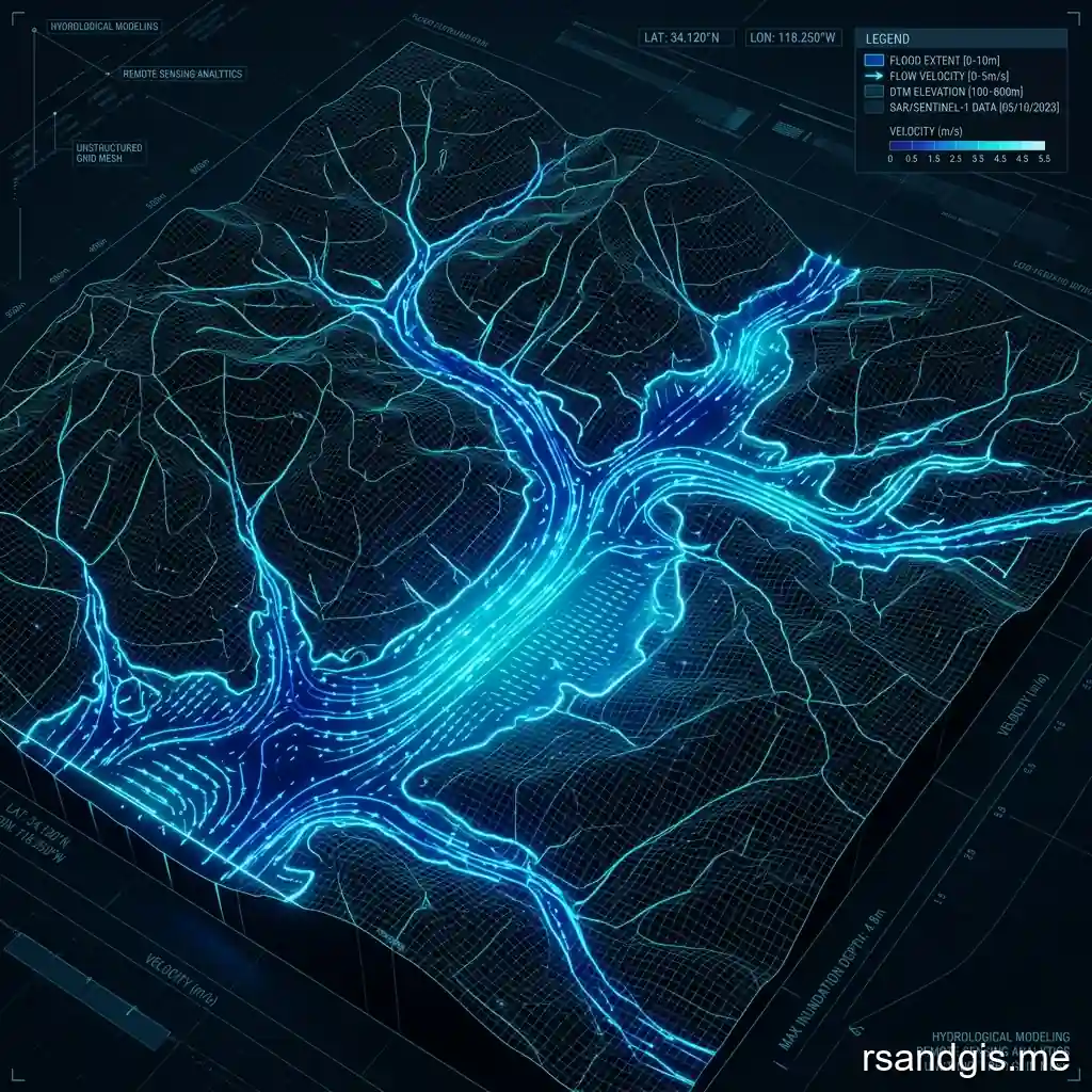
The implementation of real time flood inundation mapping has fundamentally transformed how emergency responders, city planners, and hydrological engineers approach disaster management and mitigation strategies. By fusing dynamic hydrological models with instantaneous data streams from sensor networks and satellite constellations, this technology provides an immediate, highly accurate visual representation of floodwaters as they spread across complex topography. The sheer computational complexity of translating rainfall and streamflow data into geospatial polygons of water depth and velocity requires a meticulously orchestrated digital infrastructure. Modern systems must ingest heterogeneous data, process it through sophisticated hydrodynamic equations, and render the results on user-facing Geographic Information Systems (GIS) dashboards, all within a matter of minutes or even seconds to ensure actionable intelligence reaches those in harm's way.
Historically, flood mapping was a static endeavor, relying on historical data to draw arbitrary 100-year or 500-year floodplains. These maps, while useful for long-term zoning and insurance purposes, fell woefully short during actual catastrophic events. A static map cannot account for soil saturation anomalies, localized levee breaches, or sudden urban drainage failures. Real-time mapping bridges this gap, creating a "digital twin" of a watershed that continuously updates its state variables based on incoming telemetry. This article delves deeply into the underlying architecture, mathematical models, sensor integrations, and machine learning advancements that make these dynamic cartographic systems possible.
Introduction to Hydroinformatics
Hydroinformatics is the cross-disciplinary field that marries water science with computational data engineering. In the context of mapping inundation dynamically, hydroinformatics provides the theoretical framework for organizing vast amounts of geospatial and temporal data. An effective system relies heavily on precise Digital Elevation Models (DEMs) or Digital Terrain Models (DTMs), typically derived from Light Detection and Ranging (LiDAR) surveys. The resolution of these elevation datasets dictates the spatial accuracy of the resulting flood maps. A sub-meter DEM allows hydrodynamic models to simulate water routing around individual buildings, over specific roadway crowns, and through complex urban stormwater infrastructure, whereas a coarser 30-meter DEM might only be suitable for broad regional watershed assessments.
The Role of Continuous Simulation
Unlike event-based modeling, which isolates a specific storm and models its immediate runoff, continuous simulation maintains a running water balance for a watershed over months or years. This is critical for real-time systems because the antecedent moisture conditions, how wet the soil is before the storm even begins, drastically affect the runoff coefficient. Continuous simulation models keep track of evapotranspiration, groundwater baseflow, and soil moisture percolation. When a heavy precipitation event occurs, the system already knows the exact infiltration capacity of the soil, allowing for a much more accurate prediction of the resulting surface runoff that will ultimately drive the inundation mapping engine.
Governing Equations in Hydraulics
At the core of any physical flood mapping engine lies a set of partial differential equations that describe fluid motion. The Navier-Stokes equations represent the most complete mathematical description of fluid flow in three dimensions. But solving the full 3D Navier-Stokes equations over a large geographical area in real-time is computationally prohibitive, even with modern supercomputers. Therefore, hydrologists employ depth-averaged versions of these equations, reducing the problem from three dimensions to two or one, depending on the required fidelity and available compute resources.
The Shallow Water Equations
The 2D Shallow Water Equations (SWE), derived from Navier-Stokes by integrating over the water column depth, are the workhorse of modern inundation modeling. The SWE consist of a continuity equation (conserving mass) and two momentum equations (conserving momentum in the x and y directions). These equations account for gravity, friction, Coriolis forces, and the topographic gradients of the channel and floodplain. By resolving these equations across a spatial grid, the model calculates the water depth and two-dimensional velocity vector at every computational node at every time step.
Numerical Discretization Methods
To solve the SWE on a computer, the continuous differential equations must be translated into discrete algebraic equations. This is typically achieved using Finite Volume Methods (FVM), Finite Element Methods (FEM), or Finite Difference Methods (FDM). The Finite Volume Method is particularly popular in flood modeling because it inherently conserves mass across grid boundaries and can naturally handle the mathematical "shocks" or discontinuities that occur during rapid flows, such as a dam break or a levee overtopping. Explicit time-stepping schemes, like the Runge-Kutta method, advance the solution forward in time, though they are subject to the Courant-Friedrichs-Lewy (CFL) stability condition, which limits the maximum allowable time step based on grid size and water velocity.
Sensor Networks and Telemetry Systems
The accuracy of any real-time mapping system is inextricably linked to the quality and latency of its input data. Terrestrial and space-based sensor networks act as the nervous system of the hydroinformatics platform, constantly feeding it observations that are used to update boundary conditions and assimilate state variables.
Terrestrial Stream Gauges
Physical stream gauges deployed along rivers and channels provide the most direct and reliable measurements of water stage (elevation) and discharge (volume per unit time). Agencies like the United States Geological Survey (USGS) maintain thousands of these gauges. Modern telemetry systems attached to these gauges utilize cellular, satellite, or Line-of-Sight (LoS) radio communications to transmit data packets at frequent intervals, often every 15 minutes. In a real-time mapping context, this stream gauge data serves two crucial purposes: providing the upstream boundary hydrograph to force the hydraulic model, and providing downstream observations for automated calibration and error correction.
Acoustic Doppler Current Profilers
Traditional stage-discharge rating curves can become highly inaccurate during extreme floods due to hysteresis effects and channel bed scour. To capture accurate velocity profiles and discharge during unsteady flow, Acoustic Doppler Current Profilers (ADCPs) are increasingly deployed. These devices sit at the bottom of a river or are mounted on bridge piers, emitting ultrasonic pulses into the water column. By measuring the Doppler shift of the sound waves backscattered by suspended sediment and micro-bubbles, the ADCP maps the complete 3D velocity profile of the river. This high-fidelity data drastically improves the parameterization of channel roughness coefficients in the hydrodynamic models.
Remote Sensing Technologies
While terrestrial gauges offer pinpoint accuracy, they represent sparse point data. Remote sensing bridges the spatial gaps, providing wide-area observational data that can capture the full extent of a flood as it unfolds.
Synthetic Aperture Radar (SAR)
Optical satellites are frequently blinded by the heavy cloud cover that naturally accompanies flood-producing storm systems. Synthetic Aperture Radar (SAR) solves this problem by emitting active microwave pulses that penetrate clouds, rain, and darkness. When a SAR pulse hits smooth, flat floodwater, the energy is scattered away from the sensor (specular reflection), resulting in a dark pixel on the radar image. Conversely, rough terrain or vegetation scatters energy back to the sensor. By analyzing backscatter intensity algorithms, remote sensing scientists can dynamically classify flooded versus non-flooded pixels across vast regions.
Sentinel-1 and Constellation Orbits
The European Space Agency's Sentinel-1 mission provides free, high-quality SAR imagery with a revisit time of just a few days, making it invaluable for operational flood mapping. Also, commercial constellations utilizing microsatellites equipped with X-band SAR are shrinking the revisit latency to mere hours. Integrating this raw SAR data into an automated pipeline requires complex pre-processing, including radiometric calibration, speckle filtering, and terrain correction, before water extraction algorithms can be applied to delineate the inundation boundary.
Penetration Capabilities Through Cloud Cover
The distinct advantage of utilizing C-band and L-band microwaves in SAR operations lies in their wavelength properties. L-band SAR, with its longer wavelength (approximately 24 cm), can penetrate not only dense atmospheric water vapor but also forest canopies. This makes it possible to detect "flooded vegetation", areas where water has inundated a forest floor or agricultural crop, but the canopy remains intact. Detecting flooded vegetation is notoriously difficult for optical sensors and shorter-wavelength radars, yet it is a critical component for accurately assessing total flood extents and mapping ecological impacts in real-time.
Cloud Infrastructure and Data Assimilation
Moving from individual components to a unified, instantaneous system requires enterprise-grade cloud architecture. The compute requirements to ingest radar precipitation estimates, run continuous hydrological simulations, execute 2D hydraulic routing, and serve vector tiles to thousands of concurrent web users are immense and highly variable.
Real-Time Data Pipelines
The ingestion layer of a flood mapping system must be highly robust, capable of handling disparate data formats (GRIB for weather forecasts, JSON/REST for gauge telemetry, GeoTIFF for satellite imagery) arriving asynchronously. Event-driven architectures are the gold standard here. As a new radar rainfall grid is deposited into a cloud storage bucket, it triggers a serverless function that automatically clips, reprojects, and formats the data into the specific input structure required by the hydrological model.
Apache Kafka and Streaming Architectures
For systems handling thousands of telemetry nodes updating sub-minutely, distributed streaming platforms like Apache Kafka provide the necessary throughput and fault tolerance. Kafka operates as a high-performance message broker, decoupling the data producers (stream gauges, IoT sensors) from the data consumers (data assimilation engines, archiving databases). This ensures that if the hydraulic model temporarily goes offline for an update or encounters an error, the incoming telemetry is queued safely and no data is lost.
Microservices in Hydrological Modeling
Monolithic modeling software is ill-suited for cloud-native deployment. Modern inundation mapping frameworks are broken down into microservices. One service might handle the soil moisture accounting, another calculates channel routing, and a separate, GPU-accelerated service performs the 2D floodplain diffusion. These microservices communicate via lightweight APIs. This modularity allows system administrators to scale specific bottlenecks independently. If a massive storm hits and the 2D hydraulic routing becomes computationally bound, the orchestration layer can automatically spin up additional GPU instances just for that specific microservice.
Containerization with Kubernetes
To manage these diverse microservices across massive server clusters, orchestration tools like Kubernetes are deployed. Kubernetes ensures that the Docker containers housing the hydrological engines, data scrapers, and GIS servers are kept running, load-balanced, and securely networked. It allows for infrastructure as code (IaC), meaning the entire flood mapping backend can be version-controlled, audited, and rapidly deployed to an alternate availability zone in the event of a primary data center failure, a critical requirement for mission-critical emergency management software.
Machine Learning in Inundation Mapping
Despite advances in cloud computing, running high-resolution 2D SWE models for large basins can still take longer than the lead time of a flash flood. To achieve true instantaneous mapping, researchers are increasingly turning to Machine Learning (ML) and Artificial Intelligence (AI) to bypass the computationally expensive physics equations entirely.
Surrogate Modeling Techniques
Surrogate modeling, or emulation, involves training a machine learning algorithm on massive datasets of pre-computed, physics-based flood simulations. Millions of synthetic storm events are run through a 2D hydraulic model, and the resulting inundation maps are saved alongside their input hydrographs and rainfall patterns. The ML algorithm learns the complex, non-linear mappings between the inputs (rainfall/flow) and the outputs (water depth/extent). Once trained, the ML surrogate can predict inundation for a new, unseen storm event in fractions of a second, compared to the hours required by the numerical physics model.
Long Short-Term Memory (LSTM) Networks
Hydrological data is inherently sequential, streamflow at time T is highly dependent on streamflow at time T-1 and rainfall at time T-lag. Recurrent Neural Networks (RNNs), specifically Long Short-Term Memory (LSTM) networks, excel at modeling this time-series data. LSTMs contain internal memory cells that can maintain state over long sequences, allowing them to capture the complex delay mechanisms of watershed routing. In real-time mapping systems, LSTMs are frequently used to rapidly forecast streamflow at critical junctions, which then serves as the boundary condition for downstream inundation estimation.
Graph Convolutional Networks (GCN) for River Routing
River networks form natural directed acyclic graphs (DAGs), where water flows from upstream nodes to downstream nodes following the topography. Standard Convolutional Neural Networks (CNNs), which operate on regular grid matrices, struggle to capture the arbitrary branching topology of a river basin. Graph Convolutional Networks (GCNs) are designed specifically to operate on graph structures. By representing a watershed as a graph of stream reaches and junctions, GCNs can accurately model the spatial-temporal propagation of flood waves through the network, sharing information mathematically exactly as water shares volume physically.
Physics-Informed Neural Networks (PINNs)
A major criticism of pure machine learning in flood modeling is its "black box" nature; it may produce physically impossible results, such as water flowing uphill or mass magically appearing, because the network does not inherently understand physics. Physics-Informed Neural Networks (PINNs) address this by embedding the governing equations (like the Shallow Water Equations) directly into the neural network's loss function. During training, the PINN is penalized not only for differing from the training data but also for violating physical laws (e.g., conservation of mass). This hybrid approach guarantees that the ultra-fast AI predictions remain physically realistic, building crucial trust with emergency managers relying on the real-time maps.
Conclusion and Future Trajectories
The discipline of producing instant, highly reliable cartographic representations of flooding is advancing at a breakneck pace. The convergence of better orbital sensors, omnipresent IoT terrestrial gauges, infinitely scalable cloud compute, and revolutionary AI architectures has brought what was once a theoretical academic exercise into the operational realm. Emergency operations centers no longer have to guess where the water is going; they can watch it flow across their digital dashboards in sync with reality.
Next-Generation Digital Twins
The future of this technology lies in the creation of comprehensive Digital Twins. A digital twin goes beyond mere topographic inundation. It models the cascading failures of infrastructure. If a real-time map shows an electrical substation flooding, the digital twin automatically models the resulting power outage grid, identifying which pump stations will lose power, thereby updating the flood model to account for the loss of pumping capacity. This feedback loop of socio-economic and infrastructural data creates a holistic operational picture.
Integrating Socio-Hydrological Variables
Beyond physical infrastructure, advanced real-time systems are beginning to ingest anonymized cellular data and traffic routing APIs to model human behavior during a flood. By overlapping the real-time inundation polygons with live population density matrices and evacuation route congestion metrics, the mapping system can automatically redirect digital traffic signs and send targeted push notifications to citizens precisely in the path of the advancing water, optimizing the evacuation flow dynamically as roads become impassable.
Edge Computing for Immediate Warnings
While centralized cloud architectures are powerful, they rely on intact communication networks, something frequently compromised during severe hurricanes or typhoons. The next frontier involves pushing the trained ML surrogate models to the "edge." Micro-controllers installed directly on stream gauges can run lightweight neural networks. If a gauge detects a rapid rise in water level indicative of a dam break, the edge device itself can instantly compute the downstream inundation map and trigger local sirens and radio broadcasts directly, completely bypassing the need to communicate with a distant cloud server.
Final Thoughts on Resilience
The ultimate goal of real time flood inundation mapping is not merely to document a disaster as it happens, but to buy humanity the most precious commodity during a crisis: time. By continually pushing the boundaries of spatial resolution, computational speed, and physical accuracy, engineers and scientists are building systems that give communities the critical minutes and hours needed to save lives, protect assets, and build profound resilience against the accelerating threats of a changing global climate.
Frequently Asked Questions
How does real-time flood inundation mapping work?
Real-time flood mapping combines live meteorological data, stream gauge readings, and topographic models (like DEMs) to dynamically simulate and visualize where floodwaters are expected to spread during an extreme weather event.
Which satellite imagery is best for flood detection?
Synthetic Aperture Radar (SAR) imagery, such as data from Sentinel-1, is highly effective for flood detection because it can penetrate cloud cover and distinguish between water and land surfaces regardless of weather conditions.
Can machine learning improve flood mapping?
Yes, machine learning algorithms can rapidly analyze satellite imagery and historical flood data to automate water extraction, reducing processing time from hours to minutes, which is critical during emergency response.
