Geospatial Blockchain For Land Registry Management
Table of Contents
- Introduction to Land Registry Systems and New Technologies
- The Current State of Land Registry Systems
- Historical Context and Legacy Infrastructure
- The Cost of Inaccuracy and Corruption
- Understanding the Core Technologies
- Geographic Information Systems (GIS)
- Blockchain Technology and Distributed Ledgers
- The Intersection: How Geospatial Blockchain Works
- Connecting Spatial Data to the Ledger
- Creating the Immutable Property Record
- Resolving Boundary Overlaps Automatically
- Key Benefits of Geospatial Blockchain in Real Estate
- Absolute Transparency and Fraud Elimination
- Unparalleled Spatial Accuracy
- Streamlined Transactions and Cost Reduction
- Financial Inclusion and Economic Growth
- Historical Traceability and Dispute Resolution
- Environmental and Sustainability Impacts
- Sustainable Land Management
- Carbon Credit Tracking
- The Role of Cryptography in Securing Geospatial Data
- Hashing Algorithms and Data Integrity
- Public Key Infrastructure (PKI)
- Technical Architecture for Implementation
- Smart Contracts for Automated Conveyancing
- Tokenization and Fractional Ownership
- Oracles and External Data Feeds
- Challenges and Barriers to Adoption
- Regulatory and Legal Roadblocks
- The "Garbage In, Garbage Out" Conundrum
- Technological Scalability and Storage
- Data Privacy Concerns
- Integration with Legacy Systems
- Educational and Institutional Paradigm Shifts
- Training the Next Generation of Professionals
- Redefining the Role of Government
- Global Case Studies and Real-World Applications
- The Republic of Georgia's Blockchain Registry
- Sweden's Lantmäteriet Blockchain Project
- Emerging Markets and Leapfrogging Technology
- Future Trends and Evolution
- Integration with Artificial Intelligence and IoT
- 3D Cadastres and Air Rights
- Standardization of Geospatial Blockchain Protocols
- Conclusion
- Frequently Asked Questions
rsandgis.me
Introduction to Land Registry Systems and New Technologies
The global real estate market is immensely valuable, yet land registry systems remain antiquated and vulnerable to corruption. Traditional paper-based or legacy digital databases suffer from central points of failure, leading to fraud, disputes over property boundaries, and inefficiencies. To address these critical flaws, governments and technologists are deploying an innovative solution. Implementing geospatial blockchain for land registry management ensures a transparent, highly accurate, and tamper-proof ecosystem. By combining geographic information systems (GIS) with distributed ledgers, authorities can forever change how property rights are verified.
In many parts of the world, proving that you own a piece of land is a surprisingly difficult task. The lack of a reliable, universally trusted system for recording and transferring land titles stifles economic growth and leaves vulnerable populations at risk of exploitation. Also, even in developed nations where registries are digitized, the systems are often siloed, slow, and expensive to navigate. The introduction of spatial technology brings a new dimension of accuracy, ensuring that property boundaries are precisely mapped using satellites and ground surveys. When this spatial precision is securely anchored to a blockchain network, the resulting system is virtually impervious to manipulation. In this guide, we will explore the mechanisms, benefits, technical architectures, challenges, and real-world applications of merging GIS with blockchain to manage global land registries.
The Current State of Land Registry Systems
Historical Context and Legacy Infrastructure
For centuries, the concept of land ownership has been intrinsically linked to physical documents, deeds, titles, and cadastral maps drawn by hand. These physical documents were stored in centralized municipal buildings, making them susceptible to physical destruction from fires, floods, or natural disasters. Even as the digital age ushered in electronic databases, many of these systems merely replicated the flawed paper processes in a digital format. They remained centralized, meaning a single database administrator or a corrupt official could alter records without leaving a transparent audit trail. This centralization represents a single point of failure that hackers and malicious actors constantly exploit.
The Cost of Inaccuracy and Corruption
The economic toll of inefficient land registries is staggering. According to economic theorists like Hernando de Soto, trillions of dollars in "dead capital" exist globally, assets that cannot be used as collateral for loans or investments because their ownership cannot be legally or securely verified. When land registries lack spatial accuracy, properties can overlap on maps, leading to endless boundary disputes and costly litigation. Also, in nations with high levels of institutional corruption, unauthorized alterations to land registries can result in rightful owners losing their property overnight. This systemic insecurity discourages foreign investment, hampers infrastructure development, and perpetuates poverty cycles.
Understanding the Core Technologies
Geographic Information Systems (GIS)
Geographic Information Systems (GIS) are powerful technological frameworks designed to capture, store, manipulate, analyze, manage, and present spatial or geographic data. In the context of land registry, GIS replaces traditional 2D paper maps with dynamic, highly precise digital models of the earth's surface. Using coordinate reference systems (CRS), GIS accurately maps property boundaries as polygons. These polygons are created using data from satellite imagery, aerial drones, and highly precise GPS ground surveys. GIS allows for the analysis of spatial relationships, meaning the software can instantly detect if a newly proposed land parcel overlaps with an existing one. This spatial intelligence is the cornerstone of a modern cadastral system.
Blockchain Technology and Distributed Ledgers
Blockchain is a type of Distributed Ledger Technology (DLT) that records transactions across a decentralized network of computers (nodes). Each transaction is encrypted and bundled into a "block," which is then chronologically chained to the previous block using complex cryptographic hashes. This structure makes the blockchain immutable; once a transaction is recorded and verified by the network's consensus mechanism, it cannot be altered or deleted without alerting the entire network. In a land registry context, this means that once a land title is recorded on the blockchain, its history of ownership is permanently secured. The decentralized nature eliminates the single point of failure, ensuring that no single entity, not even a government official, can unilaterally change a property record.
The Intersection: How Geospatial Blockchain Works
Connecting Spatial Data to the Ledger
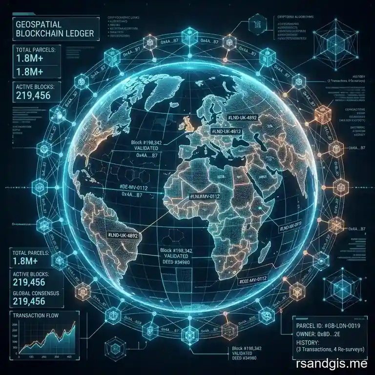
The integration of GIS and blockchain creates a system where the physical coordinates of a property are cryptographically linked to the legal ownership record. Because blockchains are generally not designed to store massive amounts of heavy data (like high-resolution GIS shapefiles or satellite imagery), a hybrid architecture is typically employed. The spatial data is stored in a secure, distributed file system like the InterPlanetary File System (IPFS) or a highly secure off-chain database. A cryptographic hash (a unique digital fingerprint) of this spatial data is then generated and stored on the blockchain. Any alteration to the off-chain spatial data would change the hash, instantly breaking the link and alerting the system to the tampering.
Creating the Immutable Property Record
When a property is registered in a geospatial blockchain system, a digital representation of the land is created, often structured as a Non-Fungible Token (NFT) or a unique digital asset. This digital token contains the property's unique identifier, the owner's cryptographic public key, and the hash of the property's exact GIS coordinates and boundaries. Transferring ownership of the property is as simple and secure as transferring the token from one digital wallet to another. This transaction is permanently recorded on the blockchain, creating an unbroken, publicly verifiable chain of title dating back to the land's initial registration.
Resolving Boundary Overlaps Automatically
One of the most profound capabilities of combining GIS with blockchain is the potential for automated spatial validation through smart contracts. When a new land registration or subdivision is proposed, the smart contract can query the GIS database to check the new coordinates against all existing recorded parcels. If the new polygon overlaps with an existing registered polygon, the smart contract will automatically reject the transaction. This programmatic enforcement ensures that a single piece of land can never be double-sold or claimed by two different parties, effectively ending boundary disputes before they even begin.
Key Benefits of Geospatial Blockchain in Real Estate
Absolute Transparency and Fraud Elimination
The immutability of the blockchain ensures that the history of a land parcel is transparent and unchangeable. Anyone, from prospective buyers to auditors, can trace the lineage of a property's ownership back to its origin. This radical transparency eliminates the possibility of "double spending" in real estate, where a fraudster sells the same property to multiple buyers. Also, because transactions require the cryptographic signature of the rightful owner, malicious actors cannot forge deeds or bribe officials to transfer titles illicitly.
Unparalleled Spatial Accuracy
By relying on modern GIS technology rather than outdated textual descriptions or inaccurate hand-drawn maps, a geospatial blockchain registry ensures that the physical dimensions of a property are flawlessly documented. High-resolution satellite imagery and advanced surveying techniques mean that property lines are defined down to the centimeter. When this level of precision is locked into an immutable ledger, property owners have absolute certainty about the exact boundaries of their land, preventing encroachment and disputes with neighbors.
Streamlined Transactions and Cost Reduction
Traditional real estate transactions are notoriously slow and expensive, heavily reliant on intermediaries such as escrow agents, title insurance companies, notaries, and lawyers. These middlemen exist primarily to establish trust and verify records, functions that are natively handled by the blockchain. By automating the verification of ownership and the execution of the transfer via smart contracts, geospatial blockchain systems can reduce transaction times from weeks or months down to mere minutes. This disintermediation drastically lowers closing costs, making property transactions more accessible and efficient.
Financial Inclusion and Economic Growth
In developing nations, the inability to prove land ownership traps millions of people in poverty. A geospatial blockchain registry provides a robust, incorruptible system for these individuals to formalize their land rights. Once their property is accurately mapped and securely recorded on the blockchain, they can use this digital title as collateral to secure bank loans, mortgages, and credit. This unlocking of "dead capital" empowers individuals to invest in their businesses, improve their homes, and participate fully in the formal economy, driving significant macroeconomic growth.
Historical Traceability and Dispute Resolution
Because the blockchain acts as an eternal, append-only ledger, the entire historical context of a land parcel is preserved. This includes not just ownership transfers, but also records of subdivisions, zoning changes, liens, and easements. In the rare event that a dispute does arise, adjudicators and courts have access to an indisputable, chronologically accurate timeline of events. This traceability drastically reduces the time and resources spent on legal battles over land rights.
Environmental and Sustainability Impacts
Sustainable Land Management
In addition to securing financial value and preventing fraud, integrating spatial technology with distributed ledgers is essential in environmental conservation and sustainable land management. Geospatial blockchain systems can track land usage over time, verifying compliance with environmental regulations. If a parcel of land is designated as a protected forest or wetland, smart contracts can prevent the land title from being transferred to commercial developers. Also, by creating a transparent record of land ownership and usage, governments can more effectively enforce environmental policies, combat illegal deforestation, and track the impact of climate change on coastal and agricultural lands.
Carbon Credit Tracking
The intersection of these technologies also opens new avenues for the booming carbon credit market. Landowners who commit to reforestation or preserving natural habitats can have their efforts verified via satellite imagery. Once verified, carbon credits can be minted as tokens on the blockchain and tied directly to the geospatial coordinates of the conserved land. This creates an immutable, transparent system that prevents the double-counting of carbon credits, a major issue in current carbon markets. By accurately linking the physical environmental impact to the digital token, geospatial blockchains foster trust in global sustainability initiatives.
The Role of Cryptography in Securing Geospatial Data
Hashing Algorithms and Data Integrity
Cryptography is the bedrock upon which the security of any blockchain system is built. When dealing with geospatial information, the integrity of the data is paramount. Hashing algorithms, such as SHA-256, take the complex numerical coordinates and attributes of a GIS polygon and convert them into a fixed-length string of characters. This hash acts as an unforgeable digital signature for the physical land parcel. Even a microscopic change to a single coordinate in the GIS database will completely alter the resulting hash. When this hash is permanently stored on the distributed ledger, it serves as a perpetual proof of the land's original, authorized boundaries, making silent tampering mathematically impossible.
Public Key Infrastructure (PKI)
Alongside hashing, Public Key Infrastructure (PKI) ensures that only the rightful owner of a property can initiate a transfer. In a geospatial blockchain registry, a property owner is issued a cryptographic private key, which functions as a hyper-secure digital signature. When the owner wishes to sell their land, they use this private key to sign the transaction. The blockchain network then uses the owner's associated public key to verify the signature's authenticity without ever exposing the private key itself. This PKI mechanism completely eliminates the need for physical signatures, seals, or traditional notary services, while providing a mathematically verifiable guarantee of the seller's intent and authorization.
Technical Architecture for Implementation
Smart Contracts for Automated Conveyancing
Smart contracts are self-executing computer programs deployed on the blockchain that automatically enforce the terms of an agreement. In a land registry, smart contracts can revolutionize the conveyancing process.
For example, a smart contract can be programmed to hold the buyer's funds in escrow and the seller's digital property token. Once the contract verifies that the funds have been successfully deposited and all legal conditions (such as municipal tax clearances) are met, it automatically swaps the assets. The funds are sent to the seller, and the title token is transferred to the buyer's wallet simultaneously, eliminating counterparty risk.
Tokenization and Fractional Ownership
Geospatial blockchain technology enables the tokenization of real estate, where a single physical property is divided into thousands or millions of digital shares (tokens). Because the GIS component precisely maps the physical asset, the blockchain can issue fractional tokens representing a specific percentage of that asset. This lowers the barrier to entry for real estate investment, allowing retail investors to buy fractions of high-value commercial properties or agricultural land. These tokens can be traded on digital exchanges in real-time, providing unparalleled liquidity to an historically illiquid market.
Oracles and External Data Feeds
Blockchains are closed systems; they cannot natively access data from the outside world. To integrate real-world geospatial events, the architecture relies on "Oracles." Oracles are trusted data feeds that push external information into the smart contracts. For a land registry, an Oracle might monitor municipal databases for zoning changes, tax payment statuses, or even environmental data (like changing flood zones or coastlines due to erosion). When the Oracle detects a change in the physical or legal status of the land, it updates the smart contract, ensuring the blockchain record reflects the real-world reality of the geospatial parcel.
Challenges and Barriers to Adoption
Regulatory and Legal Roadblocks
The most significant hurdle to implementing a geospatial blockchain registry is not technological, but legal. In most jurisdictions, current property laws dictate that land titles must be signed on physical paper, witnessed by a notary, and filed in a specific government office. Digital tokens and smart contracts are often not recognized as legally binding representations of property ownership. Widespread adoption requires sweeping legislative reforms to recognize blockchain records as authoritative legal titles and to standardize electronic cryptographic signatures as valid legal consent.
The "Garbage In, Garbage Out" Conundrum
Blockchain technology guarantees the immutability of data, but it does not inherently guarantee the accuracy of the data when it is first entered. If a corrupt official or an inaccurate legacy database uploads a fraudulent or incorrect land claim to the blockchain, that lie becomes an immutable, permanent record. Therefore, the transition to a geospatial blockchain system requires a massive initial effort of auditing, ground-truthing, and surveying to ensure that the initial data uploaded to the ledger is perfectly accurate and legally sound.
Technological Scalability and Storage
Public blockchains, such as Ethereum or Bitcoin, often struggle with scalability, processing only a limited number of transactions per second (TPS) and suffering from high transaction fees during network congestion. A national land registry requires a system capable of handling thousands of transactions and queries simultaneously. Also, the storage of heavy spatial data is costly and inefficient on a distributed ledger. Solutions such as private/permissioned blockchains (like Hyperledger Fabric), Layer-2 scaling solutions, and off-chain decentralized storage (IPFS) are essential to overcome these bottlenecks.
Data Privacy Concerns
While transparency is a massive benefit of public blockchains, absolute transparency can violate individual privacy rights. Homeowners may not want their property holdings, transaction history, and financial details available for the entire world to view on a public ledger. Designing a geospatial blockchain registry requires balancing transparency with privacy. This is often achieved through zero-knowledge proofs (ZKPs), which allow parties to prove that a transaction is valid or that they own a property without revealing the underlying sensitive data, or by using permissioned blockchains where only authorized entities can view specific details.
Integration with Legacy Systems
Governments rarely have the luxury of starting from scratch. Implementing a new blockchain system requires integrating it with numerous existing legacy systems, including tax databases, municipal planning software, and national identity registries. Building the APIs and middleware necessary to allow these antiquated systems to communicate securely with a modern blockchain network is a highly complex, expensive, and time-consuming software engineering challenge.
Educational and Institutional Paradigm Shifts
Training the Next Generation of Professionals
The transition to a blockchain-based geospatial land registry requires a major shift within the professional workforce. Traditional land surveyors, legal conveyancers, and municipal clerks must adapt to a landscape dominated by cryptography, distributed networks, and smart contracts. Universities and professional institutions are beginning to recognize this shift, integrating courses on blockchain architecture, smart contract auditing, and advanced spatial data science into their curricula. The real estate professional of the future will need to be as comfortable reviewing a smart contract's code as they are reading a traditional topographic map, bridging the gap between physical geography and digital law.
Redefining the Role of Government
As these technologies become more prevalent, the role of the government in land registry changes fundamentally. Rather than acting as the central database administrator and the sole arbiter of truth, the government transitions into the role of a network validator and regulatory oversight body. By participating as a node in a decentralized network, the state ensures compliance with national laws without monopolizing the data infrastructure. This shift from a centralized authority to a decentralized network participant increases systemic resilience and significantly reduces the administrative burden on government agencies, allowing them to focus on policy-making and dispute resolution rather than data entry and record maintenance.
Global Case Studies and Real-World Applications
The Republic of Georgia's Blockchain Registry
The Republic of Georgia is widely recognized as a pioneer in this space. In partnership with the blockchain company Bitfury, the Georgian National Agency of Public Registry (NAPR) moved its land title registration onto a custom private blockchain anchored to the public Bitcoin network. This hybrid approach provided the speed and privacy of a private network with the unparalleled security of the Bitcoin blockchain. The project was a massive success, reducing registration times, cutting operational costs, and significantly boosting public confidence in the integrity of the nation's property records.
Sweden's Lantmäteriet Blockchain Project
Sweden's mapping, cadastral, and land registration authority, Lantmäteriet, has been experimenting with blockchain technology to streamline real estate transactions. Recognizing that their underlying registry was already highly accurate, they focused on the transaction process. Their pilot project utilized smart contracts to connect all parties involved in a real estate transaction, the buyer, seller, real estate agent, bank, and the land registry. By digitizing the workflow on a blockchain, they demonstrated how the time from signing a contract to finalizing the title transfer could be reduced from months to hours.
Emerging Markets and Leapfrogging Technology
In regions where legacy systems are highly dysfunctional or entirely absent, there is an opportunity to "leapfrog" traditional digital databases directly to blockchain solutions. Companies like Medici Land Governance are working in nations like Rwanda and Zambia to use high-resolution drone imagery and mobile technology to map undocumented land. These spatial surveys are then minted directly onto a blockchain, instantly creating a secure, formal cadastral system. In South America, pilot programs in countries like Honduras have explored similar solutions to combat endemic corruption and title fraud, proving that geospatial blockchain can be a powerful tool for social justice.
Future Trends and Evolution
Integration with Artificial Intelligence and IoT
The future of geospatial land registries lies in the convergence of blockchain with Artificial Intelligence (AI) and the Internet of Things (IoT). AI algorithms can process satellite imagery to automatically detect property boundaries, buildings, and land use changes, feeding this spatial intelligence directly into the registry. IoT devices, such as connected survey equipment or environmental sensors, can provide real-time updates to the blockchain.
For example, if an IoT sensor detects that a coastline has eroded, it could trigger a smart contract to automatically update the spatial coordinates of the affected coastal properties.
3D Cadastres and Air Rights
Traditional GIS maps are two-dimensional, which is insufficient for managing modern urban environments with high-rise buildings, underground infrastructure, and complex airspace rights. The next evolution of geospatial blockchains will incorporate 3D cadastral models. This will allow the blockchain to record not just the footprint of a parcel, but its vertical dimensions. Tokenizing 3D spaces will enable the precise, immutable trading of specific apartment units, subterranean mineral rights, and urban air rights, mapping the world's property in true three dimensions.
Standardization of Geospatial Blockchain Protocols
As more nations and municipalities adopt these technologies, there will be a growing need for interoperability and standardization. Currently, various projects use different blockchain protocols and GIS data formats. The future will likely see the development of universal standards for geospatial blockchain data, allowing for cross-border real estate transactions and global property registries. Consortia of governments, tech companies, and non-profits will need to collaborate to build these open standards, ensuring that systems can communicate smoothly.
Conclusion
The implementation of geospatial blockchain technology represents a major shift in how humanity records, manages, and transfers its most valuable asset: land. By abandoning the fragile, centralized, and opaque systems of the past, we can build a future where property rights are mathematically guaranteed by cryptography and flawlessly mapped by satellites. The combination of Geographic Information Systems and Distributed Ledger Technology provides a dual layer of truth, spatial precision combined with historical immutability. While the journey toward widespread adoption is fraught with regulatory, technical, and logistical challenges, the potential rewards are too massive to ignore. Eradicating property fraud, unlocking trillions in dead capital, streamlining transactions, and providing secure land tenure to the world's most vulnerable populations are not just technological upgrades; they are profound socioeconomic advancements. As governments, innovators, and legal systems continue to evolve, the geospatial blockchain will undoubtedly become the foundational infrastructure for the global real estate economy, bringing unparalleled trust, efficiency, and transparency to land registry management systems around the world.
Frequently Asked Questions
How does blockchain improve land registry systems?
Blockchain creates an immutable, decentralized ledger of land records, which prevents fraud, reduces administrative friction, and ensures that property ownership transfers are fully transparent and instantly verifiable.
Can GIS data be stored on a blockchain?
While storing massive raw GIS datasets (like satellite imagery) on a blockchain is inefficient, spatial coordinates, parcel boundaries, and cryptographic hashes of property documents can be securely stored on-chain to verify geographic truth.
What are smart contracts in land administration?
Smart contracts are self-executing agreements coded on the blockchain that can automatically transfer property titles and funds once predefined geographic and legal conditions, such as boundary surveys and payment confirmations, are met.
