Digital Twin Technology in GIS: The Ultimate Guide for 2026
Table of Contents
- Introduction to the Future of Spatial Data
- Understanding Digital Twin GIS
- What Exactly is a Digital Twin in the Field of GIS?
- Traditional GIS vs. Digital Twin GIS: A Comparative Analysis
- The Foundational Role of 3D City Modeling in Digital Twins
- The Geometry and Semantics of the Virtual World
- Transitioning from Pure Visualization to Complex Simulation
- Reality Capture: Bridging the Physical and Digital Realities
- Capturing the World with Unparalleled Granularity
- The Era of Continuous Reality Capture
- GIS and BIM Integration: The Core Convergence
- Bridging the Macro Context and Micro Details
- Strategic Benefits of Deep GIS/BIM Integration
- Artificial Intelligence and Data Processing in Digital Twins
- The Cognitive Brains Behind the Virtual City
- Advanced Simulation and Complex "What-If" Scenarios
- Transformative Applications of the Smart City Digital Twin
- Urban Planning, Zoning Optimization, and Civic Engagement
- Next-Generation Mobility and Intelligent Transportation Systems
- Disaster Management, Emergency Response, and Climate Resilience
- Sustainability, Carbon Tracking, and Energy Efficiency
- The Economic Impact and ROI of Digital Twin Implementation
- Cost-Benefit Analysis for Municipalities and the Private Sector
- Overcoming Core Challenges: The Road Ahead for 2026 and Beyond
- Data Privacy, Surveillance Concerns, and Cybersecurity
- Interoperability and the Pursuit of Universal Data Standards
- Massive Computational Infrastructure and Edge Computing
- Conclusion: Engineering the Cities of Tomorrow
- Frequently Asked Questions
rsandgis.me
Introduction to the Future of Spatial Data
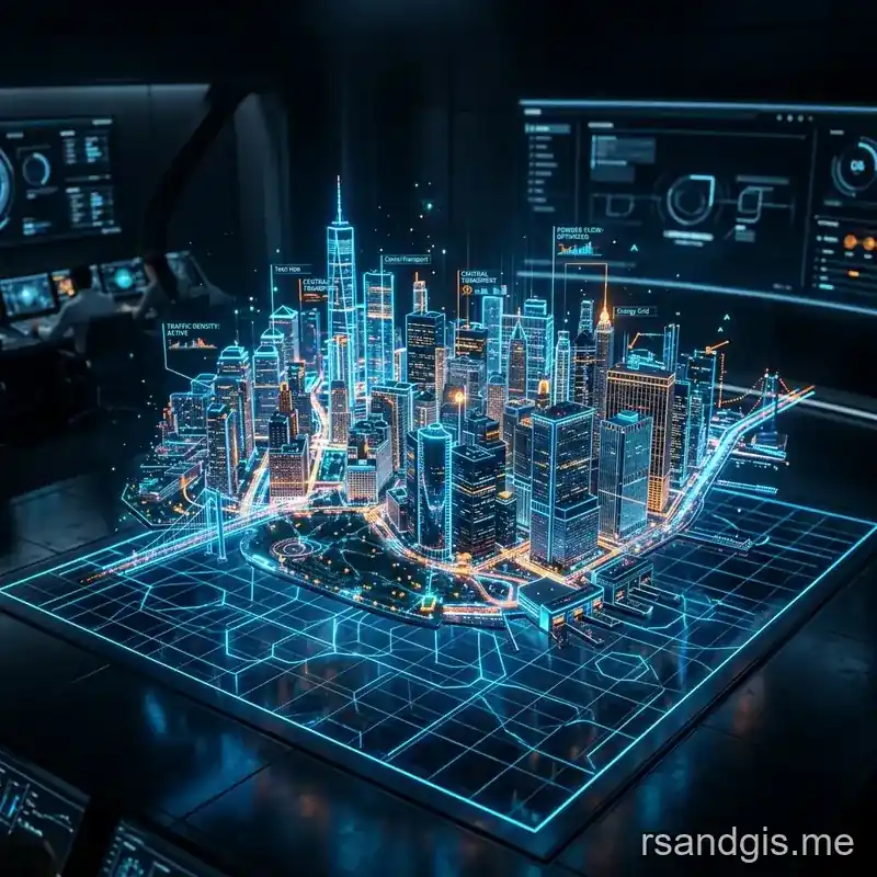
As we step firmly into 2026, the landscape of urban planning, infrastructure management, and spatial analysis has undergone a monumental major shift, driven largely by the maturation and widespread adoption of digital twin gis technologies. A digital twin is no longer a futuristic buzzword or an experimental sandbox; it has become a foundational pillar for modern engineering, civic administration, and corporate asset management. By creating a highly accurate, dynamic, and continuously updated virtual representation of physical assets, environments, and systems, organizations can simulate, predict, and optimize real-world outcomes with unparalleled precision and foresight.
This ultimate guide dives deep into the state of digital twins within Geographic Information Systems (GIS) in 2026. We will explore comprehensively how intersecting technologies like 3d city modeling, reality capture, and the profound evolution of gis and bim integration are converging to create the ultimate, all-encompassing smart city digital twin. Whether you are an urban planner striving for sustainability, a GIS professional managing vast spatial databases, or a technology enthusiast monitoring the pulse of innovation, understanding these interconnected disciplines is absolutely vital for navigating the future of spatial ecosystems.
Understanding Digital Twin GIS
What Exactly is a Digital Twin in the Field of GIS?
Fundamentally, a digital twin gis is a complex, interconnected ecosystem that integrates the macroscopic geographic context of traditional GIS with real-time data streams, Internet of Things (IoT) sensors, and dynamic simulation models. Unlike a static map or a conventional spatial database that captures a single moment in time, a digital twin lives and breathes data continuously. When a traffic light changes, a water pipe bursts, a local microclimate shifts, or pedestrian footfall spikes in the physical world, the digital twin reflects these changes instantly on the virtual plane.
This synchronicity allows decision-makers to move far beyond retrospective analysis and fully embrace predictive and prescriptive analytics. In 2026, the tight integration of artificial intelligence and machine learning with GIS platforms has enabled these virtual twins to automatically detect anomalies, forecast urban growth patterns, and simulate the cascading, long-term impacts of climate change on vulnerable coastal infrastructure.
Traditional GIS vs. Digital Twin GIS: A Comparative Analysis
To truly grasp the technological leap, we must compare the historical capabilities of GIS with the modern digital twin architecture. The transformation is not just a matter of adding a dimension; it represents a fundamental shift in how spatial data is utilized.
| Feature | Traditional GIS (Pre-2020s) | Digital Twin GIS (2026) |
|---|---|---|
| Data Nature & Freshness | Static, manually updated, periodic batch uploads | Dynamic, real-time IoT integration, continuous streaming |
| Dimensionality | Primarily 2D maps and thematic layers, limited 3D | Immersive 3D and 4D (time-series based) environments |
| Core Functionality | Mapping, spatial queries, cartographic production | Simulation, predictive analytics, autonomous feedback |
| Interactivity & Feedback | Query-driven human analysis and manual reporting | Continuous automated feedback loops, complex scenario modeling |
| Scale of Operations | Macro-level geography (cities, states, regions) | Seamless transition from macro geography to micro component details |
The Foundational Role of 3D City Modeling in Digital Twins
The Geometry and Semantics of the Virtual World
A successful and reliable digital twin requires an impeccably accurate and highly detailed spatial framework. This is precisely where 3d city modeling asserts its dominance. By generating meticulous three-dimensional representations of buildings, terrain topologies, vegetation, and critical infrastructure networks, 3D city modeling provides the indispensable geometric foundation upon which real-time data is overlaid and analyzed.
In 2026, the creation of these expansive models has become highly automated and exceptionally precise. AI-driven generative algorithms can smoothly extract building footprints, intricate roof structures, and granular street furniture directly from high-resolution satellite imagery, synthetic aperture radar (SAR), and aerial LiDAR data. Crucially, these models are not just visual aesthetic aids; they possess deep semantic information. A building represented in a modern 3D city model is not merely a grey, lifeless polygon; it is an intelligent entity endowed with critical attributes such as structural height, total volume, exact zoning classification, construction materials, and historical energy consumption metrics.
Transitioning from Pure Visualization to Complex Simulation
While early iterations of 3d city modeling focused heavily on visual aesthetics and impressive fly-through animations for stakeholders, the industry focus has entirely shifted to functional, rigorous simulation. Urban planners now utilize these advanced models to conduct highly complex line-of-sight analysis for telecommunications (like 6G network propagation), solar radiation calculations for renewable energy planning, and computational fluid dynamics (CFD) for wind flow simulations. By understanding intricately how physical structures interact with their micro-environment, municipalities can design significantly more sustainable and livable spaces, ensuring that new high-density developments do not cast permanent shadows on vital public parks or inadvertently create hazardous artificial wind tunnels in pedestrian zones.
Reality Capture: Bridging the Physical and Digital Realities
Capturing the World with Unparalleled Granularity
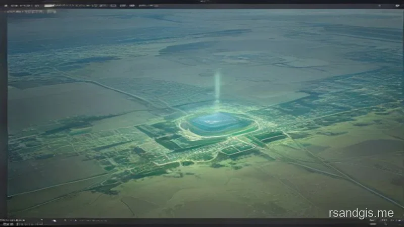
To construct a robust and authoritative digital twin, one must first digitize the real world with uncompromising accuracy. Reality capture technologies have evolved dramatically over the last few years, becoming vastly faster, significantly cheaper, and infinitesimally more precise. Reality capture encompasses a diverse suite of hardware tools and software methodologies explicitly designed to scan and digitize physical environments, instantly translating them into dense, colorized point clouds or high-fidelity textured mesh models.
- LiDAR and Laser Scanning: Both terrestrial (TLS) and aerial LiDAR (ALS) provide millimeter-level geometrical accuracy, which is absolutely essential for mapping highly complex infrastructure such as suspension bridges, subterranean rail networks, and hyper-dense urban corridors.
- Advanced Photogrammetry: Utilizing heavily overlapping high-resolution images captured by autonomous drone swarms or vehicular mobile mapping systems, modern photogrammetry software leverages neural radiance fields (NeRFs) and AI to reconstruct the exact geometry and texture of the environment, offering photorealistic visual representations that traditional methods couldn't achieve.
- Mobile and Wearable Mapping Systems: Vehicle-mounted sensors capture vast swaths of street-level data at highway speeds, while wearable SLAM (Simultaneous Localization and Mapping) scanners allow operators to walk through complex indoor environments, automatically identifying architectural elements, MEP components, and structural defects to feed directly into the overarching digital twin database.
The Era of Continuous Reality Capture
By 2026, reality capture has transitioned from being a sporadic, one-off project requirement to a state of continuous, pervasive digitization. Autonomous drones, robotic quadrupeds, and even automated transit vehicles perform routine, programmatic patrols of critical infrastructure, constantly updating the digital twin gis with the very latest physical conditions. This continuous feedback loop ensures that the digital twin remains an authoritative, unquestionable single source of truth, minimizing any potential discrepancy between the virtual analytical model and the rapidly changing physical reality.
GIS and BIM Integration: The Core Convergence
Bridging the Macro Context and Micro Details
Historically, the broader spatial industry operated on two distinct and parallel tracks: GIS meticulously managed the macro environment (cities, landscapes, regional watersheds), while Building Information Modeling (BIM) rigidly managed the micro environment (individual building architectures, interior structures, MEP engineering systems). The realization of a true, fully-functional digital twin requires the absolute, seamless fusion of these two historically siloed domains. In 2026, comprehensive gis and bim integration is no longer optional; it is the universally accepted and undisputed standard for infrastructure lifecycle management.
Through sophisticated gis and bim integration, project stakeholders can smoothly view a highly detailed, component-level BIM model of a proposed mega-hospital directly within the broader GIS context of the entire city. They can rigorously analyze how the new facility will structurally impact local traffic patterns during peak hours, whether the existing municipal water utility network possesses the capacity to support the massively increased load, and how the building's physical orientation will affect the surrounding urban microclimate in terms of heat retention and shadow casting.
Strategic Benefits of Deep GIS/BIM Integration
- Enhanced Multidisciplinary Collaboration: Architects, structural engineers, urban planners, and civic leaders now share a unified, cloud-based digital environment, effectively destroying legacy data silos and drastically reducing catastrophic communication errors.
- Comprehensive Lifecycle Management: Crucial data flows uninterrupted from the initial design and construction phases directly into long-term operations and maintenance (O&M). Facility managers utilize the integrated digital twin to locate faulty, hidden HVAC components physically and spatially without exploratory demolition.
- Massive Cost Reduction and Risk Mitigation: By proactively identifying spatial clashes, environmental conflicts, and potential design flaws in the virtual environment long before physical construction commences, organizations save tens of millions of dollars in costly rework, material waste, and project delays.
Artificial Intelligence and Data Processing in Digital Twins
The Cognitive Brains Behind the Virtual City
If 3D models and GIS frameworks provide the structural skeleton of the digital twin, and sprawling networks of IoT sensors provide the sensory nervous system, then Artificial Intelligence (AI) is unequivocally the cognitive brain. The sheer volume, extreme velocity, and immense variety of structured and unstructured data flowing incessantly into a 2026 digital twin gis would be entirely insurmountable for human operators or traditional relational databases to analyze manually.
Advanced AI algorithms, powered by high-performance edge and cloud computing, continuously parse these incoming data streams. They work tirelessly to identify hidden patterns, detect minute anomalies, and extrapolate future trends.
For instance, deep machine learning models can accurately predict imminent subterranean water main failures by correlating decades of historical maintenance records with real-time pressure sensor data and highly localized satellite-derived ground subsidence measurements. To stay ahead of the curve, professionals must keep track of the latest technological updates on AI & Data as they dictate the evolutionary pace of digital twins and predictive urban analytics.
Advanced Simulation and Complex "What-If" Scenarios
One of the most profoundly powerful capabilities of an AI-driven digital twin is complex scenario modeling. Planners and emergency responders can ask the system intricate "what-if" questions: What precisely happens to regional traffic flow if we pedestrianize this major commercial intersection? How will a category 5 hurricane, coupled with a two-meter storm surge, impact the downtown electrical grid and hospital access routes? The AI processes these colossal queries using deep reinforcement learning and complex adaptive systems theory, providing highly probabilistic, visually accessible outcomes that directly guide legislative policy, infrastructure investment, and life-saving emergency response strategies.
Transformative Applications of the Smart City Digital Twin
Urban Planning, Zoning Optimization, and Civic Engagement
The implementation of the smart city digital twin has fundamentally revolutionized how modern municipalities approach zoning, land use, and urban development. Instead of relying on archaic 2D land-use maps and static, quickly outdated demographic reports, planners can now completely immerse themselves in the living digital twin. They can instantly visualize proposed zoning changes, simulate the localized economic and environmental impact of massive commercial developments, and statistically ensure equitable access to green spaces, healthcare facilities, and public transit. Also, these visual twins serve as incredibly effective tools for civic engagement, allowing citizens to interact with and understand proposed changes to their neighborhoods via augmented reality (AR) interfaces.
Next-Generation Mobility and Intelligent Transportation Systems
Debilitating traffic congestion and inefficient transit are chronic issues in rapidly growing global metropolises. Digital twins elegantly digest terabytes of real-time data streaming from connected autonomous vehicles (CAVs), public transit GPS trackers, smart traffic cameras, and smartphone location telemetry. This massive data fusion fuels dynamic, AI-controlled traffic management systems that adjust signal timings on the fly to alleviate emerging bottlenecks before they solidify. Also, the digital twin allows for the completely virtual, risk-free testing of autonomous vehicle fleets, ensuring their algorithms can safely navigate complex, idiosyncratic urban geometry, like chaotic roundabouts and poorly marked intersections, long before their physical deployment onto public roads.
Disaster Management, Emergency Response, and Climate Resilience
Accelerating climate change demands that urban centers become significantly more resilient to extreme weather and natural disasters. A robust smart city digital twin plays a literally life-saving role in modern disaster preparedness. Highly complex hydrological models perfectly integrated into the twin can accurately simulate flood inundation levels and flow velocities during extreme weather events. This foresight allows emergency services to proactively identify vulnerable populations, dynamically optimize evacuation routes based on real-time road conditions, and position rescue resources pre-emptively. Similarly, by modeling urban heat islands down to the street level, cities can strategically plant targeted urban forests and deploy highly reflective paving materials to cool specific, at-risk micro-neighborhoods.
Sustainability, Carbon Tracking, and Energy Efficiency
Macroscopic energy optimization and carbon footprint reduction are other massive applications where digital twins shine. By rigorously analyzing the highly detailed 3D geometry of every building in a city alongside its real-time smart meter energy consumption data, the digital twin autonomously identifies systemic inefficiencies and insulation failures. City-wide, dynamic energy models accurately simulate the grid-level impact of transitioning entire districts to decentralized renewable energy sources. This technology flawlessly optimizes the spatial placement of solar panels based on annual sun path data and intelligently manages the electrical load distribution on the smart grid to robustly support the massive influx of personal and commercial electric vehicles (EVs) charging simultaneously.
The Economic Impact and ROI of Digital Twin Implementation
Cost-Benefit Analysis for Municipalities and the Private Sector
Implementing a comprehensive digital twin gis is a significant financial investment, requiring substantial capital expenditure in sensor networks, reality capture hardware, cloud computing infrastructure, and highly skilled personnel. But by 2026, the Return on Investment (ROI) has been overwhelmingly proven across multiple sectors. For municipalities, the ROI is often realized through operational efficiencies, drastically reduced infrastructure maintenance costs, and the avoidance of catastrophic failures.
For instance, predictive maintenance models powered by the digital twin can extend the lifespan of critical assets like bridges and water treatment facilities by decades, deferring massive replacement costs.
In the private sector, particularly in real estate development and large-scale facility management, gis and bim integration provides a direct boost to the bottom line. Developers use the digital twin to optimize building designs for energy efficiency, thereby reducing long-term utility costs and increasing the asset's market value. Also, the ability to virtually tour and analyze a property within its exact spatial context accelerates the sales and leasing processes. Ultimately, the economic impact of the smart city digital twin extends beyond direct cost savings; it fosters a vibrant ecosystem of innovation, attracting tech companies, research institutions, and sustainable investments to the most forward-thinking urban centers.
Overcoming Core Challenges: The Road Ahead for 2026 and Beyond
Data Privacy, Surveillance Concerns, and Cybersecurity
With an unparalleled volume of data comes unparalleled ethical and security responsibilities. The very nature of a smart city digital twin relies on the continuous, pervasive surveillance of the physical environment, which rightfully raises severe, valid concerns regarding citizen privacy and civil liberties. In 2026, the implementation of strict, transparent governance frameworks and quantum-resistant encryption protocols is absolutely essential. To maintain public trust, personal data must be rigorously anonymized and aggregated at the very edge of the network before ever entering the central digital twin database, ensuring strict, auditable compliance with stringent global data protection regulations.
Interoperability and the Pursuit of Universal Data Standards
The ultimate success of gis and bim integration, as well as the assimilation of diverse reality capture datasets, hinges entirely on seamless software and format interoperability. Historically, proprietary, closed-source data formats created massive walled gardens that severely hindered cross-disciplinary collaboration. The geospatial and construction industries have made monumental strides by aggressively adopting and enforcing open, vendor-neutral standards such as CityGML 3.0, IFC (Industry Foundation Classes), and highly standardized open RESTful APIs. But smoothly maintaining universal standardization and bidirectional data flow across continuously evolving, highly diverse vendor software ecosystems remains an ongoing, complex technical challenge that requires constant industry cooperation.
Massive Computational Infrastructure and Edge Computing
Hosting, rendering, and analyzing a real-time, high-fidelity digital twin gis spanning an entire metropolis demands immense, almost staggering computational power and highly scalable, elastic cloud architecture. Because centralized cloud servers can introduce unacceptable latency for real-time autonomous systems, edge computing has become incredibly critical. By processing raw sensor data and video feeds locally at the cell tower or on the sensor itself, edge computing drastically reduces latency and minimizes network bandwidth consumption. As spatial data resolution and IoT sensor density continue to grow exponentially, cities must continually invest heavily in robust, distributed IT infrastructure to keep their digital twins running flawlessly, without lagging or crashing during high-stress, critical decision-making moments like natural disasters.
Conclusion: Engineering the Cities of Tomorrow
The profound convergence of digital twin gis, precision 3d city modeling, ubiquitous reality capture, and deep, seamless gis and bim integration has forever and irrevocably altered how humanity interacts with, understands, and manages the built and natural environments. In 2026, deploying a highly functional smart city digital twin is no longer considered a forward-thinking luxury or a pilot project; it is an absolute operational necessity for ensuring sustainable, resilient, and economically efficient urban governance.
As reality capture methods become more democratized and AI-driven spatial data processing becomes exponentially more sophisticated, the historical gap between the physical and digital worlds will continue to close, eventually rendering the two indistinguishable for analytical purposes. For geospatial professionals, civil engineers, architects, and civic leaders, mastering these deeply integrated technologies is the ultimate key to unlocking the intelligent, adaptive cities of tomorrow. By fully leveraging the unparalleled power of the digital twin ecosystem, we are no longer just statically mapping the world exactly as it is; we are actively, intelligently engineering the world exactly as it should be.
Frequently Asked Questions
What is a Geospatial Digital Twin?
A Geospatial Digital Twin is a highly detailed, dynamic 3D virtual replica of a physical environment (like a city or infrastructure network) that is continuously updated with real-time data from IoT sensors, drones, and GIS.
How do smart cities use Digital Twins?
Smart cities use Digital Twins to simulate urban planning scenarios, monitor live traffic, manage energy grids, and predict the impact of natural disasters, allowing city planners to make data-driven decisions before implementing physical changes.
Why is BIM integration important for Digital Twins?
Integrating Building Information Modeling (BIM) with GIS allows a Digital Twin to represent both the micro-level internal architecture of a building (plumbing, electrical) and its macro-level geographic context (surrounding roads, flood zones) in a single platform.
