What is Remote Sensing? A Comprehensive Beginner's Guide
Table of Contents
- Introduction to Remote Sensing: The Eye in the Sky
- What is Remote Sensing? A Comprehensive Definition
- The Science Behind It: The Electromagnetic Spectrum
- The 7 Key Components of the Remote Sensing Process
- Active vs. Passive Remote Sensing: The Ultimate Comparison
- Passive Remote Sensing
- How Passive Sensors Work
- Examples of Passive Sensors
- Advantages of Passive Systems
- Disadvantages of Passive Systems
- Active Remote Sensing
- How Active Sensors Work
- Types of Active Sensors
- Advantages of Active Systems
- Disadvantages of Active Systems
- Active vs. Passive: Summary Comparison Table
- Types of Remote Sensing Platforms
- 1. Ground-Based Platforms
- 2. Airborne Platforms
- 3. Spaceborne Platforms
- Key Applications of Remote Sensing Across Industries
- Agriculture and Farming (Precision Agriculture)
- Forestry and Vegetation Management
- Hydrology and Water Resources
- Geology and Mineral Exploration
- Disaster Management and Mitigation
- Urban Planning and Infrastructure
- Climate Change Monitoring and Environmental Tracking
- Future Trends in Remote Sensing Technology
- 1. AI and Machine Learning Integration
- 2. Miniaturization and Nanosatellites (CubeSats)
- 3. Advancements in Hyperspectral Imaging
- Conclusion
- Frequently Asked Questions (FAQs)
- 1. Is a drone considered remote sensing?
- 2. Can remote sensing see underground?
- 3. What is the difference between spatial, spectral, and temporal resolution?
- 4. Why can't optical satellites see through clouds?
- 5. How does remote sensing help in everyday life?
- Frequently Asked Questions
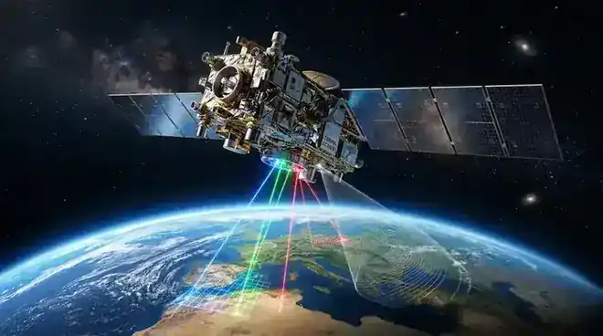
rsandgis.me
Introduction to Remote Sensing: The Eye in the Sky
Have you ever wondered how Google Earth provides such incredibly detailed views of the planet, or how meteorologists accurately track the path of a hurricane days before it makes landfall? The answer lies in a fascinating and rapidly evolving field of science and technology known as remote sensing. In our modern, data-driven world, the ability to gather information about our environment without physically touching it has become an indispensable tool across countless industries.
Remote sensing is the unseen force guiding modern agriculture, environmental conservation, urban development, and even military intelligence. By capturing data from above—whether from a drone flying over a farm or a satellite orbiting thousands of miles in space—we can unlock a wealth of information about the Earth’s surface, its atmosphere, and its oceans. This comprehensive guide will delve deep into the world of remote sensing, providing a thorough definition, explaining the science behind how it works, and offering a detailed comparison between the two primary types of systems: active vs. passive remote sensing.
Whether you are a student exploring geospatial sciences, a professional looking to integrate Earth observation data into your business, or simply a curious mind, this article will serve as your ultimate resource for understanding the complexities and applications of remote sensing technologies.
What is Remote Sensing? A Comprehensive Definition
At its core, remote sensing is the science and art of acquiring information about an object, area, or phenomenon from a distance, typically without making any physical contact with the target being observed. In the context of Earth sciences and geography, it refers to the use of sensors—mounted on aircraft, spacecraft, drones, or ground-based platforms—to detect and measure the radiation reflected or emitted from the Earth's surface and atmosphere.
To put it simply, when you take a photograph with your smartphone, you are engaging in a basic form of remote sensing. Your camera's sensor captures the light reflecting off the objects in your field of view, creating an image without you needing to touch those objects. In professional geospatial contexts, however, the sensors are vastly more sophisticated, capable of detecting energy across the entire electromagnetic spectrum, not just the visible light our eyes can see.
Remote sensing allows us to view the world from a macro perspective. Instead of studying a single tree, we can analyze an entire forest. Instead of measuring the temperature of a glass of water, we can monitor the surface temperature of the entire Pacific Ocean. It is this scalability and non-intrusive nature that makes remote sensing so powerful.
The Science Behind It: The Electromagnetic Spectrum
To truly understand remote sensing, one must first understand the Electromagnetic (EM) Spectrum. Everything in the universe reflects, absorbs, or emits electromagnetic radiation. The EM spectrum encompasses all types of electromagnetic radiation, ranging from very short, high-frequency gamma rays to very long, low-frequency radio waves. The visible light that humans can see is just a tiny fraction of this spectrum.
Different materials interact with different wavelengths of the EM spectrum in unique ways. This concept is known as a spectral signature. For example, healthy green vegetation absorbs red and blue visible light for photosynthesis but strongly reflects green visible light and near-infrared radiation. By using sensors calibrated to detect near-infrared light, scientists can easily distinguish healthy vegetation from stressed vegetation, soil, or water—even if they look identical to the naked eye.
Most remote sensing instruments operate in one or more of the following regions of the EM spectrum:
- Visible Spectrum (0.4 - 0.7 µm): The light we can see, used for standard optical photography and mapping.
- Near-Infrared (NIR) and Shortwave-Infrared (SWIR) (0.7 - 3.0 µm): Crucial for vegetation monitoring, soil moisture analysis, and mineral identification.
- Thermal Infrared (3.0 - 100 µm): Measures the heat emitted by objects, used for tracking ocean currents, volcanic activity, and urban heat islands.
- Microwave (1 mm - 1 m): Can penetrate clouds, rain, and even the forest canopy, making it essential for all-weather observation and radar systems.
The 7 Key Components of the Remote Sensing Process
The process of acquiring and utilizing remote sensing data is not just about taking a picture from space; it involves a complex, multi-step workflow. This process is generally broken down into seven key stages:
- Source of Illumination (Energy Source): Every remote sensing system requires an energy source to illuminate the target. This can be a natural source, like the Sun (passive), or an artificial source generated by the sensor itself (active).
- Radiation and the Atmosphere: As the energy travels from its source to the target, it must pass through the Earth's atmosphere. During this journey, the energy interacts with atmospheric gases and particles, leading to scattering (like why the sky is blue) and absorption.
- Interaction with the Target: Once the energy reaches the target (e.g., a forest, an ocean, a building), it interacts with it depending on the properties of both the target and the radiation. The energy may be transmitted, absorbed, or reflected.
- Recording of Energy by the Sensor: After the energy is scattered or emitted from the target, a sensor—usually mounted on a platform like a satellite or drone—collects and records this electromagnetic radiation.
- Transmission, Reception, and Processing: The energy recorded by the sensor is converted into an electronic signal and transmitted to a receiving and processing station on Earth. Here, the data is processed into a usable format, typically an image or a digital dataset.
- Interpretation and Analysis: The processed image is then analyzed—either visually by a human expert or digitally using computer algorithms and artificial intelligence—to extract meaningful information about the target.
- Application: The final stage is the practical application of the extracted information. This could be creating a map of deforestation, assessing crop damage for insurance purposes, or predicting weather patterns.
Active vs. Passive Remote Sensing: The Ultimate Comparison
One of the most fundamental classifications in the field of remote sensing is the distinction between active and passive sensors. This categorization is based entirely on the source of the electromagnetic energy used to illuminate the target.
Passive Remote Sensing
Passive remote sensing systems measure energy that is naturally available. They do not emit their own radiation. Instead, they act much like human eyes or a standard digital camera, passively recording the electromagnetic energy that is either reflected or emitted by the Earth's surface.
How Passive Sensors Work
The primary source of energy for passive sensors is the Sun. As sunlight hits the Earth, it is reflected back into space. Passive optical sensors measure this reflected solar radiation, mostly in the visible and near-infrared portions of the spectrum. Additionally, the Earth itself naturally emits thermal infrared radiation (heat), which can also be detected by passive thermal sensors.
Examples of Passive Sensors
- Photographic Cameras: Traditional film or digital cameras capturing visible light.
- Multispectral Scanners: Instruments like the Landsat Operational Land Imager (OLI) or the Sentinel-2 MultiSpectral Instrument (MSI) that capture data across several distinct wavelength bands simultaneously.
- Radiometers: Sensors that quantitatively measure the intensity of electromagnetic radiation in specific bands.
Advantages of Passive Systems
- High Quality and Natural Look: They produce images that are easily interpretable by humans, as they often closely resemble what we see with our own eyes (in the visible spectrum).
- Broad Coverage: They are excellent for continuous, large-scale monitoring of the Earth's surface, capturing vast swaths of land in a single pass.
- Cost-Effective: Because they don't need to generate their own power-intensive energy pulses, passive sensors are generally lighter, require less power, and can be less expensive to build and operate than active sensors.
Disadvantages of Passive Systems
- Weather Dependent: They are severely limited by cloud cover, atmospheric haze, and smoke. If a satellite cannot "see" the ground due to clouds, the data for that area is lost.
- Time Dependent: Because they rely primarily on solar illumination, most passive optical sensors can only capture useful data during daylight hours. Nighttime imaging is restricted to thermal sensors measuring heat.
Active Remote Sensing
Active remote sensing systems, on the other hand, provide their own source of energy to illuminate the target. The sensor emits a directed pulse of electromagnetic radiation toward the Earth and then measures the "backscatter," or the portion of the energy that is reflected back to the sensor.
How Active Sensors Work
Think of active remote sensing like using a camera with a flash in a dark room, or a bat using echolocation. The sensor sends out a signal, waits for it to hit an object, and records the time it takes for the echo to return, as well as the strength of the returning signal. This allows active sensors not only to detect the presence of an object but also to measure its exact distance and physical structure.
Types of Active Sensors
- RADAR (Radio Detection and Ranging): Emits microwave pulses. Radar is incredibly powerful because microwaves can pass straight through clouds, rain, and darkness, allowing for all-weather, day-or-night imaging. Synthetic Aperture Radar (SAR) is a common, highly advanced form used for Earth observation.
- LiDAR (Light Detection and Ranging): Uses laser pulses (usually near-infrared) to measure distances with extreme precision. LiDAR is the gold standard for creating highly detailed 3D topographical maps (Digital Elevation Models) and mapping forest canopy structures.
- SONAR (Sound Navigation and Ranging): While primarily using sound waves rather than the EM spectrum, sonar is an active remote sensing technique used extensively for underwater bathymetry mapping.
Advantages of Active Systems
- All-Weather, Day/Night Capability: Active sensors (especially Radar) are unhindered by cloud cover, darkness, or atmospheric conditions. They guarantee data acquisition regardless of the weather.
- Structural and Depth Information: Because they measure the time delay of the returning pulse, active sensors are exceptional at determining distances, heights, and 3D structures (e.g., tree height, building elevation, ground subsidence).
- Penetrating Capabilities: Certain microwave frequencies can penetrate dry soil to reveal buried structures, or penetrate forest canopies to map the bare earth beneath.
Disadvantages of Active Systems
- High Power Requirements: Generating the energy pulses requires significant electrical power, making the instruments larger, heavier, and more complex.
- Complex Data Processing: The data generated by active sensors (like SAR) is non-literal and highly complex to process and interpret. It does not look like a standard photograph and requires specialized software and expertise to analyze.
- Interference: Active pulses can sometimes suffer from interference from other signals, and interpreting backscatter can be complicated by the geometry and moisture content of the target.
Active vs. Passive: Summary Comparison Table
| Feature | Passive Remote Sensing | Active Remote Sensing |
|---|---|---|
| Energy Source | Natural (mostly the Sun or Earth's heat) | Artificial (generated by the sensor itself) |
| Time of Operation | Daytime only (except for thermal sensors) | Day or Night capabilities |
| Weather Dependency | Highly dependent; blocked by clouds and rain | Independent; microwaves penetrate clouds |
| Primary Output | 2D images, spectral data, true-color photos | 3D structural data, elevation, rough surface textures |
| Examples | Landsat, MODIS, standard photography | LiDAR, SAR (Synthetic Aperture Radar) |
| Complexity & Cost | Generally lower power, simpler interpretation | High power needs, complex data processing |
Types of Remote Sensing Platforms
The sensors used to capture data must be mounted on a stable platform. The choice of platform determines the altitude of the sensor, which in turn dictates the spatial resolution (the level of detail) and the area of coverage (the swath width). Platforms are generally categorized into three levels:
1. Ground-Based Platforms
Sensors are mounted on the Earth's surface, such as on tripods, towers, or vehicles. These are typically used for close-range analysis, calibrating airborne or spaceborne sensors, or continuous monitoring of a specific, small-scale local phenomenon (like a specific agricultural field or a structural integrity check of a bridge).
2. Airborne Platforms
These platforms operate within the Earth's atmosphere and provide high-resolution imagery over localized regions.
- Airplanes and Helicopters: Historically the most common airborne platforms. They can carry heavy sensor payloads, including large LiDAR arrays or highly specialized hyperspectral cameras. They are excellent for regional mapping and surveying.
- Unmanned Aerial Vehicles (UAVs / Drones): Drones have revolutionized remote sensing by democratizing access to geospatial data. They are cheap to operate, can fly at very low altitudes for ultra-high-resolution data (centimeter-level), and can be deployed rapidly on demand. Drones are now heavily used in precision agriculture, construction surveying, and localized environmental monitoring.
3. Spaceborne Platforms
Sensors are mounted on satellites orbiting the Earth, outside the atmosphere (typically ranging from 400 km to 36,000 km altitude). Spaceborne remote sensing provides unparalleled global coverage and the ability to monitor the planet consistently over decades.
- Low Earth Orbit (LEO): Most Earth observation satellites (like Landsat or Sentinel) operate here. They orbit pole-to-pole, passing over the same point on Earth every few days, providing excellent spatial resolution and temporal revisit times.
- Geostationary Orbit (GEO): These satellites orbit at the exact speed of the Earth's rotation, meaning they constantly "hover" over the same spot (usually the equator). They provide continuous monitoring of a specific hemisphere, which is critical for real-time weather forecasting and tracking severe storms, though their spatial resolution is much coarser due to their high altitude.
Key Applications of Remote Sensing Across Industries
The applications of remote sensing are vast and touch almost every aspect of modern life and environmental management. Here are some of the most critical use cases:
Agriculture and Farming (Precision Agriculture)
Remote sensing has transformed agriculture. By using multispectral sensors (especially those measuring the Near-Infrared band), farmers can calculate vegetation indices like NDVI (Normalized Difference Vegetation Index). This allows them to monitor crop health, identify pest infestations, assess nutrient deficiencies, and optimize irrigation long before problems are visible to the naked eye. This leads to higher yields, lower costs, and reduced environmental impact from fertilizers.
Forestry and Vegetation Management
Forestry agencies use a combination of optical imagery and LiDAR to monitor vast tracts of woodland. Passive sensors track deforestation, monitor the spread of forest fires, and map different species of trees. Active LiDAR sensors are used to penetrate the canopy, measure the height of trees, calculate biomass volume, and map the topography of the forest floor, which is crucial for managing timber resources and preserving habitats.
Hydrology and Water Resources
Monitoring the world's freshwater and oceanic resources is vital. Remote sensing tracks changes in lake and river levels, maps the extent of seasonal flooding, and monitors snowpack accumulation in mountains to predict spring runoff. Thermal sensors track ocean surface temperatures (SST), which helps in predicting weather patterns like El Niño and locating optimal fishing zones.
Geology and Mineral Exploration
Geologists use hyperspectral remote sensing to identify specific mineral signatures on the Earth's surface. Because different minerals reflect light differently, scientists can map the distribution of rock types and identify potential sites for mining oil, gas, and valuable ores without having to physically survey vast, inhospitable terrains.
Disaster Management and Mitigation
When natural disasters strike, speed is critical. Remote sensing provides rapid situational awareness. Radar satellites can see through hurricane clouds to map the extent of flooding below. Optical sensors can assess the damage caused by earthquakes, tsunamis, or tornadoes, helping direct emergency response teams to the hardest-hit areas. Thermal sensors are indispensable for tracking the real-time spread of wildfires.
Urban Planning and Infrastructure
As cities expand, remote sensing helps planners map urban sprawl, identify illegal construction, and manage transportation networks. High-resolution imagery helps update land-use maps, while thermal imaging identifies "Urban Heat Islands," allowing city planners to strategically plant trees or design green roofs to cool cities down.
Climate Change Monitoring and Environmental Tracking
Perhaps the most critical application of remote sensing is tracking the long-term effects of global climate change. Satellites monitor the shrinking of polar ice caps, the retreat of mountain glaciers, the rising of sea levels, and the thinning of the ozone layer. They also track atmospheric greenhouse gases like carbon dioxide and methane, providing the undeniable data that fuels global climate science and policy.
Future Trends in Remote Sensing Technology
The field of remote sensing is currently undergoing a massive technological renaissance. The future promises even more data, higher resolutions, and faster insights, driven by several key trends:
1. AI and Machine Learning Integration
The sheer volume of remote sensing data generated every day (petabytes of data) has made manual analysis impossible. Artificial Intelligence (AI) and Machine Learning (ML) algorithms are now being trained to automatically detect features in satellite imagery. AI can count cars in parking lots to predict economic activity, automatically detect new building construction, or identify ships engaged in illegal fishing. This shift from "data gathering" to "automated insight generation" is revolutionizing the industry.
2. Miniaturization and Nanosatellites (CubeSats)
Historically, Earth observation satellites were massive, billion-dollar projects the size of school buses. Today, technology has been miniaturized. Companies are launching "constellations" of hundreds of Nanosatellites or CubeSats (some no bigger than a shoebox). While individual sensors might be less powerful, the constellation approach means every inch of the Earth can be imaged daily, providing unprecedented high-temporal resolution.
3. Advancements in Hyperspectral Imaging
While multispectral sensors capture data in 4 to 10 broad bands of the EM spectrum, hyperspectral sensors capture data in hundreds of narrow, contiguous bands. This allows for incredibly detailed spectral signatures. In the future, hyperspectral data will allow us not just to see that a plant is stressed, but to chemically identify exactly what disease or nutrient deficiency is causing the stress from space.
Conclusion
Remote sensing is an extraordinary technological achievement that has forever changed our perspective of the Earth. By harnessing the power of the electromagnetic spectrum, we can gather critical intelligence about our world from afar. Understanding the fundamental differences between passive remote sensing (relying on the sun's natural illumination) and active remote sensing (providing its own targeted energy pulses) is key to utilizing these technologies effectively.
As our sensors become more advanced, our satellite constellations more numerous, and our AI processing more sophisticated, remote sensing will only become more integrated into our daily lives. From ensuring food security and managing resources to combating climate change and responding to disasters, remote sensing remains our most vital tool for observing, understanding, and protecting the dynamic planet we call home.
Frequently Asked Questions (FAQs)
1. Is a drone considered remote sensing?
Yes, absolutely. A drone (or UAV) is simply a platform. When you attach a sensor (like a standard RGB camera, a thermal camera, or a LiDAR scanner) to a drone to gather data about the ground below without touching it, you are actively engaging in remote sensing.
2. Can remote sensing see underground?
In general, most remote sensing techniques only observe the surface. However, certain active sensors, specifically low-frequency Ground Penetrating Radar (GPR), can penetrate dry soil, ice, and sand to reveal buried structures, archaeological sites, or geological formations up to a few meters deep.
3. What is the difference between spatial, spectral, and temporal resolution?
Spatial resolution refers to the size of one pixel on the ground (e.g., 1 meter resolution means one pixel represents a 1x1 meter square area). Spectral resolution refers to the number and width of the electromagnetic bands the sensor can detect (multispectral vs. hyperspectral). Temporal resolution (or revisit time) refers to how often a satellite passes over and captures data for the exact same location on Earth.
4. Why can't optical satellites see through clouds?
Optical satellites are passive sensors that rely on visible and near-infrared light. Water droplets in clouds are large enough to scatter this short-wavelength energy completely, meaning the light bouncing off the Earth's surface never reaches the satellite sensor. Active microwave (radar) sensors use much longer wavelengths that can easily bypass these water droplets.
5. How does remote sensing help in everyday life?
You use remote sensing data almost every day without realizing it. The weather forecast on your phone relies on satellite data. The GPS navigation maps you use are updated using satellite and aerial imagery. The food you eat may have been grown using precision agriculture techniques guided by drone or satellite data.