Photogrammetric Survey in Civil Engineering
Table of Contents
- The Core Principles of Photogrammetry
- Historical Context and Evolution
- The Workflow of a Photogrammetric Survey
- 1. Planning and Flight Path Generation
- 2. Establishing Ground Control Points (GCPs)
- 3. Image Acquisition
- 4. Data Processing and Point Cloud Generation
- 5. Generating Deliverables (Orthomosaics and DEMs)
- Key Applications in Civil Engineering
- Topographic Mapping and Earthworks
- Infrastructure Monitoring and Inspection
- As-Built Documentation
- BIM Integration and Digital Twins
- Disaster Management and Risk Assessment
- Advantages Over Traditional Surveying
- Speed and Efficiency
- Cost-Effectiveness
- Enhanced Safety
- Data Richness and Accessibility
- Challenges and Limitations
- Weather and Environmental Factors
- Computational Requirements
- Vegetation Penetration
- Comparative Analysis: Photogrammetry vs. LiDAR
- Detailed Accuracy Considerations in Photogrammetry
- Software Solutions in the Industry
- Advanced Techniques: Thermal and Multispectral Photogrammetry
- The Future of Photogrammetry
- AI and Machine Learning Integration
- Real-time Processing and Edge Computing
- Swarm Technology and Automation
- Conclusion
- Frequently Asked Questions
rsandgis.me
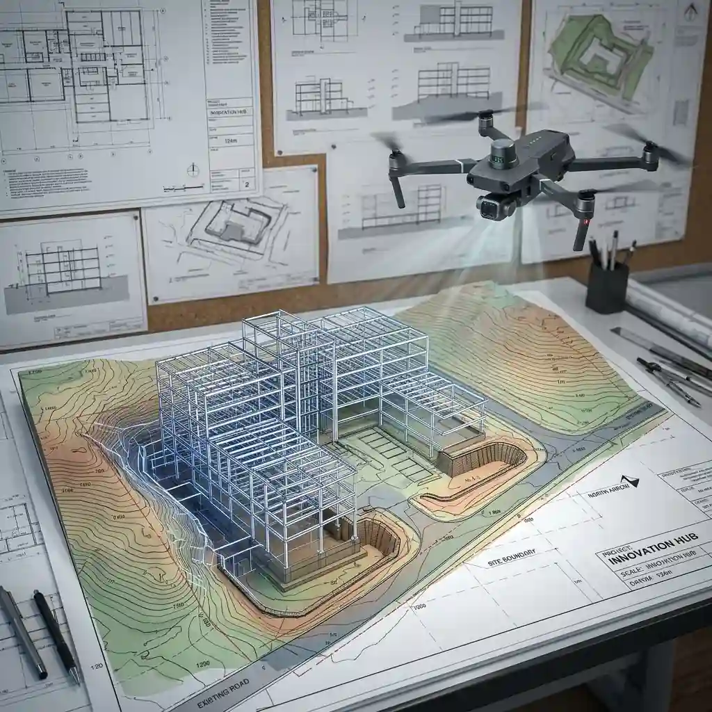
The modern construction and infrastructure industry relies heavily on accurate data collection and analysis to ensure that projects are built safely, efficiently, and within precise budgetary constraints. A photogrammetric survey in civil engineering is a highly advanced technique used to obtain reliable information about physical objects and the environment through the process of recording, measuring, and interpreting photographic images and patterns of electromagnetic radiant imagery. By capturing overlapping images from various angles and utilizing complex algorithms, civil engineers and land surveyors can create high-resolution, three-dimensional representations of landscapes, structures, and entire project sites. This methodology has fundamentally transformed how surveying, planning, and continuous project monitoring are conducted across the globe, providing an unparalleled combination of speed, accuracy, and immense detail that traditional methods simply cannot match.
The Core Principles of Photogrammetry
At its foundational level, photogrammetry is the science of making measurements from photographs. When applied to civil engineering, it usually involves aerial photogrammetry (using drones or manned aircraft) and close-range or terrestrial photogrammetry (using handheld cameras or ground-based tripods). The primary principle relies on triangulation, a concept also used by human eyes for depth perception. By taking photographs from at least two different locations, so-called "lines of sight" can be developed from each camera to points on the object. These lines of sight (sometimes called rays due to their optical nature) are mathematically intersected to produce the 3-dimensional coordinates of the points of interest. This technique allows for highly precise models to be built entirely from 2D images, creating a robust digital twin of the physical world.
With the advent of digital imaging and powerful computational capabilities, traditional stereophotogrammetry has largely evolved into what is now known as Structure from Motion (SfM). SfM algorithms are capable of automatically identifying matching features across dozens, hundreds, or even thousands of overlapping images. These algorithms can simultaneously estimate the 3D structures of the scene, the positions of the cameras at the exact moment each photo was taken, and the internal calibration parameters of the camera lens. This simultaneous solving of the camera poses and scene geometry is what allows modern photogrammetry to be so robust and flexible, even when using consumer-grade drones or non-metric cameras. SfM has democratized the use of photogrammetry, making it highly accessible to civil engineering firms of all sizes, from small local surveying outfits to massive multinational construction conglomerates.
Historical Context and Evolution
While photogrammetry might seem like a modern marvel driven by drones and fast computers, its origins actually trace back to the mid-19th century, shortly after the invention of photography itself. Early pioneers recognized that photographs could be used to deduce geometric properties of the subject. In the mid-20th century, aerial photogrammetry became a vital tool for mapping large expanses of land, typically using large, specialized metric cameras mounted in manned aircraft. This was an expensive and time-consuming process, generally reserved for government topographic mapping agencies or massive infrastructure projects like interstate highway networks.
The digital revolution of the late 20th and early 21st centuries profoundly altered the landscape. The transition from film to digital sensors eliminated the need for chemical processing and physical scanning of negatives. Following this, the exponential growth in computing power enabled the development of dense image matching algorithms. More recently, the explosion of the commercial drone market (Unmanned Aerial Vehicles, or UAVs) has been the biggest catalyst for change. Drones have made it incredibly cheap and easy to capture high-quality, perfectly overlapping images from ideal vantage points, propelling photogrammetric techniques into everyday civil engineering workflows. Today, what used to take weeks of fieldwork and expensive aircraft rentals can be accomplished in a matter of hours by a single operator with a drone.

The Workflow of a Photogrammetric Survey
Executing a successful photogrammetric survey in civil engineering requires a systematic approach to ensure accuracy and reliability. The workflow is generally broken down into several distinct phases: planning, field data acquisition, data processing, and final deliverable generation. Each step is critical, and errors in the early stages compound rapidly throughout the process.
1. Planning and Flight Path Generation
The success of any survey is dictated by the quality of the initial planning. Engineers must determine the required Ground Sampling Distance (GSD), which is the physical distance on the ground represented by a single pixel in the image. The GSD dictates the altitude at which the drone must fly and the resolution of the camera needed. Flight planning software is used to design automated grid or double-grid flight paths over the area of interest. These automated paths ensure consistent overlap between images, typically aiming for 75-85% front overlap and 65-75% side overlap. High overlap is critical for SfM algorithms to find enough common tie points between adjacent images.
2. Establishing Ground Control Points (GCPs)
While SfM can create highly accurate relative models (where the scale and shape are internally consistent), civil engineering requires absolute accuracy tied to a specific geographic coordinate system (like a state plane coordinate system). To achieve this, surveyors place Ground Control Points (GCPs) across the site. GCPs are highly visible targets (often large black-and-white checkerboards) whose precise coordinates (X, Y, and Z) are measured using high-precision Real-Time Kinematic (RTK) GPS or traditional total stations. These GCPs are later identified in the photographs and used to anchor, scale, and orient the entire 3D model to the real world, ensuring centimeter-level accuracy.
3. Image Acquisition
Once planning is complete and GCPs are established, the drone is deployed. The flight is largely autonomous, with the drone following the programmed path and triggering the camera at precise intervals. It is crucial during this phase to monitor environmental conditions. High winds can cause motion blur, while changing lighting conditions (like intermittent cloud cover) can cause issues during image matching. Optimal conditions are typically overcast skies, which provide flat, even lighting and eliminate harsh shadows that can obscure terrain features. If terrestrial photogrammetry is being used alongside or instead of aerial, operators carefully walk the site, capturing overlapping images by hand or with specialized rigs.
4. Data Processing and Point Cloud Generation
After the flight, the images are offloaded and imported into specialized photogrammetry software. The software begins the SfM process by extracting unique feature points from every image and matching them across the dataset. This results in a sparse point cloud and the calculated camera positions. The software then performs dense image matching, evaluating every single pixel to create a dense point cloud containing millions or even billions of highly accurate 3D points. Each point contains X, Y, and Z coordinates as well as color data derived from the original photographs, creating a photorealistic 3D representation of the site.
5. Generating Deliverables (Orthomosaics and DEMs)
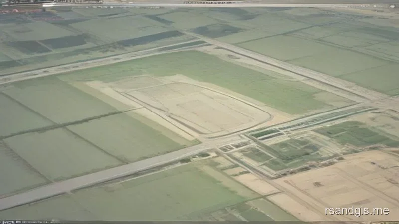
The dense point cloud is the foundation for creating various engineering deliverables. The most common is the orthomosaic, which is a highly detailed, distortion-free aerial map created by stitching the images together and ortho-rectifying them to remove the effects of perspective and terrain relief. Because an orthomosaic has a uniform scale, true distances and areas can be measured directly from it. Another crucial deliverable is the Digital Elevation Model (DEM), which can be further refined into a Digital Surface Model (DSM) that includes structures and vegetation, or a Digital Terrain Model (DTM) which represents the bare earth. These elevation models are essential for hydrological analysis, contour generation, and volume calculations.
Key Applications in Civil Engineering
The versatility of photogrammetry allows it to be applied across the entire lifecycle of a civil engineering project, from initial feasibility studies to construction monitoring and long-term asset management.
Topographic Mapping and Earthworks
Before any construction begins, engineers need accurate topographic maps of the existing terrain. Photogrammetry allows for the rapid creation of high-resolution DTMs and contour maps over vast areas in a fraction of the time required for traditional terrestrial surveying. During the construction phase, particularly for large earthwork projects, photogrammetry is used for volumetric analysis. By flying drones over stockpiles or excavation sites and comparing the resulting 3D surfaces against previous surveys or design models, engineers can quickly and accurately calculate the volumes of cut and fill material, streamlining contractor payments and logistical planning.
Infrastructure Monitoring and Inspection
Maintaining aging infrastructure is a massive challenge for civil engineers worldwide. Photogrammetry, particularly when paired with drones, provides a safe and efficient way to inspect critical assets such as bridges, dams, retaining walls, and tall buildings. Drones can fly close to these structures, capturing high-resolution images of hard-to-reach areas without putting human inspectors at risk. The resulting 3D models can be scrutinized by structural engineers in the office to identify cracks, spalling, corrosion, or structural deformation. Periodic surveys allow engineers to track the progression of degradation over time and prioritize maintenance interventions.
As-Built Documentation
Throughout the construction process, and upon completion, it is critical to document the "as-built" conditions to verify that the project was constructed according to the design specifications. Photogrammetry provides an objective, highly detailed visual and spatial record of the site at any given moment. These as-built models are invaluable for resolving disputes, facilitating future modifications, and integrating into facility management systems.
BIM Integration and Digital Twins
Building Information Modeling (BIM) is transforming how infrastructure is designed and managed. Photogrammetry is essential in the "scan-to-BIM" workflow. By capturing the real-world conditions of an existing site or structure, the resulting point clouds and 3D meshes can be imported directly into BIM software (such as Autodesk Revit or Civil 3D). This provides designers with an accurate context in which to design new additions or modifications, ensuring that the new design perfectly integrates with the existing environment, thereby reducing costly clashes and rework during construction. The data acts as the physical foundation for a project's Digital Twin.
Disaster Management and Risk Assessment
In the aftermath of natural disasters such as earthquakes, landslides, or floods, rapid assessment of the damage is critical for directing emergency response and planning reconstruction. Drones equipped with cameras can quickly survey devastated areas, providing emergency managers and civil engineers with up-to-date maps and 3D models to assess structural damage, identify unstable slopes, and plan safe access routes. Also, photogrammetry is heavily used in risk assessment, such as modeling flood plains or monitoring the movement of slow-moving landslides over time.
Advantages Over Traditional Surveying
The rapid adoption of photogrammetric techniques in civil engineering is driven by several distinct advantages over traditional ground-based surveying methods.
Speed and Efficiency
Traditional surveying using total stations or GPS rovers requires surveyors to physically walk the site, taking discrete point measurements one at a time. This process is inherently slow and labor-intensive, especially for large or complex sites. Conversely, a drone can cover hundreds of acres in a single flight lasting less than an hour, capturing millions of data points simultaneously. This massive increase in data acquisition speed drastically reduces the time required for fieldwork, allowing projects to proceed faster.
Cost-Effectiveness
While the initial investment in drone hardware and processing software can be substantial, the operational costs of photogrammetric surveys are significantly lower than traditional methods. The reduction in field time means fewer man-hours are required, which translates to direct cost savings. Also, the comprehensive nature of the data captured often eliminates the need for return trips to the site to pick up missing information, further reducing expenses.
Enhanced Safety
Civil engineering sites are inherently dangerous environments, often featuring heavy machinery, uneven terrain, high traffic volumes, or hazardous structures. By using remote sensing techniques like drone photogrammetry, surveyors can capture necessary data from a safe distance, keeping personnel out of harm's way. This is particularly crucial for surveying busy highways, unstable slopes, or active construction zones where ground access is severely restricted or highly dangerous.
Data Richness and Accessibility
A traditional topographic survey might result in a few thousand individual points defining the terrain. A photogrammetric survey, on the other hand, yields a dense point cloud with tens or hundreds of millions of points, capturing the minutest details of the site. Also, because each point is colorized by the original photographs, the resulting model is highly intuitive and visually understandable, even for non-technical stakeholders. This rich dataset can be mined for various types of information long after the initial survey is completed.
Challenges and Limitations
Despite its many benefits, photogrammetry is not a panacea and has certain limitations that civil engineers must understand and mitigate.
Weather and Environmental Factors
Photogrammetry relies entirely on passive sensors (cameras) capturing reflected light. Therefore, the technique is highly dependent on environmental conditions. Poor lighting, heavy rain, snow, or fog can completely halt a survey. Also, high winds can ground drones or cause severe motion blur in the imagery, degrading the quality of the final model. Surveyors must carefully monitor the weather and plan flights for optimal conditions.
Computational Requirements
Processing hundreds or thousands of high-resolution images requires massive computational power. Generating dense point clouds and orthomosaics is highly demanding on the CPU, GPU, and RAM of a workstation. While cloud processing solutions exist, dealing with massive datasets (often tens or hundreds of gigabytes per project) requires robust data management strategies and significant processing time, which must be factored into project schedules.
Vegetation Penetration
Perhaps the most significant limitation of photogrammetry compared to active sensing technologies like LiDAR (Light Detection and Ranging) is its inability to penetrate dense vegetation. A camera can only map what it can see. In heavily forested areas or sites with dense ground cover, photogrammetry will map the top of the canopy rather than the bare earth below. While filtering algorithms exist, if the ground is completely obscured, photogrammetry cannot accurately create a DTM. In such cases, LiDAR is the preferred technology.
Comparative Analysis: Photogrammetry vs. LiDAR
When selecting a remote sensing technology for civil engineering, professionals often debate the merits of Photogrammetry versus LiDAR. While both are powerful 3D scanning technologies, they operate on completely different principles and are suited to different types of projects.
LiDAR uses laser pulses to measure distance. An active sensor emits a laser beam and measures the time it takes for the reflection to return. This allows LiDAR to physically penetrate gaps in vegetation to map the ground beneath the canopy, a feat impossible for photogrammetry. LiDAR is also indifferent to lighting conditions; it can map a site in complete darkness. Also, LiDAR typically yields a cleaner, sharper point cloud on the edges of structures like power lines or thin towers.
On the other hand, photogrammetry holds several key advantages over LiDAR. First and foremost is the visual output. Because photogrammetry is based on high-resolution photography, the resulting point clouds and 3D meshes are perfectly colorized and photorealistic. LiDAR, by default, generates a point cloud based on elevation or intensity of reflection, not color (unless paired with an auxiliary camera). Second, the hardware cost for photogrammetry is vastly lower. A highly capable surveying drone with an excellent camera costs a fraction of an entry-level aerial LiDAR system. Finally, photogrammetry is often sufficient for the vast majority of bare-earth or lightly vegetated civil engineering projects, meaning the extra cost of LiDAR is not always justified.
Detailed Accuracy Considerations in Photogrammetry
Accuracy in photogrammetry is generally categorized into relative accuracy and absolute accuracy. Relative accuracy refers to how precisely objects within the model are scaled and positioned relative to each other. A model with high relative accuracy allows engineers to confidently measure distances and volumes within the model. Absolute accuracy refers to how accurately the model aligns with a global coordinate system. High absolute accuracy ensures that when the model is overlaid on a map or imported into a GIS (Geographic Information System), it sits exactly where it is supposed to in the real world.
To achieve high accuracy, particularly absolute accuracy, the use of Ground Control Points (GCPs) is critical. As mentioned earlier, GCPs tie the model to the ground. But the placement and distribution of GCPs are just as important as their measurement. Surveyors must ensure that GCPs are evenly distributed across the site, capturing the edges, high points, and low points of the terrain. If GCPs are clumped together, the edges of the model may suffer from a "bowling effect" where the Z-axis (elevation) curves incorrectly due to lens distortion and lack of anchoring points.
Another crucial factor is the use of RTK (Real-Time Kinematic) or PPK (Post-Processed Kinematic) enabled drones. These advanced drones tag each photograph with highly precise GPS coordinates at the moment of capture. While this does not completely eliminate the need for GCPs, it significantly reduces the number of GCPs required and dramatically improves the overall robustness and accuracy of the final model, saving immense amounts of time in the field.
Software Solutions in the Industry
The processing of photogrammetric data requires specialized software. Over the past decade, a highly competitive market has emerged, offering various solutions tailored to the needs of civil engineering professionals. Leading the pack are applications like Pix4Dmapper, Agisoft Metashape, and Bentley ContextCapture. These desktop solutions offer deep customization, allowing advanced users to tweak matching parameters, manually edit dense point clouds, and generate highly customized deliverables.
In addition to desktop software, cloud-based processing platforms like DroneDeploy, Propeller, and Pix4Dcloud have gained massive popularity. These platforms leverage cloud computing to process data quickly without requiring expensive hardware on the user's end. They also offer powerful collaboration tools, allowing engineers to share 3D models, orthomosaics, and volumetric calculations with clients and stakeholders through a simple web browser. The choice between desktop and cloud processing depends entirely on the firm's workflow, security requirements, and available hardware infrastructure.
Advanced Techniques: Thermal and Multispectral Photogrammetry
While standard RGB (Red, Green, Blue) cameras are the workhorses of civil engineering photogrammetry, advanced applications are increasingly utilizing specialized sensors. Thermal photogrammetry, utilizing FLIR cameras, allows engineers to identify heat signatures. In civil engineering, this is used for inspecting building facades for energy loss, locating subterranean utility leaks, or detecting delamination in concrete bridge decks, as damaged areas heat and cool at different rates than solid concrete.
Multispectral cameras, which capture light outside the visible spectrum (such as Near-Infrared), are primarily used in agriculture, but they also have niche civil engineering applications.
For example, they can be used for advanced environmental impact assessments, mapping wetland vegetation health before and after construction, or detecting subtle variations in soil moisture content across a large grading site. Combining these specialized sensors with traditional photogrammetric workflows opens up entirely new dimensions of data analysis for civil engineers.
The Future of Photogrammetry
The field of photogrammetry is evolving rapidly, driven by continuous advancements in hardware and software. The future promises even greater integration into the daily lives of civil engineers.
AI and Machine Learning Integration
Artificial Intelligence (AI) and Machine Learning (ML) are beginning to revolutionize photogrammetric processing. ML algorithms are being used to automatically classify point clouds, differentiating between ground, vegetation, buildings, and vehicles with high accuracy. AI is also being employed to automate the detection of defects in structural inspections, such as automatically identifying and quantifying cracks in concrete surfaces from drone imagery. This automation will further increase the speed and utility of photogrammetric data, freeing engineers to focus on analysis and design rather than tedious data sorting.
Real-time Processing and Edge Computing
Currently, the standard workflow involves acquiring data in the field and processing it later in the office or on the cloud. But advances in edge computing and more powerful onboard processors for drones are pushing toward real-time or near-real-time processing. In the future, a drone could generate a 3D model on the fly as it flies, allowing engineers on the ground to immediately assess the data and make critical decisions without waiting for post-processing.
Swarm Technology and Automation
As autonomous systems improve, the concept of using drone swarms for photogrammetric surveys is becoming a reality. Instead of a single drone surveying a massive highway project, a coordinated swarm of drones could cover the entire area simultaneously, dramatically reducing data acquisition time. Coupled with advanced collision avoidance and automated charging stations (drone-in-a-box solutions), we may soon see large infrastructure projects monitored continuously and autonomously, with updated 3D models delivered to engineers every single day without any manual intervention.
Conclusion
The integration of the photogrammetric survey in civil engineering workflows marks a fundamental major shift in how spatial data is collected, processed, and utilized. By offering unparalleled speed, safety, cost-effectiveness, and data richness, photogrammetry has moved from a niche, highly specialized technology to an indispensable tool for modern infrastructure development and management. While challenges such as vegetation penetration and computational demands remain, the continuous advancement of drone technology, coupled with the integration of artificial intelligence and machine learning, ensures that photogrammetry will remain at the forefront of the civil engineering industry for decades to come. As we look toward a future of increasingly complex infrastructure projects, tight budgets, and demanding schedules, the ability to rapidly and accurately digitize the physical world will be paramount, solidifying photogrammetry's role as a cornerstone of modern engineering practice.
Frequently Asked Questions
What is photogrammetry in civil engineering?
Photogrammetry is the science of making precise 3D measurements from overlapping 2D photographs. In civil engineering, it is used to generate highly accurate topographic maps, 3D models, and volume calculations from drone surveys.
What are Ground Control Points (GCPs)?
Ground Control Points are physical markers placed on the ground with highly accurate, known GPS coordinates. Photogrammetry software uses these points to mathematically anchor and scale the 3D model to the real world, ensuring survey-grade accuracy.
How is photogrammetry used for volume calculations?
By generating a high-density 3D surface model (Digital Surface Model) of a construction site or quarry, engineers can calculate the exact volume of a stockpile (like gravel or soil) or the amount of earth required to fill a trench, optimizing logistics.
