Multispectral Drone Imagery in Agriculture
Table of Contents
- The Physics of Multispectral Sensing
- Electromagnetic Spectrum and Plant Reflectance
- Chlorophyll Absorption Bands
- Near-Infrared Reflectance
- Sensor Architecture
- Global Shutter vs. Rolling Shutter
- Narrowband vs. Broadband Filters
- Radiometric Calibration and Corrections
- Incident Light Sensors
- Downwelling Light Sensor (DLS) Calibration
- Reflectance Panel Calibration
- Empirical Line Method
- Atmospheric and Geometric Corrections
- Bidirectional Reflectance Distribution Function (BRDF)
- Advanced Vegetation Indices Beyond NDVI
- Normalized Difference Red Edge (NDRE)
- Correlating NDRE with Nitrogen Uptake
- Soil Adjusted Vegetation Index (SAVI)
- L-Factor Optimization for Canopy Cover
- Photochemical Reflectance Index (PRI)
- Assessing Photosynthetic Light Use Efficiency
- Data Processing Pipeline and Photogrammetry
- Image Stitching and Orthomosaic Generation
- Structure from Motion (SfM) Algorithms
- Ground Control Points (GCPs) and RTK/PPK
- Radiometric Equalization Across Swaths
- Vignetting and Dark Current Compensation
- Machine Learning and Predictive Analytics
- Convolutional Neural Networks (CNNs) in Crop Health
- Weed Detection and Classification
- Disease Outbreak Prediction Models
- Time-Series Analysis and Phenotyping
- Spatiotemporal Yield Forecasting
- Hardware Considerations for Large-Scale Deployment
- Fixed-Wing vs. Multi-Rotor Platforms
- Payload Capacity and Flight Endurance
- Edge Computing for Real-Time Analysis
- On-board Processing Architectures
- Economic Implications and Future Trajectories
- Return on Investment (ROI) Metrics
- Input Reduction and Variable Rate Application (VRA)
- Integration with Autonomous Farm Machinery
- Seamless Data Transfer Protocols
- Conclusion
- Frequently Asked Questions
rsandgis.me
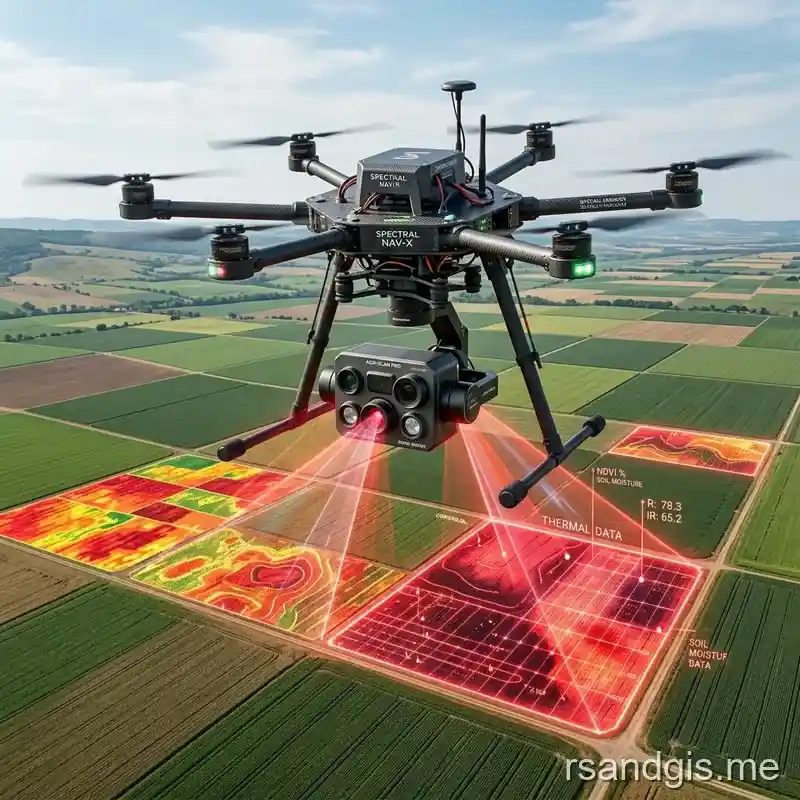
The implementation of multispectral drone imagery agriculture is fundamentally transforming modern precision farming techniques. By leveraging specialized narrow-band optical sensors mounted on unmanned aerial vehicles (UAVs), agronomists and geospatial scientists can extract highly nuanced biochemical and biophysical metrics from crop canopies. Unlike standard RGB photography, which merely replicates human vision, multispectral remote sensing captures non-visible wavelengths, particularly in the near-infrared (NIR) and red-edge regions of the electromagnetic spectrum. This capability allows for the early detection of physiological stress long before it manifests as visible chlorosis or necrosis, fundamentally shifting crop management from a reactive approach to a proactive, data-driven science. The integration of high-resolution spatial data with complex radiometric processing pipelines creates an unparalleled opportunity to optimize agricultural inputs, maximize yields, and mitigate environmental impacts.
The Physics of Multispectral Sensing
To fully appreciate the efficacy of multispectral sensing, one must explore the fundamental physics of light-matter interactions within plant cellular structures. The foundational principle relies on the specific reflectance, transmittance, and absorption properties of leaf tissues across varying wavelengths of electromagnetic radiation. When solar irradiance strikes a plant canopy, the photons interact with various foliar components, dictating the spectral signature that the drone's sensors eventually capture.
Electromagnetic Spectrum and Plant Reflectance
The electromagnetic spectrum encompasses all types of radiation, but agricultural remote sensing primarily focuses on the visible (400–700 nm) and near-infrared (700–1300 nm) regions. Healthy vegetation exhibits a characteristic spectral reflectance curve, often referred to as the "red edge," which marks the steep transition between the low reflectance in the visible red band and the high reflectance in the near-infrared band. This spectral behavior is directly correlated with the plant's physiological status, cellular integrity, and pigment concentrations.
Chlorophyll Absorption Bands
Within the visible spectrum, plant leaves predominantly absorb red (around 650–680 nm) and blue (around 450 nm) light. This absorption is driven by the presence of photosynthetic pigments, primarily chlorophyll a and b, which utilize these specific wavelengths of energy to drive the biochemical reactions of photosynthesis. As a result, healthy plants with high chlorophyll content reflect very little red light. When a plant experiences stress, due to nutrient deficiency, drought, or pathogenic infection, chlorophyll production decreases, leading to a measurable increase in red reflectance. Multispectral sensors are precisely calibrated to detect these minute variations in the red band, providing an early indicator of suboptimal plant health.
Near-Infrared Reflectance
Conversely, the near-infrared (NIR) region (700–1300 nm) interacts entirely differently with plant tissue. NIR radiation is poorly absorbed by plant pigments; instead, it is strongly scattered and reflected by the internal spongy mesophyll cellular structure of the leaves. A robust, healthy plant with turgid, well-structured mesophyll cells will exhibit remarkably high NIR reflectance. As plants undergo stress or senescence, the internal cellular structure degrades, causing a significant reduction in NIR scattering and reflectance. By comparing the low red reflectance (driven by chlorophyll) with the high NIR reflectance (driven by cell structure), agronomists can synthesize powerful indices to quantify plant vigor.
Sensor Architecture
The hardware responsible for capturing this spectral data must meet stringent engineering specifications to ensure radiometric accuracy and spatial fidelity. Multispectral drone sensors typically consist of an array of individual imagers, each equipped with a specific optical bandpass filter designed to isolate a narrow slice of the electromagnetic spectrum.
Global Shutter vs. Rolling Shutter
In aerial photogrammetry, the type of electronic shutter employed by the sensor drastically impacts data quality. Traditional consumer cameras utilize rolling shutters, which expose the image sensor sequentially line-by-line. While flying at high speeds, this temporal delay across the sensor frame introduces spatial distortions, colloquially known as the "jello effect," which compromises the geometric accuracy of the final orthomosaic. Professional multispectral sensors employ global shutters, which expose the entire pixel array simultaneously. This instantaneous capture effectively freezes the dynamic motion of the drone, ensuring crisp, geometrically accurate imagery that is essential for precise band-to-band alignment and spatial analysis.
Narrowband vs. Broadband Filters
The spectral resolution of the sensor is dictated by its optical filters. Broadband filters, typical of modified RGB cameras, allow a wide range of wavelengths to pass through (often 50–100 nm wide), which dilutes the spectral signature and obscures subtle physiological variations. High-end multispectral sensors utilize narrowband dielectric interference filters (typically 10–40 nm wide at the Full Width at Half Maximum - FWHM). These narrow bands precisely target critical spectral features, such as the exact trough of chlorophyll absorption or the peak of the red edge, providing the radiometric purity required for advanced agricultural analytics.
Radiometric Calibration and Corrections
Raw digital numbers (DN) captured by the sensor are entirely relative and inherently flawed due to dynamic ambient lighting conditions, sensor variations, and atmospheric interference. To extract biologically meaningful data, these raw pixel values must be converted into absolute surface reflectance values through a rigorous process of radiometric calibration.
Incident Light Sensors
Agricultural drone flights often span several minutes to over an hour, during which solar illumination can fluctuate wildly due to shifting cloud cover, changing solar elevation, and varying atmospheric aerosols. Without accounting for these fluctuations, a field scanned under partial clouds might erroneously appear less vigorous than a field scanned under direct sunlight.
Downwelling Light Sensor (DLS) Calibration
To dynamically compensate for changing illumination, professional multispectral drones integrate a Downwelling Light Sensor (DLS) mounted on the dorsal surface of the aircraft. The DLS continuously measures the ambient spectral irradiance in the exact same wavelength bands as the primary imagers facing the ground. During the post-processing phase, the software utilizes the DLS metadata synchronized with each image capture to normalize the sensor's raw output, ensuring that the calculated reflectance is purely a function of the crop's properties, irrespective of the ambient light at the moment of capture.
Reflectance Panel Calibration
While the DLS provides dynamic relative corrections, absolute calibration requires a known physical reference. This is achieved using specialized radiometric calibration panels, which are captured by the drone immediately prior to and following the flight mission.
Empirical Line Method
Calibration panels are manufactured with specialized coatings that possess rigorously laboratory-tested, lambertian reflectance profiles across all spectral bands (e.g., exactly 50% reflectance in the NIR, 45% in the Red). By applying the Empirical Line Method, photogrammetry software extracts the digital numbers from the image of the calibration panel and maps them to the known absolute reflectance values. This mathematical relationship is then applied across the entire dataset, anchoring the dynamic DLS corrections to a solid, absolute radiometric baseline.
Atmospheric and Geometric Corrections
Even with absolute calibration, the path of light through the atmosphere and the viewing geometry between the sun, the target, and the sensor introduce complex artifacts that require advanced mathematical mitigation.
Bidirectional Reflectance Distribution Function (BRDF)
Plant canopies are not perfect Lambertian reflectors; they are highly anisotropic, meaning their apparent reflectance changes depending on the angle of observation and the angle of solar illumination. This phenomenon is quantified by the Bidirectional Reflectance Distribution Function (BRDF). As the drone flies along its flight lines, the viewing angle shifts continuously, causing the same patch of crop to appear brighter or darker depending on whether it is viewed from a forward-scatter or back-scatter perspective. Advanced photogrammetry pipelines incorporate BRDF correction algorithms to normalize these angular effects, generating a seamless, radiometrically homogenous orthomosaic devoid of noticeable flight-line banding.

Advanced Vegetation Indices Beyond NDVI
The Normalized Difference Vegetation Index (NDVI) is the most widely recognized metric in remote sensing, calculated as (NIR - Red) / (NIR + Red). While highly effective for general biomass estimation, NDVI suffers from saturation in dense crop canopies and is sensitive to soil background noise in early growth stages. As a result, advanced precision agriculture relies on a broader suite of specialized vegetation indices.
Normalized Difference Red Edge (NDRE)
As crops reach peak maturity and canopy closure, the red absorption bands become entirely saturated by high chlorophyll concentrations, rendering NDVI blind to further physiological changes. The Normalized Difference Red Edge (NDRE) index utilizes the red-edge band (typically around 710–730 nm) instead of the standard red band.
Correlating NDRE with Nitrogen Uptake
Light in the red-edge band penetrates deeper into the multi-layered crop canopy rather than being immediately absorbed by the top leaves. This deeper penetration makes NDRE highly sensitive to total canopy chlorophyll content and, by extension, plant nitrogen status. Agronomists heavily rely on NDRE mapping in mid-to-late season crops (such as corn and sugarcane) to prescribe variable rate nitrogen applications, as it provides a much more accurate representation of nutrient uptake dynamics than NDVI.
Soil Adjusted Vegetation Index (SAVI)
In early growth stages, such as emergence and initial vegetative development, the crop canopy is sparse, exposing a significant proportion of bare soil. The spectral reflectance of the soil can severely skew standard indices, leading to erroneous crop health assessments.
L-Factor Optimization for Canopy Cover
The Soil Adjusted Vegetation Index (SAVI) introduces a canopy background adjustment factor, denoted as 'L'. The formula modifies the standard NDVI calculation to (NIR - Red) / (NIR + Red + L) * (1 + L). The 'L' value varies from 0 to 1 depending on the green vegetation cover. For exceedingly sparse canopies, an L value of 1 is utilized, whereas for dense canopies, L approaches 0, effectively reverting the equation to standard NDVI. By dynamically optimizing the L-factor based on spatial emergence patterns, agronomists can accurately assess seedling vigor without the confounding influence of soil moisture and composition.
Photochemical Reflectance Index (PRI)
While most indices measure structural biomass or total chlorophyll concentration, the Photochemical Reflectance Index (PRI) provides a real-time snapshot of the plant's photosynthetic efficiency.
Assessing Photosynthetic Light Use Efficiency
PRI utilizes extremely narrow bands in the green/yellow region (specifically 531 nm and 570 nm) to detect minute changes in the xanthophyll cycle, a critical biochemical process that protects plants from excess light energy. When a plant undergoes acute stress (e.g., severe water deficit or heat shock), the xanthophyll cycle down-regulates photosynthesis instantly, long before structural damage or chlorophyll degradation occurs. PRI can therefore detect these ephemeral stress events on an hourly basis, offering an ultra-early warning system for irrigation management and environmental stress mitigation.
Data Processing Pipeline and Photogrammetry
The raw output of a drone flight consists of thousands of individual, overlapping, multi-band TIFF images. Transforming this unstructured data into actionable agronomic maps requires a highly sophisticated computational pipeline.
Image Stitching and Orthomosaic Generation
The primary goal is to generate an orthomosaic, a highly accurate, top-down map constructed from the individual images, corrected for topographic distortions and camera perspective.
Structure from Motion (SfM) Algorithms
Modern processing software relies on Structure from Motion (SfM) algorithms. SfM analyzes overlapping images to identify millions of common geometric features (tie points). By calculating the parallax shift of these features across multiple images, the algorithm reconstructs the 3D geometry of the agricultural terrain and the precise internal and external camera parameters. This process generates a dense point cloud and a Digital Surface Model (DSM), which are subsequently used to orthorectify the imagery, removing perspective distortions caused by canopy height and terrain topography.
Ground Control Points (GCPs) and RTK/PPK
To ensure the resulting orthomosaic is highly accurate in geographic space, external reference data is required. Traditionally, this involved surveying Ground Control Points (GCPs) with high-precision GPS rovers. But modern drone platforms integrate Real-Time Kinematic (RTK) or Post-Processed Kinematic (PPK) GNSS receivers. These advanced systems record the exact geolocation of the sensor at the millisecond of image capture down to centimeter-level accuracy, drastically reducing or eliminating the need for physical GCPs while ensuring perfect spatial alignment across multi-temporal flights.
Radiometric Equalization Across Swaths
Beyond spatial accuracy, the computational pipeline must address radiometric inconsistencies across the entire mapped area.
Vignetting and Dark Current Compensation
Individual images suffer from optical vignetting, a gradual darkening toward the edges of the frame due to lens geometry. Also, thermal noise within the silicon sensor generates 'dark current' that skews pixel values. The processing pipeline must apply rigorous mathematical models to flat-field correct each image, compensating for vignetting and dark current before the images are blended. Failure to execute these corrections results in localized radiometric anomalies in the orthomosaic, which can trigger false positives in variable rate prescription maps.
Machine Learning and Predictive Analytics
While traditional index calculation provides valuable insights, the vast dimensionality of multispectral data is perfectly suited for advanced artificial intelligence algorithms.
Convolutional Neural Networks (CNNs) in Crop Health
Deep learning architectures, specifically Convolutional Neural Networks (CNNs), are increasingly being deployed to analyze multispectral orthomosaics. Unlike simple threshold-based index maps, CNNs can interpret complex spatial patterns, textures, and multi-band spectral signatures simultaneously.
Weed Detection and Classification
By training CNNs on thousands of annotated multispectral images, researchers have developed robust models capable of not only detecting weed infestations but also classifying them by species. Because different weed species exhibit unique spectral reflectance curves and morphological textures, a CNN can differentiate between broadleaf weeds and grassy weeds within a crop row. This enables highly targeted, variable rate herbicide applications, drastically reducing chemical usage and preventing herbicide resistance.
Disease Outbreak Prediction Models
Pathogenic infections alter plant physiology at a microscopic level before macroscopic symptoms appear. Machine learning models can analyze minute changes in thermal characteristics (if a thermal band is included), red-edge dynamics, and structural indices to identify localized stress epicenters. By integrating these spectral anomalies with historical weather data and epidemiological models, predictive analytics can forecast disease outbreak trajectories, allowing farmers to apply localized fungicidal treatments preemptively.
Time-Series Analysis and Phenotyping
The true power of drone imagery is realized through frequent, repeatable flights over the entire growing season, creating a hyper-temporal dataset.
Spatiotemporal Yield Forecasting
By analyzing the spatiotemporal evolution of vegetation indices, data scientists construct complex growth curves for every square meter of the field. These growth curves are correlated with historical yield data to train predictive forecasting models. By mid-season, these models can accurately predict spatial yield variations, allowing agricultural enterprises to optimize logistics, estimate storage requirements, and market their commodities well before the actual harvest.
Hardware Considerations for Large-Scale Deployment
Implementing multispectral drone programs at a commercial agricultural scale requires careful evaluation of aviation hardware to maximize efficiency and data quality.
Fixed-Wing vs. Multi-Rotor Platforms
The choice of airframe directly impacts the operational scalability of the imaging program.
Payload Capacity and Flight Endurance
Multi-rotor drones offer vertical takeoff and landing (VTOL) capabilities and exceptional maneuverability, making them ideal for small, complex plots and intensive phenotyping research. But their reliance on constant rotor thrust drastically limits flight endurance. Conversely, fixed-wing platforms leverage aerodynamic lift, allowing them to cover hundreds of hectares in a single flight. For large-scale commercial farming, fixed-wing VTOL hybrids have become the industry standard, combining the deployment flexibility of a multi-rotor with the immense area coverage and energy efficiency of a traditional airplane.
Edge Computing for Real-Time Analysis
Traditionally, multispectral data requires high-bandwidth upload to cloud infrastructure for processing, which is often unfeasible in remote rural environments.
On-board Processing Architectures
The latest generation of agricultural drones is incorporating edge computing architectures directly onto the aerial platform. Utilizing low-power, high-performance GPUs, these systems can run localized SfM algorithms and CNN inference engines mid-flight. By processing the raw imagery in the air, the drone can instantly downlink a lightweight, georeferenced index map or an anomaly shapefile to the operator's ground station the moment the flight concludes, enabling immediate, day-of field scouting and rapid intervention.
Economic Implications and Future Trajectories
The transition toward highly technical remote sensing fundamentally alters the agricultural economic model, shifting capital from blanket chemical applications toward precision data acquisition and analytics.
Return on Investment (ROI) Metrics
Calculating the ROI of a multispectral drone program involves quantifying both hard savings and soft agronomic benefits.
Input Reduction and Variable Rate Application (VRA)
The most immediate economic benefit is realized through Variable Rate Application (VRA) of fertilizers, herbicides, and desiccants. By generating prescription maps from multispectral indices (like NDRE), farmers can target chemical applications specifically to zones exhibiting deficiency or stress, while reducing rates in highly vigorous zones. This optimization not only slashes chemical input costs but also mitigates environmental runoff and localized toxicity, ensuring the long-term ecological sustainability of the farming operation.
Integration with Autonomous Farm Machinery
The ultimate trajectory of this technology is the complete integration of aerial analytics with ground-based autonomous robotics.
Seamless Data Transfer Protocols
Future agricultural ecosystems will rely on standardized data pipelines where the drone automatically analyzes the field, generates a high-resolution VRA shapefile, and transmits it directly to an autonomous tractor or smart-sprayer system via local mesh networks. This closed-loop system, driven by continuous multispectral monitoring, represents the pinnacle of precision agriculture, a highly automated, data-driven methodology that maximizes biological efficiency while minimizing human intervention.
Conclusion
The science of remote sensing has transcended its origins in satellite geography to become an indispensable tool at the micro-agronomic level. By understanding the intricate physics of spectral reflectance and deploying rigorous computational processing, the industry is unlocking unparalleled insights into plant physiology. As sensor hardware continues to miniaturize and machine learning algorithms become increasingly sophisticated, the reliance on these aerial platforms will only intensify. Ultimately, mastering these technologies is not merely an operational upgrade; it is a fundamental requisite for ensuring global food security and agricultural sustainability in the modern era.
Frequently Asked Questions
What does a multispectral drone camera do?
A multispectral camera captures image data within specific, narrow wavelength bands across the electromagnetic spectrum, including bands invisible to the human eye, like Near-Infrared (NIR) and Red-Edge.
How do farmers use the Red-Edge band?
The Red-Edge band is highly sensitive to changes in chlorophyll content. It provides a much earlier and more precise indication of plant stress, disease, or nutrient deficiency than standard visible color cameras.
Why use drones instead of satellites for precision agriculture?
Drones can fly underneath clouds and at much lower altitudes, providing ultra-high resolution imagery (centimeter-level) on demand, allowing farmers to spot individual stressed plants and apply immediate interventions.
