Edge AI for Real-Time Drone Photogrammetry Processing
Table of Contents
- The Evolution of Drone Mapping: From Cloud to the Edge
- Core Components of Edge AI Photogrammetry Systems
- 1. Hardware Layer: The Edge Compute Nodes
- 2. Algorithmic Layer: Neural SfM and SLAM
- 3. GIS Integration Layer: Real-Time Spatial Streaming
- The Transformative Advantages of Edge AI Mapping
- Zero-Latency Decision Making
- Bandwidth Independence
- Enhanced Data Security and Privacy
- Autonomous Flight Adjustments
- Mathematical Optimization: Making Deep Learning Fit on a Drone
- Model Quantization and Network Pruning
- Knowledge Distillation
- Challenges and Future Horizons
- Frequently Asked Questions
- Conclusion
rsandgis.me
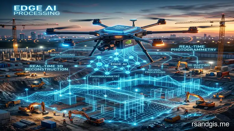
The geographic information systems (GIS) industry is currently undergoing a massive transformation. Historically, capturing high-resolution spatial data via Unmanned Aerial Vehicles (UAVs) involved a tedious, multi-step process: flying the drone, extracting SD cards, transferring gigabytes of raw images to high-performance workstations, and waiting hours, sometimes days, for cloud-based photogrammetry engines to stitch the data together. Today, the integration of edge AI for real time drone photogrammetry is completely shattering this bottleneck. By moving the computational power directly to the "edge" (the drone itself or a ruggedized field computer), GIS professionals can now generate 3D point clouds, digital elevation models (DEMs), and orthomosaics instantly while still in the field.
This guide explores the highly specialized, rapidly evolving intersection of Edge Artificial Intelligence, real-time photogrammetry, and next-generation GIS mapping. We will dive deep into the hardware requirements, the underlying neural network architectures that make real-time stitching possible, the mathematical optimization of Structure-from-Motion (SfM) algorithms for edge devices, and the transformative real-world applications across disaster response, precision agriculture, and industrial surveying.
The Evolution of Drone Mapping: From Cloud to the Edge
To fully appreciate the impact of edge AI, we must first understand the traditional photogrammetry pipeline. Photogrammetry, the science of making measurements from photographs, relies heavily on Structure-from-Motion (SfM) and Multi-View Stereo (MVS) algorithms. These algorithms require massive computational resources to identify thousands of tie points across overlapping images, calculate camera matrices, and construct dense 3D meshes.
For years, this meant relying on monolithic desktop software (like Pix4D or Agisoft Metashape) or uploading massive datasets to cloud infrastructure (like DroneDeploy). While cloud processing offers near-infinite scalability, it introduces a critical vulnerability: latency and bandwidth dependence. In remote environments, such as a deep-forest conservation site or a disaster zone, uploading 50GB of raw 4K imagery over a weak cellular connection is simply impossible.
Enter Edge Computing. Edge computing decentralizes data processing by bringing the computational hardware as close to the data source as possible. In the context of drone mapping, "the edge" can be an onboard companion computer (like an NVIDIA Jetson Orin) physically mounted on the drone, or a ruggedized base station laptop deployed at the launch site.
When we inject Artificial Intelligence into this edge paradigm, we achieve Edge AI. Instead of running traditional, mathematically exhaustive SfM algorithms that require hours of brute-force matching, Edge AI utilizes lightweight, pre-trained neural networks (often Convolutional Neural Networks or CNNs) to estimate depth, identify feature matches, and generate meshes in a fraction of the time. This allows the drone to literally "build the map" as it flies.
Core Components of Edge AI Photogrammetry Systems
Implementing edge AI for real time drone photogrammetry requires a highly sophisticated synergy between hardware miniaturization and algorithmic efficiency. A typical enterprise-grade edge mapping system consists of three primary layers:
1. Hardware Layer: The Edge Compute Nodes
The hardware must balance computational horsepower with strict Size, Weight, and Power (SWaP) constraints. Drones cannot carry heavy server racks or massive power supplies. Therefore, the industry relies on highly optimized System-on-Modules (SoMs).
- Onboard Companion Computers: Devices like the NVIDIA Jetson series (Nano, Xavier NX, Orin) are the gold standard. These microcomputers feature dedicated Tensor Cores designed specifically for accelerating deep learning matrix operations at low wattages (often under 15W).
- Neural Processing Units (NPUs): Many modern drone cameras now feature integrated NPUs that handle initial image processing, such as feature extraction and noise reduction, before the data even reaches the companion computer.
- Rugged Field Processors: For heavier processing tasks, field workers utilize specialized, ruggedized tablets or portable servers stationed at the launch site. The drone streams raw sensor data via high-bandwidth radio links (like OcuSync or proprietary mesh networks) to this ground edge node.
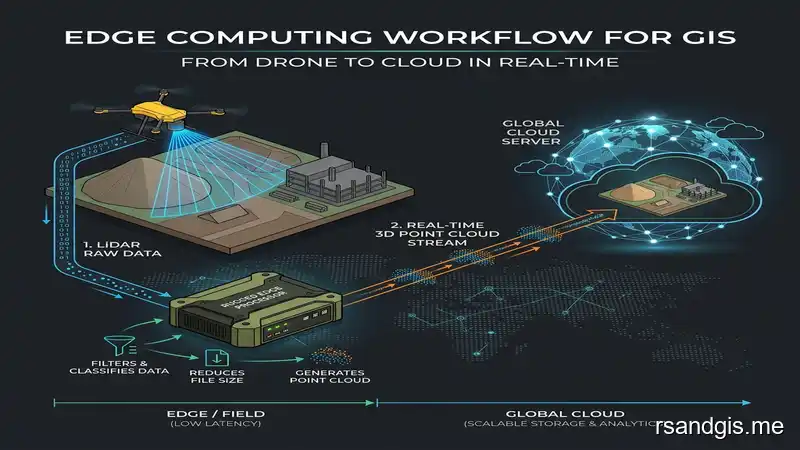
Conceptual illustration of edge computing workflow for GIS from drone to field processor.
2. Algorithmic Layer: Neural SfM and SLAM
Traditional Structure-from-Motion relies on the SIFT (Scale-Invariant Feature Transform) algorithm, which is highly accurate but computationally expensive. Edge AI replaces or augments these steps using Deep Learning.
Neural Feature Extraction: Deep learning models like SuperPoint or D2-Net are deployed to extract keypoints and descriptors. These models are heavily compressed using techniques like quantization (reducing 32-bit floats to 8-bit integers) to run efficiently on edge hardware.
Visual SLAM (Simultaneous Localization and Mapping): Real-time mapping relies heavily on SLAM. By combining visual data from the camera with inertial data from the IMU, SLAM algorithms allow the drone to understand its exact position in 3D space while simultaneously building a map of its environment. AI-enhanced SLAM can handle dynamic environments, shadows, and low-texture surfaces much better than traditional SLAM.
Monocular Depth Estimation: Advanced edge AI systems use convolutional networks to predict depth maps directly from single 2D images. As the drone flies, it continuously infers depth, rapidly stitching these depth maps into a cohesive 3D point cloud without needing hundreds of overlapping passes.
3. GIS Integration Layer: Real-Time Spatial Streaming
Generating the map is only half the battle; integrating it into a GIS environment is the final step. Edge processors utilize spatial streaming protocols to transmit the generated 3D tiles (like Cesium 3D Tiles) or compressed orthomosaics directly to field tablets.
Field workers using software like QGIS or Esri ArcGIS Field Maps can ingest these streams instantly. This means a geologist can see a high-resolution, centimeter-accurate map of a landslide literally minutes after the drone takes off, completely bypassing the cloud upload/download bottleneck.
The Transformative Advantages of Edge AI Mapping
The transition to edge AI for real time drone photogrammetry is not merely an incremental upgrade; it represents a major shift in how spatial data is collected, processed, and utilized in mission-critical scenarios.
Zero-Latency Decision Making
In emergency response situations, such as a wildfire, flood, or earthquake, waiting 24 hours for a cloud server to process a map can cost lives. Edge AI allows incident commanders to deploy a drone and instantly receive a live, stitched orthomosaic of the disaster zone on their command screens. They can measure distances, calculate the volume of debris, and identify safe evacuation routes in absolute real-time.
Bandwidth Independence
Many critical infrastructure inspections (pipelines, power grids, remote mining operations) occur in areas with zero cellular connectivity. Cloud-based workflows break down entirely in these environments. Edge computing ensures that the data is processed locally. Instead of trying to upload 100GB of raw imagery over a satellite link, the edge node processes the data and only transmits the final 50MB vectorized result or critical anomaly alerts.
Enhanced Data Security and Privacy
For defense, law enforcement, and highly regulated industries, uploading sensitive spatial data to third-party cloud servers poses a significant security risk. Processing data on the edge ensures that sensitive imagery never leaves the physical hardware. The drone lands, the encrypted map is downloaded directly to a secure local server, and compliance is maintained without relying on external cloud providers.
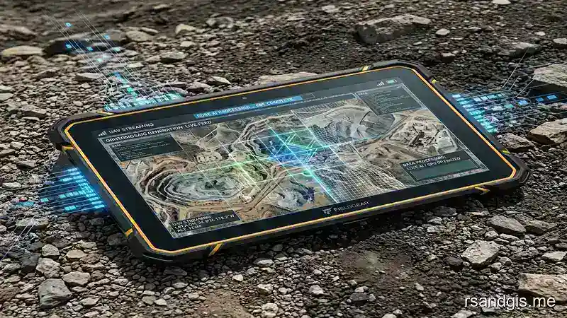
Conceptual illustration of a real-time orthomosaic map being generated instantly on a rugged field tablet.
Autonomous Flight Adjustments
When processing occurs in the cloud, the drone is merely a "blind" data collection tool. It flies a pre-programmed grid, captures photos, and lands. If the photos are blurry or the overlap is insufficient, the operator won't know until hours later when the cloud processing fails. With Edge AI, the drone is "aware" of the map it is building. If it detects a gap in the point cloud or poor lighting in a specific area, the onboard AI can autonomously override the flight plan, return to the area, and capture additional overlapping images to ensure the final model is flawless.
Mathematical Optimization: Making Deep Learning Fit on a Drone
How do we fit deep learning models that normally require massive data center GPUs onto a tiny microcomputer flying at 40mph? The answer lies in rigorous mathematical optimization and model compression.
Model Quantization and Network Pruning
Neural networks are typically trained using 32-bit floating-point arithmetic (FP32). While this provides immense precision, it consumes vast amounts of memory and power. Edge AI deployments utilize Quantization to convert these FP32 weights into 8-bit integers (INT8). This mathematically compresses the model size by up to 4x and significantly accelerates inference speed on edge NPUs, with a negligible drop in mapping accuracy.
Also, Network Pruning is used to identify and remove "dead" or redundant neurons within the network that do not significantly contribute to the final photogrammetry output. This creates sparse, highly efficient networks tailored specifically for aerial imagery analysis.
Knowledge Distillation
In this advanced training technique, a massive, highly accurate "Teacher" model (run on a cloud supercomputer) is used to train a much smaller "Student" model (designed for the edge drone). The Student model learns to mimic the mathematical outputs of the Teacher model. This allows the lightweight edge device to achieve near-cloud-level photogrammetry accuracy without the computational overhead.
Challenges and Future Horizons
While the potential of edge AI for real time drone photogrammetry is immense, the industry still faces several critical engineering hurdles.
Thermal Management: Processing heavy neural networks generates significant heat. Drones operating in hot climates (like desert mining operations) struggle to keep onboard edge computers cool. Engineers are continuously developing advanced passive cooling techniques, utilizing the drone's own rotor downdraft as a cooling mechanism.
Battery Constraints: Powering both a multi-rotor flight system and an edge AI processor requires massive energy. Flight times are often reduced when heavy edge processing is engaged. The future relies on the development of ultra-low-power neuromorphic chips that process spatial data using a fraction of the wattage required by traditional GPUs.
Looking forward, the ultimate goal is Swarm Edge Intelligence. Imagine a fleet of ten drones mapping an entire city simultaneously. Instead of each drone processing its own isolated map, the drones use decentralized edge AI to communicate with each other in real-time. They share feature points, coordinate flight paths to avoid redundant mapping, and collaboratively stitch a massive, city-wide 3D digital twin on the fly. This level of autonomous, decentralized spatial computing will redefine the very fabric of the GIS and remote sensing industries.
Frequently Asked Questions
What is edge AI in drone photogrammetry?
Edge AI in drone photogrammetry refers to the process of running artificial intelligence algorithms directly on the drone's onboard computer (the "edge") to stitch images and generate 3D maps or orthomosaics in real-time, eliminating the need to upload raw data to a cloud server.
How does real-time photogrammetry differ from traditional mapping?
Traditional mapping requires capturing all images first, landing the drone, and processing the data on a powerful desktop or cloud server for hours. Real-time photogrammetry uses Edge AI and visual SLAM to stitch the images together instantly as the drone flies, providing immediate spatial data to field workers.
What hardware is needed for drone edge computing?
Drone edge computing typically requires lightweight, low-power System-on-Modules (SoMs) equipped with Neural Processing Units (NPUs) or Tensor Cores, such as the NVIDIA Jetson series, which are physically mounted on the drone to handle intense matrix calculations.
Conclusion
The integration of edge AI for real time drone photogrammetry is rapidly rendering traditional "fly-then-process" workflows obsolete. By decentralizing computational power and bringing deep learning directly to the sensor level, GIS professionals are unlocking unparalleled levels of speed, autonomy, and security. Whether applied to urgent disaster response coordination, remote infrastructure inspection, or autonomous agricultural monitoring, edge AI is not just accelerating the map-making process, it is fundamentally transforming drones from passive data collectors into highly intelligent, autonomous spatial reasoning machines.
