Machine Learning Groundwater Potential Mapping
Table of Contents
- Understanding Groundwater Potential Zones
- The Role of GIS in Data Preparation
- Key Groundwater Conditioning Factors
- Topographical Factors
- Geological and Hydrological Factors
- Common Conditioning Factors in GWP Mapping
- Algorithms for Groundwater Mapping
- Random Forest (RF)
- Support Vector Machines (SVM)
- Artificial Neural Networks (ANN)
- Step-by-Step Mapping Workflow
- Step 1: Groundwater Inventory
- Step 2: Preparation of Conditioning Factors
- Step 3: Multicollinearity Analysis
- Step 4: Model Training and Validation
- Step 5: Generating the Potential Map
- Advanced Machine Learning Techniques
- Deep Learning and CNNs
- Ensemble Modeling
- Challenges and Limitations
- Data Quality and Availability
- Dynamic Environments
- The "Black Box" Problem
- Real-World Applications and Impact
- Sustainable Resource Management
- Drought Mitigation
- Infrastructure Planning
- The Future of Groundwater Mapping
- Frequently Asked Questions
rsandgis.me
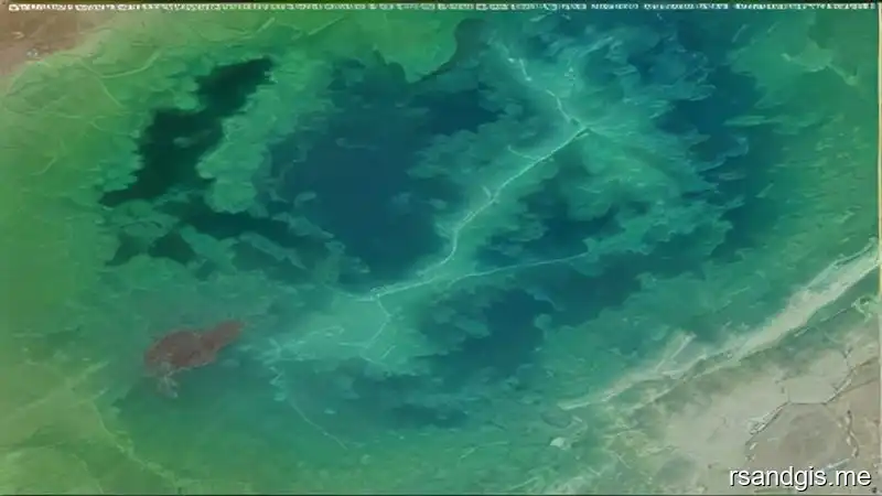
Machine learning groundwater potential mapping represents one of the most significant breakthroughs in modern hydrogeology and spatial analysis. As global water scarcity becomes an increasingly pressing issue due to climate change and rapid urbanization, identifying and managing sustainable groundwater resources is absolutely critical. In this guide, we will explore the methodologies, data requirements, algorithmic approaches, and the profound impact of integrating advanced artificial intelligence into geographic information systems (GIS) for accurate subsurface water detection.
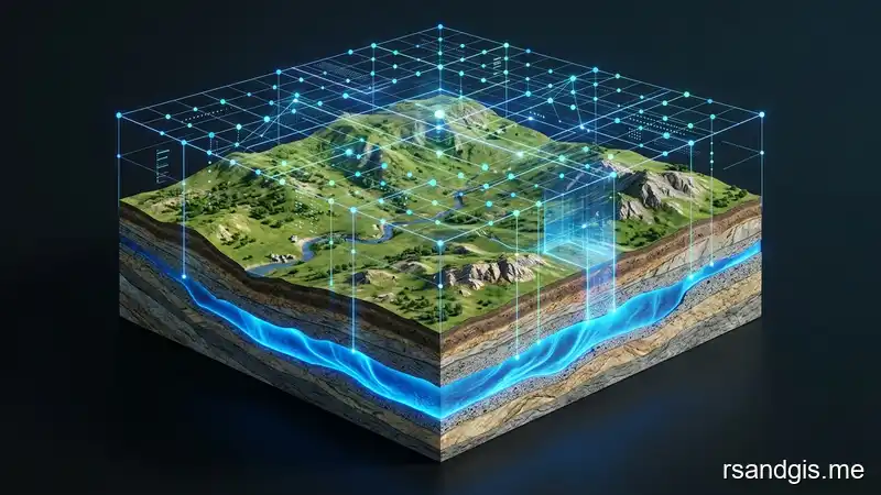
Traditional methods of groundwater exploration often relied on extensive field surveys, which were time-consuming, expensive, and limited in spatial scale. Today, machine learning groundwater potential mapping allows scientists and urban planners to analyze vast amounts of geospatial data in a fraction of the time. By harnessing satellite imagery, digital elevation models (DEMs), geological maps, and meteorological data, machine learning algorithms can uncover complex, non-linear relationships between environmental factors and groundwater availability.
Understanding Groundwater Potential Zones
Before diving into the algorithms, it is essential to understand what groundwater potential zones (GWPZs) are. These are specific geographical areas where the geological, topographical, and hydrological conditions are highly favorable for the accumulation and extraction of groundwater. Identifying these zones is the primary objective of any machine learning groundwater potential mapping project.
Groundwater is a hidden resource. It resides in aquifers beneath the Earth's surface, making direct observation impossible without drilling. Instead, hydrogeologists use surface indicators, or "conditioning factors", to infer the presence of water below. These factors include slope, elevation, soil type, land use/land cover (LULC), drainage density, lineament density, and rainfall distribution. Machine learning groundwater potential mapping thrives on this multivariate data.
The Role of GIS in Data Preparation
Geographic Information Systems (GIS) provide the foundational framework for machine learning groundwater potential mapping. GIS is used to collect, store, process, and visualize the spatial data required by the machine learning models. Without a robust GIS infrastructure, it would be impossible to align the disparate datasets required for accurate predictions.
For instance, a digital elevation model (DEM) might be captured at a 30-meter resolution, while geological maps might be available as vector polygons. GIS tools are used to convert, resample, and normalize this data into a uniform grid format. Each pixel or grid cell in the study area is then assigned a set of values corresponding to the various conditioning factors, creating the ultimate dataset for the machine learning algorithm.
Key Groundwater Conditioning Factors
The accuracy of any machine learning groundwater potential mapping model is heavily dependent on the quality and selection of the conditioning factors. While the specific factors may vary depending on the local geography and climate, several variables are universally recognized as critical for groundwater prediction.
Topographical Factors
Topography plays a massive role in surface water runoff and infiltration rates. High-resolution DEMs are processed in GIS to extract several topographical derivatives:
- Elevation: Generally, lower elevations have higher groundwater potential as water naturally flows downwards and accumulates in valleys and basins.
- Slope: Steep slopes promote rapid surface runoff, reducing the time water has to infiltrate the soil. Conversely, flat areas encourage infiltration, increasing groundwater recharge.
- Topographic Wetness Index (TWI): TWI is a steady-state wetness index commonly used to quantify topographical control on hydrological processes. High TWI values strongly correlate with high groundwater potential.
- Aspect and Curvature: These factors influence soil moisture retention and the direction of surface flow, indirectly affecting groundwater accumulation.
Geological and Hydrological Factors
The subsurface composition is perhaps the most direct indicator of groundwater. Machine learning groundwater potential mapping relies on geological maps to provide this context:
- Lithology: The physical characteristics of rocks (e.g., porosity and permeability) dictate how much water they can hold and how easily it can flow through them. Sandstone and limestone are typically excellent aquifers, while clay and granite are poor.
- Lineament Density: Lineaments are linear structural features on the Earth's surface, often representing faults or fractures. High lineament density indicates highly fractured rock, which serves as excellent conduits for groundwater movement.
- Drainage Density: This is the total length of all streams and rivers in a drainage basin divided by the total area of the basin. High drainage density usually implies low infiltration and high surface runoff, indicating lower groundwater potential.
Common Conditioning Factors in GWP Mapping
Algorithms for Groundwater Mapping
Once the GIS data is prepared, the core phase of machine learning groundwater potential mapping begins. Numerous algorithms have been tested and deployed in this field, each with its unique strengths and weaknesses. The choice of algorithm often depends on the size of the dataset, the complexity of the terrain, and the computational resources available.
Random Forest (RF)
Random Forest is one of the most popular algorithms used in machine learning groundwater potential mapping. It is an ensemble learning method that constructs a multitude of decision trees during training and outputs the mode of the classes for classification or mean prediction for regression. RF is highly regarded because it is robust against overfitting, can handle large datasets with high dimensionality, and naturally provides a measure of feature importance.
In the context of groundwater mapping, RF can easily determine which conditioning factors (e.g., slope vs. lithology) are driving the predictions in a specific study area. This interpretability is crucial for hydrogeologists who need to validate the model's findings against field observations.
Support Vector Machines (SVM)
Support Vector Machines are supervised learning models with associated learning algorithms that analyze data for classification and regression analysis. SVMs map training examples to points in space so as to maximize the width of the gap between the two categories (e.g., 'groundwater present' vs. 'groundwater absent').
For machine learning groundwater potential mapping, SVM is particularly effective when dealing with complex, non-linear relationships between the conditioning factors. By utilizing different kernel functions (such as the Radial Basis Function), SVM can create highly accurate decision boundaries in multidimensional space.
Artificial Neural Networks (ANN)
Artificial Neural Networks are computing systems vaguely inspired by the biological neural networks that constitute animal brains. An ANN is based on a collection of connected units or nodes called artificial neurons. They are highly capable at modeling complex, non-linear patterns.
While ANNs require significant computational power and large amounts of training data, they frequently outperform traditional models in machine learning groundwater potential mapping. But they are often considered "black boxes" because interpreting how the network weighted the different conditioning factors to arrive at its conclusion can be exceedingly difficult.
Step-by-Step Mapping Workflow
Successfully executing a machine learning groundwater potential mapping project requires a structured, multi-step workflow. Skipping or rushing any of these steps can lead to highly inaccurate models and poor resource management decisions.
Step 1: Groundwater Inventory
The foundation of supervised machine learning is the training data. In this context, the training data consists of a groundwater inventory map. This map shows the locations of known, existing groundwater springs, high-yield wells, or boreholes. These locations act as the "positive" samples (groundwater present). For the model to learn effectively, it also requires "negative" samples (groundwater absent), which are usually generated randomly in areas known to have poor groundwater yields.
Step 2: Preparation of Conditioning Factors
As discussed earlier, all topographical, geological, and hydrological conditioning factors are processed in GIS. They must all be projected to the same coordinate reference system (CRS) and resampled to the same spatial resolution. This ensures that every pixel in the study area has a complete suite of data values for the algorithm to analyze.
Step 3: Multicollinearity Analysis
Before training the model, it is crucial to perform a multicollinearity analysis on the conditioning factors. Multicollinearity occurs when two or more independent variables are highly correlated with each other.
For example, 'Slope' and 'Elevation' might be highly correlated in a mountainous region. Including highly correlated variables can skew the machine learning model. Techniques like the Variance Inflation Factor (VIF) or Pearson correlation matrix are used to identify and remove redundant factors.
Step 4: Model Training and Validation
To avoid severe spatial autocorrelation (spatial data leakage) that violates Tobler’s First Law of Geography, random pixel-level splitting is invalid. The rigorous scientific methodology requires Spatial Cross-Validation (Spatial Block K-Fold or spatial buffer partitioning) to divide the training and validation sets. The machine learning algorithm is fed the training data along with the corresponding values of the conditioning factors. It learns the complex rules governing groundwater occurrence. Once trained, the model is tested against the validation set to assess its accuracy and generalizability.
Step 5: Generating the Potential Map
Once the model is trained and validated, it is applied to the entire study area. The algorithm predicts the probability of groundwater occurrence for every single pixel. These probabilities are then imported back into GIS and classified into distinct zones, typically categorized as Very Low, Low, Moderate, High, and Very High groundwater potential.
Advanced Machine Learning Techniques
As technology advances, so too do the techniques used in machine learning groundwater potential mapping. Researchers are constantly pushing the boundaries to achieve higher accuracy and better spatial resolution.
Deep Learning and CNNs
Deep learning, specifically Convolutional Neural Networks (CNNs), is beginning to make waves in groundwater mapping. Unlike traditional algorithms that process each pixel independently, CNNs can analyze spatial patterns and contextual information within the data. This allows the model to "see" geological structures and topographical forms in a way that closely mimics human interpretation, leading to unparalleled accuracy in complex terrains.
Ensemble Modeling
No single algorithm is perfect for every scenario. Ensemble modeling involves combining the predictions of multiple different machine learning algorithms to create a single, more robust prediction.
For example, averaging the outputs of an SVM, a Random Forest, and an ANN can smooth out the individual biases of each model, resulting in a highly reliable machine learning groundwater potential mapping product.
Challenges and Limitations
Despite its incredible power, machine learning groundwater potential mapping is not without its challenges. Understanding these limitations is critical for practitioners and decision-makers.
Data Quality and Availability
The old adage "garbage in, garbage out" perfectly applies here. A machine learning model is only as good as the data it is trained on. In many developing regions, high-resolution DEMs, accurate geological maps, and extensive groundwater inventory data are simply not available. Relying on coarse, globally available datasets (like 30m SRTM DEMs) can limit the accuracy of local-scale predictions.
Dynamic Environments
Groundwater systems are dynamic. They respond to seasonal rainfall, long-term climate change, and human extraction rates. A machine learning groundwater potential mapping model provides a static snapshot based on the training data. If land use changes dramatically (e.g., massive deforestation or rapid urbanization), the model's predictions may quickly become obsolete. Integrating time-series data and dynamic modeling into machine learning frameworks remains a significant ongoing challenge.
The "Black Box" Problem
As mentioned earlier, highly complex algorithms like Deep Neural Networks act as black boxes. When an algorithm designates an area as having "Very High" potential, it can be difficult to explain exactly why to stakeholders or local communities. This lack of interpretability can hinder the adoption of machine learning models in conservative governmental or regulatory environments that demand transparent methodologies.
Real-World Applications and Impact
The successful implementation of machine learning groundwater potential mapping has profound real-world implications, particularly in arid and semi-arid regions.
Sustainable Resource Management
By accurately identifying GWPZs, governments can optimize their drilling programs. Instead of relying on expensive and often unsuccessful exploratory drilling, resources can be directed to areas with a mathematically proven high probability of yield. This saves millions of dollars and ensures that communities gain access to clean water faster.
Drought Mitigation
In regions prone to severe drought, knowing the exact location and extent of groundwater resources is a matter of survival. Machine learning groundwater potential mapping allows authorities to calculate precise aquifer limits and establish strict extraction quotas, preventing over-exploitation during dry seasons and ensuring the long-term sustainability of the water supply.
Infrastructure Planning
Conversely, identifying areas with very shallow or abundant groundwater is crucial for civil engineering. Infrastructure projects, such as tunneling, deep foundations, or landfill site selection, must carefully consider groundwater potential to avoid flooding, structural instability, or catastrophic contamination of the aquifer.
The Future of Groundwater Mapping
The integration of machine learning into hydrogeology is still in its relative infancy, but its trajectory is clear. As satellite technology improves, providing daily, high-resolution multi-spectral and radar imagery, the inputs for these models will become vastly richer. Also, as cloud computing platforms like Google Earth Engine become more accessible, researchers worldwide can run complex machine learning groundwater potential mapping algorithms without needing expensive local hardware.
We are moving towards a future where groundwater mapping is not a static, one-time study, but a dynamic, real-time dashboard. By continuously feeding incoming climate data, extraction rates, and satellite imagery into pre-trained machine learning models, we can achieve true, predictive, and sustainable management of the world's most vital hidden resource.
Ultimately, machine learning groundwater potential mapping has forever altered the landscape of spatial analysis and hydrogeology. By bridging the gap between advanced artificial intelligence and traditional geographic information systems, it provides a powerful, scalable, and highly accurate tool for securing our global water future.
Frequently Asked Questions
What is groundwater potential mapping?
Groundwater potential mapping uses spatial data and machine learning to identify zones with high probability of groundwater occurrence, helping in sustainable water resource management.
Which machine learning algorithms are best for groundwater mapping?
Common algorithms include Random Forest, Support Vector Machines (SVM), and Artificial Neural Networks (ANN), as they effectively handle complex, non-linear hydrogeological variables.
What factors are used in groundwater potential analysis?
Key factors include slope, elevation, drainage density, land use/land cover (LULC), soil type, geology, and rainfall distribution.
